This item has been sold, but you can get on the Waitlist to be notified if another example becomes available, or purchase a digital scan.
1916 U.S. Department of the Interior Map of Indian Reservations in the United States
IndianReservations-interior-1916$150.00

Title
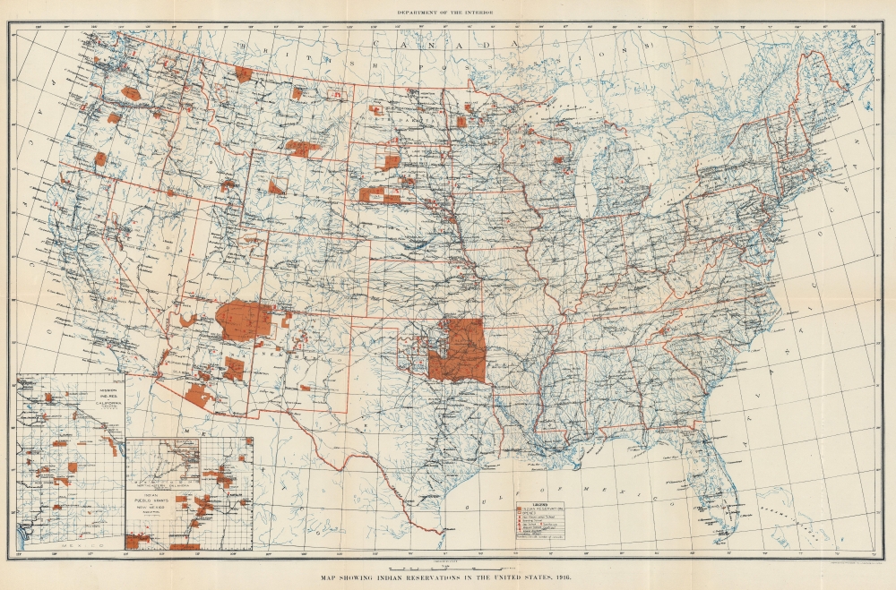
Map Showing Indian Reservations in the United States, 1916.
1916 (dated) 16.25 x 24.5 in (41.275 x 62.23 cm) 1 : 8000000
1916 (dated) 16.25 x 24.5 in (41.275 x 62.23 cm) 1 : 8000000
Description
This is a 1916 U.S. Department of the Interior Map of Indian Reservations across the United States. In the early 20th century, the reservation system was a contentious network of territories that primarily served as a mechanism for the Federal government to control and assimilate tribes to Eurocentric cultural norms.
A Closer Look
Depicting the continental United States, dark orange highlights Indian reservations throughout the western United States. Symbols mark schools (non-reservation, boarding, day, and contract and non-contract mission), sanitariums, and insane asylums. White areas bordered by orange within reservations represent lands that opened to non-Native settlement through lease, or sale, or lottery. According to the National Library of Medicine, 'Between 1887 and 1934, more than 86 million acres, which represent more than 60 percent of the remaining Native land, passed into non-Native hands'.Publication History and Census
This map was engraved and printed by the U.S. Geological Survey and published by the U.S. Department of the Interior in 1916. We note two examples of the present 1916 edition cataloged in OCLC: Osher Map Library at the University of Southern Maine and the University of California Davis. We have previously handled an example of the 1915 edition of the Department of the Interior Map of Indian Reservations.Cartographer
The United States Geological Survey (1878 - Present), aka the U.S.G.S., is a scientific agency of the United States government, which was founded in 1879. USGS scientists study the landscape of the United States, its natural resources, and the natural hazards that threaten it. The organization has four major science disciplines: biology, geography, geology, and hydrology. It is a bureau of the United States Department of the Interior and is the department's only scientific agency. More by this mapmaker...
Condition
Very good. Light wear along original fold lines. Closed tear extending 1 inch into printed area from left margin professionally repaired on verso. Close left margin.
References
OCLC 173147402.