
United States Geological Survey (USGS)

The United States Geological Survey (1878 - Present), aka the U.S.G.S., is a scientific agency of the United States government, which was founded in 1879. USGS scientists study the landscape of the United States, its natural resources, and the natural hazards that threaten it. The organization has four major science disciplines: biology, geography, geology, and hydrology. It is a bureau of the United States Department of the Interior and is the department's only scientific agency.
United States Geological Survey is also known as: USGS
An early geological map of the Grand Canyon region.
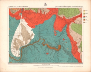
Parts of Northern and North Western Arizona and Southern Utah. Sheet No. 67.
$500.00
Acquire
- Digital Map Information
- Suitable for large format printing
- File Size: 21.85 MB
- File Type: ZIP / TIFF
- ICC color profile embedded
- Delivered instantly via download link
A beautifully chromolithographed geologic map of northern Arizona and environs, including the Grand Canyon, produced by the Wheeler Survey c. 1873 and published in the Topographical Atlas which summarized the survey's work. (more details)
Boulder Canyon before Hoover Dam.
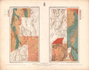
Parts of E. California, S.E. Nevada, N.W. Arizona and S.W. Utah. Atlas Sheet Number 58 / Atlas Sheet Number 66.
$400.00
Acquire
- Digital Map Information
- Suitable for large format printing
- File Size: 20.22 MB
- File Type: ZIP / TIFF
- ICC color profile embedded
- Delivered instantly via download link
An interesting pair of geologic maps of the American West, displaying the region around the Colorado River at Boulder Canyon, not far from the future city of Las Vegas. They were produced by the Wheeler Survey c. 1873 and published in the Topographical Atlas, which summarized the survey's work. (more details)
Surveying the High Desert.
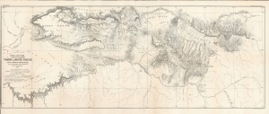
Map of the Country Between Yampa and White Rivers (For General Reference) to accompany the Report of Gust. R. Bechler.
$400.00
Acquire
- Digital Map Information
- Suitable for large format printing
- File Size: 27.41 MB
- File Type: ZIP / TIFF
- ICC color profile embedded
- Delivered instantly via download link
A large format 1876 map of a portion of northwestern Colorado and northeastern Utah, prepared to accompany a report by Gustavus Bechler that appeared in the Tenth Annual Report of the United States Geological and Geographical Survey of the Territories.... The northern portion of this map overlaps with today's Dinosaur National Monument. (more details)
Early Survey of the Grand Valley,
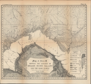
Map of Area B Showing the Geology of Grand River Valley and the Book Cliffs.
$150.00
Acquire
- Digital Map Information
- Suitable for large format printing
- File Size: 350.84 MB
- File Type: ZIP / TIFF
- ICC color profile embedded
- Delivered instantly via download link
A detailed 1876 U.S. Geological Survey map of Colorado River Valley in southwestern Colorado and southeastern Utah. At the time, this area was undergoing a demographic shift, as the native Ute people were displaced to make way for American miners and settlers. (more details)
High Desert and Higher Mountains.
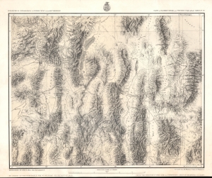
Parts Of Eastern Nevada And Western Utah, Atlas Sheet No. 49.
$350.00
Acquire
- Digital Map Information
- Suitable for large format printing
- File Size: 24.13 MB
- File Type: ZIP / TIFF
- ICC color profile embedded
- Delivered instantly via download link
A detailed c. 1879 George Montague Wheeler survey map of northeastern Nevada and northwestern Utah, issue for the Topographical Atlas Projected to Illustrate United States Geographical Surveys West of the 100th Meridian of Longitude. It is one of the earliest detailed maps of this region and includes interesting details on the Native American and early American inhabitants of the area, including mines, ranches, and early settlements. (more details)
Heartland of the Rockies
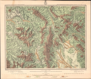
Land Classification Map Of Part Of Central Colorado, Atlas Sheet No. 52 (D).
$350.00
Acquire
- Digital Map Information
- Suitable for large format printing
- File Size: 29.51 MB
- File Type: ZIP / TIFF
- ICC color profile embedded
- Delivered instantly via download link
A chromolithograph survey map of the Rocky Mountains and environs in central Colorado, prepared in 1879 by George Wheeler and associates, representing the first detailed surveys of these lands. (more details)
First detailed survey of the Grand Canyon.
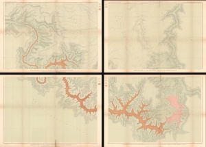
Geologic Map of the Southern Part of the Kaibab Plateau. / Geologic Map of the Southern Part of the Kaibab Plateau. / Geologic Map of the Grand Cañon in the Kaibab Plateau. / Geologic Map of the Southern part of the Kaibab Plateau - Head of the Grand Cañon.
$950.00
Acquire
- Digital Map Information
- Suitable for large format printing
- File Size: 101.44 MB
- File Type: ZIP / TIFF
- ICC color profile embedded
- Delivered instantly via download link
The first map of the Grand Canyon based on actual surveys - this is Clarence E. Dutton's 1882 four-part map of the Grand Canyon, published for the Atlas to Accompany the Monograph on the Tertiary History of the Grand Cañon District. (more details)
The ranges of cedar, giant sequoia, and California redwood trees in North America.
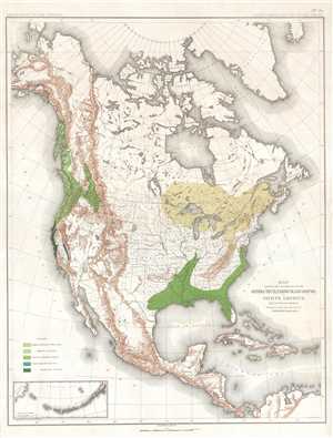
Map Showing the Distribution of the Genera Thuya, Taxodium and Sequoia in North America Exclusive of Mexico.
$300.00
Acquire
- Digital Map Information
- Suitable for large format printing
- File Size: 8.78 MB
- File Type: ZIP / TIFF
- ICC color profile embedded
- Delivered instantly via download link
This is an 1884 Charles Sprague Sargent arboreal thematic map of North America. The map depicts the continent of North America from the Arctic Ocean, Alaska, and Canada south to Mexico and Central America as well as the extreme northern reaches of South America and ... (more details)
Just after Consolidation.
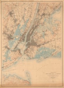
New York City and Vicinity.
$950.00
Acquire
- Digital Map Information
- Suitable for large format printing
- File Size: 94.06 MB
- File Type: ZIP / TIFF
- ICC color profile embedded
- Delivered instantly via download link
Produced soon after New York City's consolidation of the five boroughs, this large-format 1901 (reprinted 1915) topographic map of New York City and vicinity was produced by the U.S. Geological Survey. In addition to topographic information, it provides an excellent snapshot of the city at the turn of the 20th century. (more details)
Supplying the City and Suburbs with Water.
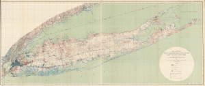
Map Showing the Waterworks Systems of Long Island, New York.
$1,500.00
Acquire
- Digital Map Information
- Suitable for large format printing
- File Size: 88.83 MB
- File Type: ZIP / TIFF
- ICC color profile embedded
- Delivered instantly via download link
This is a large-format 1903 map of Long Island by A.C. Veatch and Isaiah Bowman of the U.S. Geological Survey. It highlights the island's waterworks system, an essential factor in Long Island's rapid development in the early 20th century. (more details)
The Grand Canyon of Yellowstone.
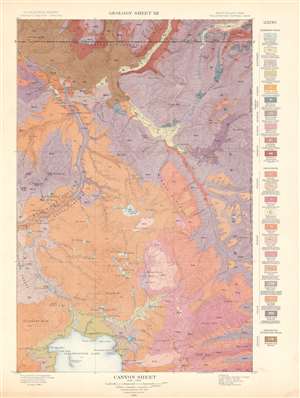
Canyon Sheet. Geology Sheet XII.
$250.00
Acquire
- Digital Map Information
- Suitable for large format printing
- File Size: 28.56 MB
- File Type: ZIP / TIFF
- ICC color profile embedded
- Delivered instantly via download link
This is a 1904 Arnold Hague's U.S. Geological Survey geological map of the spectacular Grand Canyon of the Yellowstone in Yellowstone National Park, Wyoming. The map depicts the entire Canyon Region and the Absaroka Range from the Yellowstone Lake northward, along the Yellowstone River, as far as the Hellroaring Creek in Montana. Many well-known Yellowstone sites are noted, including Elephant Back, Mirror Plateau, Sherman Volcano, and Fossil Forest, as well as various springs, peaks, creeks, and lakes. Twenty-two different colors highlight differing geological formations throughout the region and correspond with a legend situated along the right border. (more details)
A topographic map highlighting Yellowstone National Park's unique topography.
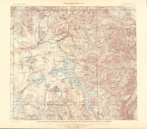
Yellowstone National Park and Portion of Yellowstone Forest Reserve. Topography Sheet XVI.
$250.00
Acquire
- Digital Map Information
- Suitable for large format printing
- File Size: 31.43 MB
- File Type: ZIP / TIFF
- ICC color profile embedded
- Delivered instantly via download link
This is a 1904 Arnold Hague and U.S. Geological Survey topographic map of Yellowstone National Park, Wyoming. Centered on the Yellowstone Lake, the largest mountain lake in the United States, the map depicts the entirety of Yellowstone National Park, as well as part of the Yellowstone Forest Reserve. It is part of Hague's study of the region's unique geology and related geothermal activity. Contour lines highlight the region's unique topography with elevation noted every 500 feet. A dashed line representing the Continental Divide winds its way through the park, while the red dashed lines mark roads. Creeks, rivers, and lakes are labeled, as are plateaus, gulches, and mountain peaks. (more details)
A topographic map of Travertine Terrace, Yellowstone National Park.
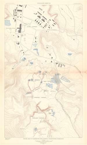
Detail Map of Mammoth Hot Springs Travertine Terraces. Topography Sheet XX.
$250.00
Acquire
- Digital Map Information
- Suitable for large format printing
- File Size: 23.7 MB
- File Type: ZIP / TIFF
- ICC color profile embedded
- Delivered instantly via download link
This is a 1904 Arnold Hague and U.S. Geological Survey topographic map of spectacular Mammoth Hot Springs Travertine Terraces of Yellowstone National Park, Wyoming. Centered on Cleopatra Spring in Minerva Terrace, the map depicts the Travertine Terraces from the Painted Pool on the White Elephant in Highland Terrace to McCartney Cave in Hotel Terrace. It also identifies Liberty Cap on Hymen Terrace. Contour lines highlight the region's unique topography with elevation noted every 500 feet. Roads and buildings are illustrated, including the Mammoth Hot Springs Hotel. (more details)
Water Supply for the Great Metropolis.
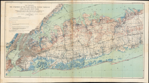
Map showing the Position of the Main Ground-water Table on Long Island, New York.
$350.00
Acquire
- Digital Map Information
- Suitable for large format printing
- Full resolution TIFF file
- ICC color profile embedded
- Delivered instantly via download link
This is a 1904 map of the groundwater table and water supply infrastructure on western Long Island produced by the U.S. Geological Survey. Part of the effort to map Long Island's water resources, it addressed a critical need for information as the water demands of the rapidly growing New York City increased. (more details)
Mammoth Hot Springs and the immediate vicinity.
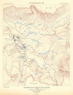
Mammoth Hot Springs and Vicinity. Topography Sheet XVIII.
$250.00
Acquire
- Digital Map Information
- Suitable for large format printing
- File Size: 16.72 MB
- File Type: ZIP / TIFF
- ICC color profile embedded
- Delivered instantly via download link
This is a 1904 Arnold Hague and U.S. Geological Survey topographic map of the spectacular Mammoth Hot Springs in Yellowstone National Park, Wyoming. The map depicts Mammoth Hot Spring Terraces from Terrace Mountain to Mount Everts. Building over thousands of years and still growing, the Mammoth Terraces constantly change shape and color. The map also features a handful of buildings, including the famous Mammoth Hotel built over the old terrace formation called Hotel Terrace. Contour lines highlight the region's unique topography with elevation noted every 500 feet. A dashed line representing the Continental Divide winds its way through the park, while the red dashed lines mark roads. Creeks, rivers, and lakes are labeled, as are plateaus, gulches, and mountain peaks. (more details)
Mammoth Hot Springs and the immediate vicinity.
Mammoth Hot Springs and Vicinity. Topography Sheet XVIII.
$250.00
Acquire
- Digital Map Information
- Suitable for large format printing
- File Size: 45.63 MB
- File Type: ZIP / TIFF
- ICC color profile embedded
- Delivered instantly via download link
This is a 1904 Arnold Hague and U.S. Geological Survey topographic map of the spectacular Mammoth Hot Springs in Yellowstone National Park, Wyoming. The map depicts Mammoth Hot Spring Terraces from Terrace Mountain to Mount Everts. Building over thousands of years and still growing, the Mammoth Terraces constantly change shape and color. The map also features a handful of buildings, including the famous Mammoth Hotel built over the old terrace formation called Hotel Terrace. Contour lines highlight the region's unique topography with elevation noted every 500 feet. A dashed line representing the Continental Divide winds its way through the park, while the red dashed lines mark roads. Creeks, rivers, and lakes are labeled, as are plateaus, gulches, and mountain peaks. (more details)
The geological wonder of Yellowstone.
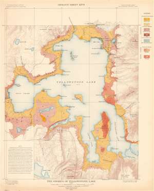
The Shores of Yellowstone Lake. Geology Sheet XXVII.
$250.00
Acquire
- Digital Map Information
- Suitable for large format printing
- File Size: 31.23 MB
- File Type: ZIP / TIFF
- ICC color profile embedded
- Delivered instantly via download link
A fine example of Arnold Hague's 1904 geological survey map of the shores of Yellowstone Lake in Yellowstone National Park, Wyoming. Centered on the Yellowstone Lake, the largest mountain lake in the United States, the map details the lake, its shores, and adjacent terraces and slopes. The map is part of Hague's study of the region's unique geology and related geothermal activity. A legend situated on the upper right identifies the various geological formations and matches them with the corresponding colors used here. A note in the lower left cites an 1889 geological survey of Yellowstone Lake. It also provides a short history of Yellowstone Lake's formation. (more details)
Long Island, from the ground up.
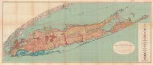
Geologic Map of Long Island, New York.
$1,000.00
Acquire
- Digital Map Information
- Suitable for large format printing
- File Size: 79.45 MB
- File Type: ZIP / TIFF
- ICC color profile embedded
- Delivered instantly via download link
This is a colorful large format 1913 geological map of Long Island made by the U.S. Geological Survey and the geologist Myron Fuller. It displays geological data, mostly defined by glacial activity in the last ice age, as well as signs of development on the island, whose population was rapidly increasing when this map was made. (more details)
Long Island, primed for a population boom.
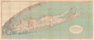
Topographic Map of Long Island, New York.
$1,000.00
Acquire
- Digital Map Information
- Suitable for large format printing
- File Size: 74.95 MB
- File Type: ZIP / TIFF
- ICC color profile embedded
- Delivered instantly via download link
This is a large format 1913 U.S. Geological Survey topographic map of Long Island. Aside from topography, the map provides a clear sense of the growing population and infrastructure of the island when the map was made. (more details)
Birth of Alaska's Oil Industry.
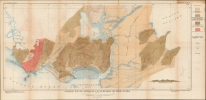
Geologic Map of Controller Bay or Katalla Oil Field, Alaska.
$250.00
Acquire
- Digital Map Information
- Suitable for large format printing
- File Size: 29.88 MB
- File Type: ZIP / TIFF
- ICC color profile embedded
- Delivered instantly via download link
A colorful large-format 1921 map of the region around Katalla in southern Alaska, produced by the U.S. Geological Survey. It presents the area following an oil and coal boom at the start of the 20th century that saw it inundated with aspiring oilmen, only to collapse within a matter of a few years. (more details)
Hydrocarbons along the Alaska Coast.
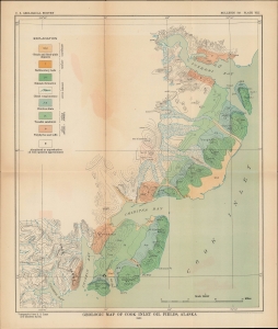
Geologic Map of Cook Inlet Oil Fields, Alaska.
$250.00
Acquire
- Digital Map Information
- Suitable for large format printing
- Full resolution TIFF file
- ICC color profile embedded
- Delivered instantly via download link
A colorful map of the southwestern portion of the Cook Inlet in Alaska produced in 1921 by the U.S. Geological Survey. This period saw a thorough exploration of the Alaskan coast for large-scale oil and gas deposits, which were eventually discovered and exploited in the Cook Inlet Basin several decades later. (more details)
Presentation issue of foundational Kentuky Geolgical Map.
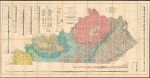
Geologic Map of Kentucky.
$950.00
Acquire
- Digital Map Information
- Suitable for large format printing
- Full resolution TIFF file
- ICC color profile embedded
- Delivered instantly via download link
An exceptional presentation issue of Willard Rouse Jillson's 1929 geological map of Kentucky, compiled from the landmark Sixth Kentucky Geological Survey (1925 - 1928). The map provides an extraordinary record of the state's geology and mineral wealth during a formative period of industrial and natural resource development. This presentation example is inscribed to Major Maurice Kirby Gordon (1878 - 1974), an important Madisonville attorney, Kentucky historian, World War I officer, and founding figure of the American Legion whose research focused extensively on western Kentucky coal mining and regional development. (more details)
Yosemite National Park!
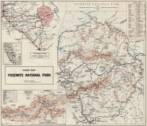
Motorists Guide Map and Manual Yosemite National Park California. / Guide Map Yosemite National Park.
$400.00
Acquire
- Digital Map Information
- Suitable for large format printing
- Full resolution TIFF file
- ICC color profile embedded
- Delivered instantly via download link
This is the 1929 National Park Service map of Yosemite National Park. Such maps allowed visitors to navigate the state's roads an visit the park in their own cars, or explore the park on foot via its network of hiking trails. (more details)
'A vast wilderness of rocks in a sea of light'.
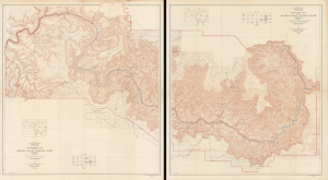
Topographic Map of the Grand Canyon National Park Arizona (West Half). / Topographic Map of the Grand Canyon National Park Arizona (East Half).
$750.00
Acquire
- Digital Map Information
- Suitable for large format printing
- File Size: 181.53 MB
- File Type: ZIP / TIFF
- ICC color profile embedded
- Delivered instantly via download link
This is an expansive two-sheet, large-format, 1948 topographic wall map of the Grand Canyon National Park, issued by the U.S. Geological Survey. Based on surveys undertaken in the early 20th century, it captures the canyon in a period when it was transitioning from a storied but still largely inaccessible national treasure to a tourist site for the masses, aided by the completion of the Grand Canyon Railroad and early highways. (more details)
A Defining Era for Aramco.
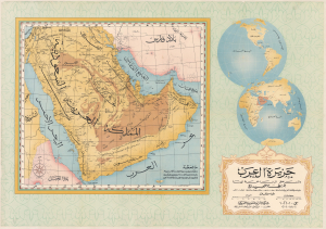
جزيرة العرب و المناطق المتاخمة لها خريطة تمهيدية / [The Arabian Peninsula and Adjacent Regions An Introductory Map].
$4,000.00
Acquire
- Digital Map Information
- Suitable for large format printing
- File Size: 147.51 MB
- File Type: ZIP / TIFF
- ICC color profile embedded
- Delivered instantly via download link
This is a stunning, large-format 1952 Arabic-language wall map of the Arabian Peninsula, issued by the oil giant, the Arabian American Oil Company (Aramco). It was issued at a critical time in the company's history, following its rearrangement to a 50/50 profit-sharing agreement with the Saudi state and the discovery in 1951 of the Safaniya Oil Field, the world's largest offshore field. (more details)
A huge map of Seattle!
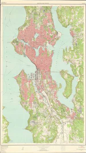
An extremely large format 1957 U.S. Geological Survey map of Seattle, Washington and vicinity that renders the densest regional urban areas immediately apparent by shading with them a striking red. Per a note along the bottom border, 'red tint indicates area in which only landmark buildings are shown'. In addition, countless suburban buildings individually illustrated south of Seattle along the Olympic Peninsula. In this part of the metropolis, schools, golf clubs, and cemeteries are identified, along with Seattle-Tacoma Airport and Renton Airport. Kirkland, Houghton, and Renton are labeled along the shores of Lake Washington, and the Lake Washington Pontoon Bridge is labeled as well. The dark red lines highlight the region's major transportation arteries, its 4- and 6-lane highways. Contour lines illustrate topography and areas shaded green are parks or wooded areas. (more details)
Balancing infrastructure and environmental preservation.
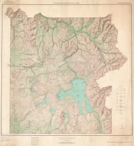
This is a 1964 large-format U.S. Geological Survey map of Yellowstone National Park. The map captures the park as Park Service was struggling to ballance infractructure to accomindate wildly incrased tourism with enviromental ballance - likely the raison d'être of this map. (more details)
One of the Most Successful Partnerships in History.
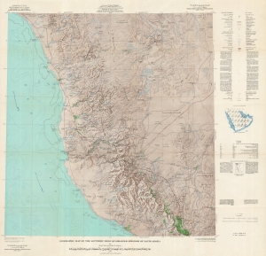
Geographic Map of the Southern Hijaz Quadrangle, Kingdom of Saudi Arabia Miscellaneous Geologic Investigations Map I-210B. / [خريطة جغرافية للوحة الحجاز الجنوبي بالمملكة العربية السعودية ابحاث جيولوجية مختلفة ؛ خريطة رقم I 210B].
$2,000.00
Acquire
A remarkable map of the southern portion of the Hijaz (Hejaz, ٱلْحِجَاز), Saudi Arabia - includding Mecca / Mekkah. This map was prepared by Glen F. Brown and Roy O. Jackson of the U.S. Geological Survey in 1958 for the oil conglomerate Saudi Aramco, then updated with information to 1968. It represents one part of a special partnership between the USGS and Aramco that has helped make the latter among the largest and most profitable corporations in the world. (more details)
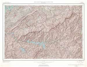
Great Smoky Mountains National Park and Vicinity.
$300.00
Acquire
- Digital Map Information
- Suitable for large format printing
- File Size: 96.45 MB
- File Type: ZIP / TIFF
- ICC color profile embedded
- Delivered instantly via download link
This is a 1968 U.S. Geological Survey topographical map of Great Smoky Mountains National Park and its vicinity. The map depicts the region from the Cherokee National Forest and the Tennessee River to the Pisgah National Forest and from the Bays Mountains and the Tennessee River to the Nantahala National Forest. Highly detailed, innumerable locations throughout the park and its vicinity are identified. Ridges, peaks, gaps, knobs, and tops are all labeled. The Appalachian Trail winds its way across the map, as do numerous other trails (both maintained and not) and roads of varying degree of improvement. Blue colored creeks, rivers, and lakes stand out against the brown terrain of the surrounding mountains. Towns are noted throughout the vicinity of the park, such as Sevierville and Maryville, Tennessee and Robbinsville, North Carolina. Counties are also noted. (more details)
Death Valley in Granular Detail.
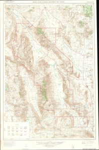
This is a 1972/1974 U.S. Geological Survey topographic map of Death Valley National Monument at the border of California and Nevada. (more details)
Death Valley in Granular Detail.
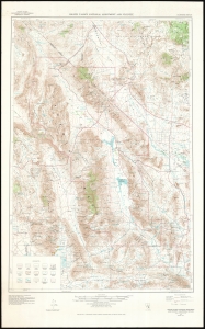
This is a 1972/1977 U.S. Geological Survey topographic map of Death Valley National Monument, at the border of California and Nevada. Depicting from Scottys Junction and the Nellis Air Force Range in the north to the Fort Irwin Military reservation in the south, contour lines present the region's forbidding topography in striking detail. (more details)
Mt. Rainier - North America's most dangerous active volcano.
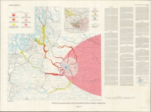
Potential hazards from future eruptions of Mount Rainier, Washington. / Miscellaneous Geologic Investigations Map I-836.
$750.00
Acquire
This is a 1973 Dwight 'Rocky' Crandell map of Washington State in the vicinity of the volcanic Mt. Rainier, considered North America's most dangerous active volcano. It illustrates the danger zones most at risk in a Mt. Rainier eruption. (more details)