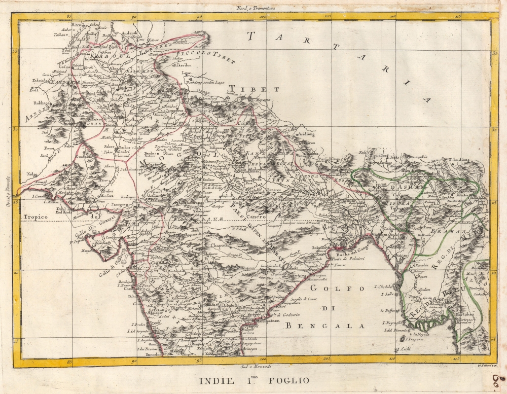
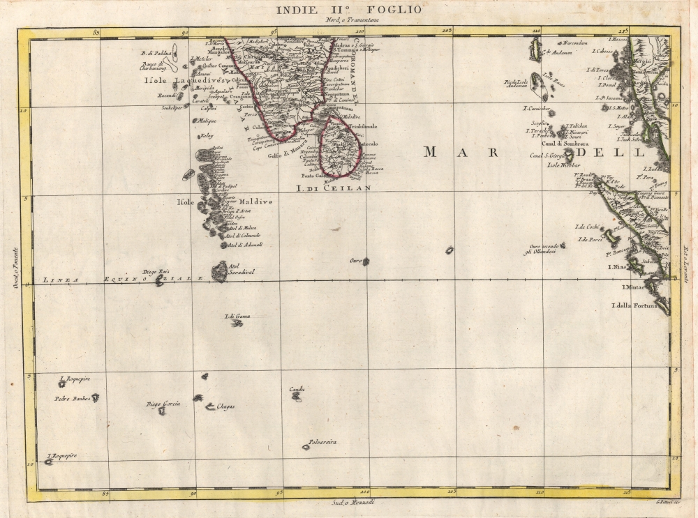
1784 Zatta 2 Sheet Map of India
Indie2Foglio-zatta-1784$1,200.00


Title
Indie Imo. Foglio. / Indie IIo. Foglio.
1784 (undated) 12.5 x 16 in (31.75 x 40.64 cm) 1 : 10100000
1784 (undated) 12.5 x 16 in (31.75 x 40.64 cm) 1 : 10100000
Description
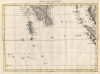
This is a 1784 Antonio Zatta 2 sheet map of India. Published as the British East India Company was fighting to bring all of India within its sphere. At it went to the presses, the British East India Company and the Kingdom of Mysore were at a war, partially ignited by the American Revolutionary War (1775 - 1783), known as the Second Anglo-Mysore War (1780 - 1784).
A Closer Look
Depicting from Tibet to Sri Lanka, the map includes the Maldives and parts of the Malaysian peninsula and Sumatra. Zatta includes impressive detail throughout modern-day India, Afghanistan, Bangladesh, Pakistan, and western Myanmar.The Second Anglo-Mysore War
Fought between 1780 and 1784, the Second Anglo-Mysore War pitted the British East India Company against the Kingdom of Mysore. Mysore, being allied to the French, who were in turn allied with the American Revolutionaries, led to the American Revolution spilling over into India. In 1873, a preliminary peace was settled between Great Britain and France and the fighting ended in Mysore. The subsequent 1784 Treaty of Mangalore formally ended the war and restored the status quo ante bellum, an unsatisfactory end in the eyes of the British East India Company.Publication History and Census
This map was created by Antonio Zatta and published by Zatta in 1788 in his Atlante novissimo. We note cataloged examples of the separate sheets as being part of the collection at the University of Toronto and an example of the entire atlas is digitized and is part of the David Rumsey Map Collection.Cartographer
Antonio Zatta (1775 - April 2, 1797) was the most prominent Italian map publisher of the late 18th and early 19th century. His firm, based in Venice, produced maps that mark an important transition from 18th to 19th century cartographic styles. He updates and redefines the traditional title cartouche by replacing the mythic elements common to the 17th and 18th century with more representative images. His maps also strive to keep many 18th century details, such as figural depictions on the map itself, while striving for the accuracy that a 19th century clientele demanded. His most important work is the four volume Atlante novissima published from 1775 to 1789. More by this mapmaker...
Source
Zatta, A., Atlante novissimo, (Venice: Zatta) 1788.
Condition
Very good. Some soiling to margins on both sheets.
References
Rumsey 11598.202, 11598.203. OCLC 977690102, 977395546.