This item has been sold, but you can get on the Waitlist to be notified if another example becomes available, or purchase a digital scan.
1944 Persian Gulf Command Pictorial Map of Iran
Iran-persiangulf-1944$275.00

Title
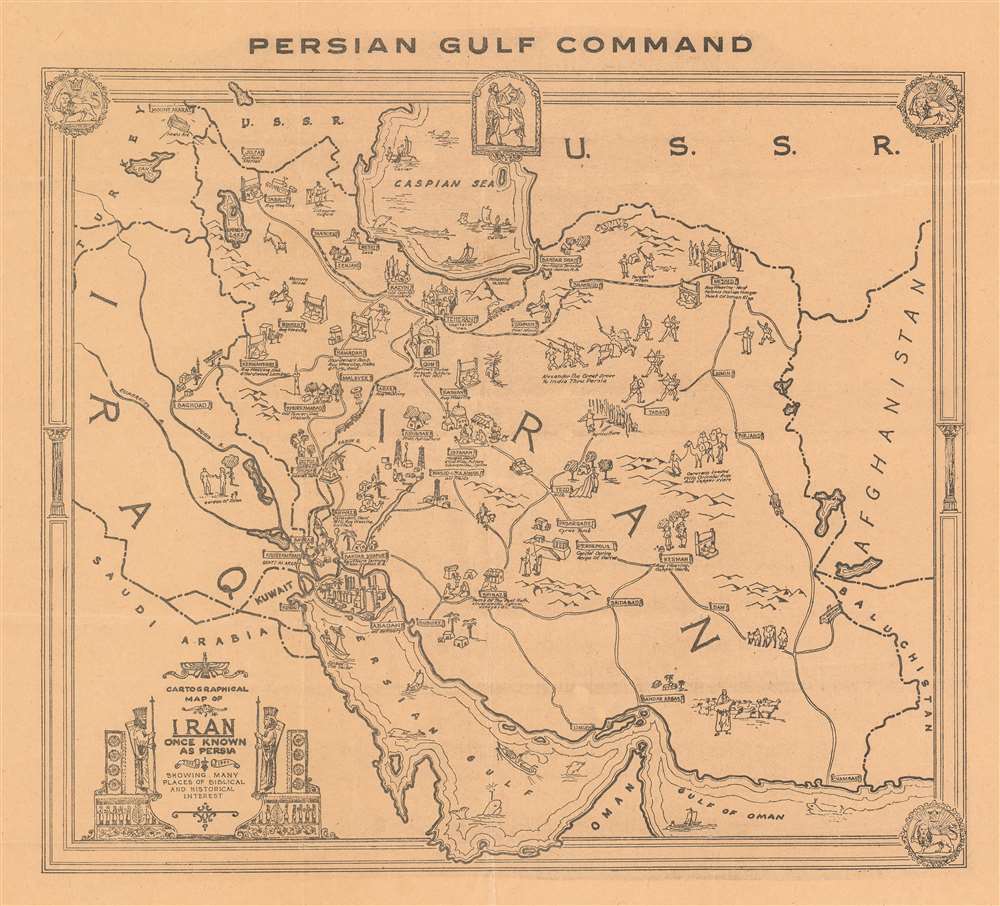
Cartographical Map of Iran Once Known as Persia 1322 - 1944 Showing Many Places of Biblical and Historical Interest.
1944 (dated) 14.75 x 16 in (37.465 x 40.64 cm) 1 : 5650000
1944 (dated) 14.75 x 16 in (37.465 x 40.64 cm) 1 : 5650000
Description
This is a 1944 Persian Gulf Command pictorial map of Iran. The map depicts the region from Turkey, Iraq, and Saudi Arabia to Afghanistan and from the Soviet Union to the Perisan Gulf and the Gulf of Oman. Cities throughout Iraq are labeled and illustrated with pictorial vignettes. Most of these municipalities are also accompanied by a small caption giving some information about them. Teheran (Tehran), for example, is labeled simply as the capital of Iran, but Persepolis is noted as the capital of Iran during the reign of Darius, Shush is labeled as the site of Daniel's tomb, and Isfahan is noted for its mosque as well as its pottery, silk mills, and silversmiths. Other cities are also noted for their resources, such as Resht, which is known for its lace, and Shiraz, which is known for opium and vineyards. Cars, trucks, and people riding horses are illustrated using the roads connecting the towns, while trains are drawn on the rail lines, with one appearing on the route between Basra and Tehran. A vignette to the right of Tehran notes that Alexander the Great marched to India through Persia, and another notes that caravans traditionally transported oriental rugs and copper ware from the East. People are illustrated harvesting caviar on the Caspian Sea, while both small sailboats and large steamships ply the waters of the Persian Gulf. A title cartouche that invokes ancient Persian art is situated in the lower left corner.
Publication History and Census
This map was published by the U.S. Persian Gulf Command in 1944. Two examples are known to be part of the institutional collections at the Library of Congress and the David Rumsey Map Collection at Stanford University.Condition
Very good. Even overall toning. Light wear along original fold lines. Blank on verso.
References
OCLC 1089259096.