1885 Large Bacon Pocket Map of Ireland
Ireland-bacon-1885$650.00

Title
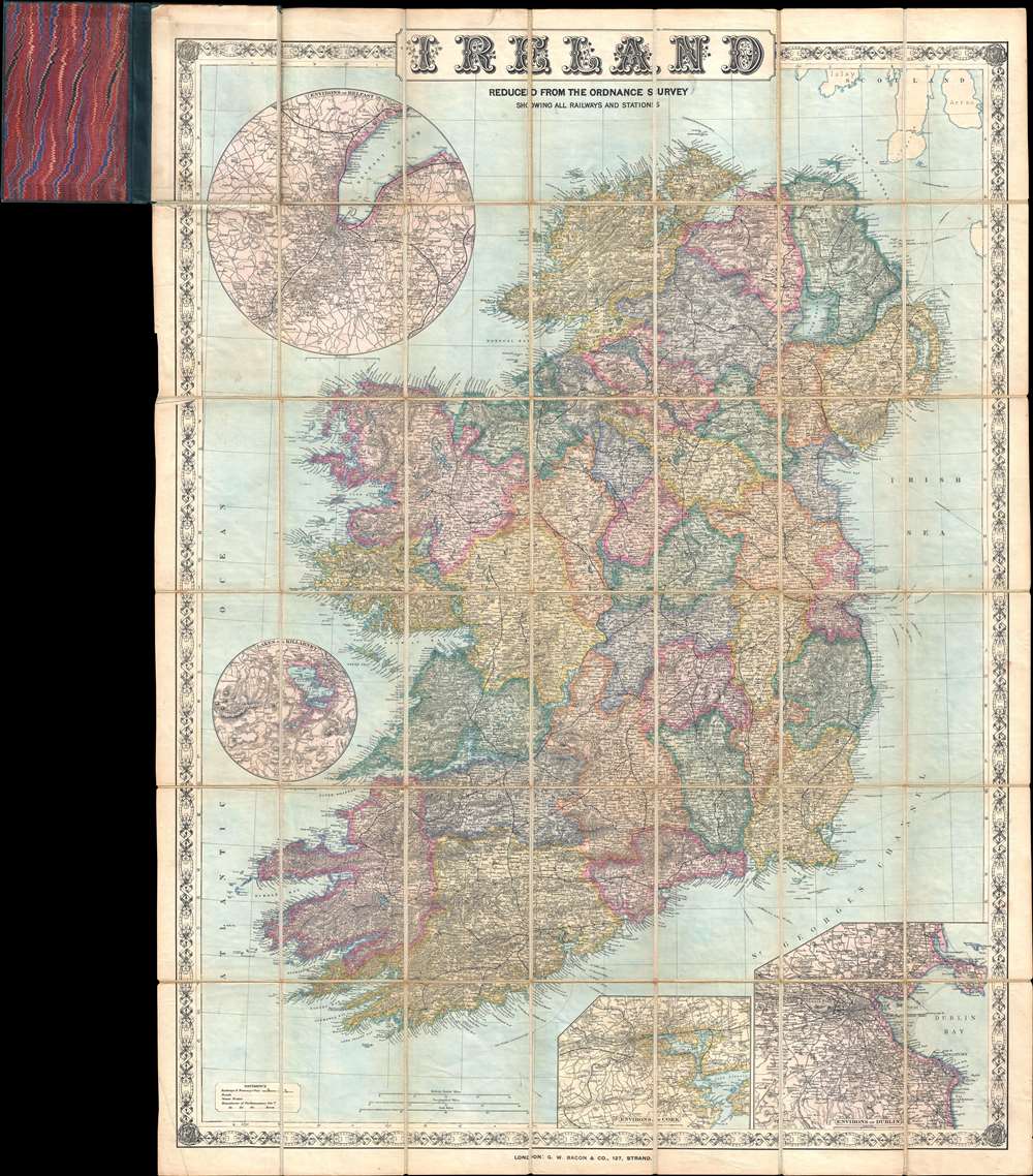
Ireland Reduced from the Ordnance Survey Showing All Railways and Stations.
1885 (undated) 40 x 30 in (101.6 x 76.2 cm) 1 : 600000
1885 (undated) 40 x 30 in (101.6 x 76.2 cm) 1 : 600000
Description
This is a c. 1885 George Washington Bacon pocket map of Ireland. The map depicts Ireland in full, from the Atlantic Ocean to the Irish Sea and from Scotland to St. George's Channel. Cities, towns, and villages are labeled, including Dublin, Belfast, Londonderry, and Cork. Roads are illustrated throughout, and the rail network is shown by black and white dashed lines. International steamship routes are also noted, including the route from Londonderry to New York City. A key, situated in the lower left explains all these notations. Four inset maps highlight different areas around Ireland. Two, located in the lower right corner, focus on the environs of Cork and the environs of Dublin, respectively. The Lakes of Killarney are illustrated in a circular inset situated in the Atlantic off the coast of County Clare, and finally a circular inset featuring the environs of Belfast is included in the upper left corner. The whole is surrounded by a charming border decorated with clovers.
Publication History
This map was published by George Washington Bacon and Company c. 1885.Cartographer
George Washington Bacon (1830 - 1922) was a London based book and map publisher active in the mid to late 19th century. Bacon's firm G.W. Bacon and Co. purchased the plates created by Edward Weller for the Weekly Dispatch Atlas then modified and updated them for several of their own important atlases, including The New Ordnance Atlas of the British Isles. In 1893, Bacon & Co. acquired the map publishing business of J. Wyld. Then, around the turn of the century, Bacon & Co. itself was folded into the Scottish publishing house of W.& A.K. Johnston. More by this mapmaker...
Condition
Very good. Dissected and mounted on linen in 42 panels. Light wear along original folds. Attached to original binder.