
Bacon, George Washington

George Washington Bacon (1830 - 1922) was a London based book and map publisher active in the mid to late 19th century. Bacon's firm G.W. Bacon and Co. purchased the plates created by Edward Weller for the Weekly Dispatch Atlas then modified and updated them for several of their own important atlases, including The New Ordnance Atlas of the British Isles. In 1893, Bacon & Co. acquired the map publishing business of J. Wyld. Then, around the turn of the century, Bacon & Co. itself was folded into the Scottish publishing house of W.& A.K. Johnston.
Reluctant relief expedition to the Sudan.
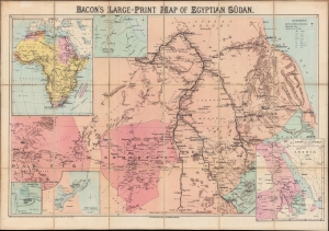
Bacon's large-print map of Egyptian Sûdan.
$1,200.00
Acquire
- Digital Map Information
- Suitable for large format printing
- File Size: 32.6 MB
- File Type: ZIP / TIFF
- ICC color profile embedded
- Delivered instantly via download link
A colorful, large-format c. 1884 G. W. Bacon chromolithograph folding map of the Sudan. The map was produced during the Mahdist War, a widespread revolt against the British-backed Khedivate of Egypt, more specifically during or soon after the Siege of Khartoum and a failed British expedition to relieve the city. (more details)
Large and charming map of Ireland.
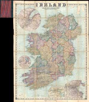
Ireland Reduced from the Ordnance Survey Showing All Railways and Stations.
$650.00
Acquire
- Digital Map Information
- Suitable for large format printing
- File Size: 35.44 MB
- File Type: ZIP / TIFF
- ICC color profile embedded
- Delivered instantly via download link
This is a c. 1885 George Washington Bacon pocket map of Ireland. The map depicts Ireland in full, from the Atlantic Ocean to the Irish Sea and from Scotland to St. George's Channel. Cities, towns, and villages are labeled, including Dublin, Belfast, Londonderry, and Cork. Roads are illustrated throughout, and the rail network is shown by black and white dashed lines. International steamship routes are also noted, including the route from Londonderry to New York City. A key, situated in the lower left explains all these notations. Four inset maps highlight different areas around Ireland. Two, located in the lower right corner, focus on the environs of Cork and the environs of Dublin, respectively. The Lakes of Killarney are illustrated in a circular inset situated in the Atlantic off the coast of County Clare, and finally a circular inset featuring the environs of Belfast is included in the upper left corner. The whole is surrounded by a charming border decorated with clovers. (more details)
Stunning view of the Holy Land!
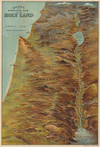
Bacon's Bird's-Eye View of the Holy Land.
$1,000.00
Acquire
- Digital Map Information
- Suitable for large format printing
- Full resolution TIFF file
- ICC color profile embedded
- Delivered instantly via download link
A scarce c. 1890 chromolithograph bird's-eye view of the Holy Land, Israel, and Palestine, published in London by G. W. Bacon. Brilliantly colored and rendered from an elevated oblique perspective, the view presents the Biblical landscape from Mount Lebanon and Mount Hermon south along the Jordan River Valley, encompassing the Sea of Galilee, Jerusalem, Bethlehem, and the Dead Sea. Bacon dramatically exaggerates key geographical features, transforming the ancient Biblical landscape into an immediately comprehensible three-dimensional panorama. (more details)
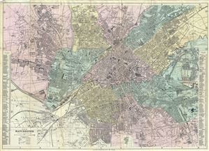
Plan of Manchester.
$250.00
Acquire
- Digital Map Information
- Suitable for large format printing
- Full resolution TIFF file
- ICC color profile embedded
- Delivered instantly via download link
This is a beautiful c.1890 map or plan of Manchester, England by G. W. Bacon. It covers the city of Manchester and depicts individual streets, buildings, parks, canals, docks, railways, stations, and a host of additional topographic features. Notes the Throstle ... (more details)
British-Boer competition in Southern Africa.
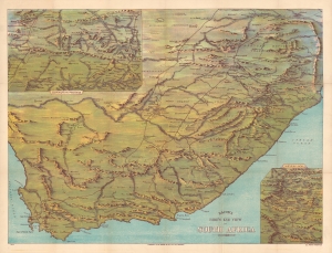
Bacon's Bird's-Eye View of South Africa during the 'South African Crisis'.
$700.00
Acquire
- Digital Map Information
- Suitable for large format printing
- File Size: 59.73 MB
- File Type: ZIP / TIFF
- ICC color profile embedded
- Delivered instantly via download link
An impressive c. 1890 chromolithograph view and map of South Africa extending from the Limpopo River to Cape Agulhas and from the Atlantic to the Indian Oceans. It was published during the 'South African Crisis,' leading up to and including the Second Boer War (1898 - 1901). (more details)
British support for Japan over Russia in 1904.
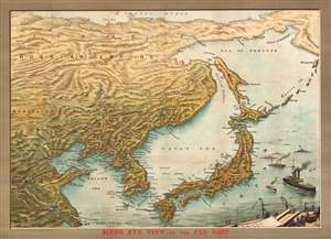
Bird's Eye View of the Far East.
$2,250.00
Acquire
- Digital Map Information
- Suitable for large format printing
- File Size: 40.64 MB
- File Type: ZIP / TIFF
- ICC color profile embedded
- Delivered instantly via download link
This is a finely executed George Washington Bacon and NIC's chromolithograph bird's-eye view of the theater of the Russo-Japanese War (1904 - 1905). Presented as a Bird's eye view and centered on Vladivostok, the view covers from the Arctic to Shanghai and from China to Kamchatka. The focus is on Japan, Korea, and Manchuria, the seat of the Russo-Japanese War. In the lower right, Japanese gunships and battleships prepare for war. This view and map was issued early in the war, just following the Japanese Imperial Navy attack on the Russian Far East Fleet at Port Arthur (February 8, 1904). (more details)
Wonderment with the world.
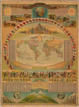
Bacon's Chart of Useful Knowledge.
$6,000.00
Acquire
- Digital Map Information
- Suitable for large format printing
- Full resolution TIFF file
- ICC color profile embedded
- Delivered instantly via download link
This is George W. Bacon's striking wall-map style compendium of all 'useful knowledge' - a densely informative chromolithographic masterpiece. Bacon's map/chart emerges out of the great age of data collection - a period following the Age of Discovery in which improved transportation and intellectual optimism encouraged a furious effort to catalog, 'collect', and contextualize the natural world. The present map synthesizes these efforts into a single dense infographic aimed at both the next generation of explorer/scientists and the armchair adventurer. Herein, information is effectively summarized and categorized, embracing an impressive range of subjects: astronomy, geography, transportation, ethnology, geology, anthropology, and more. (more details)
Bittersweet victory of Irish Republicanism.
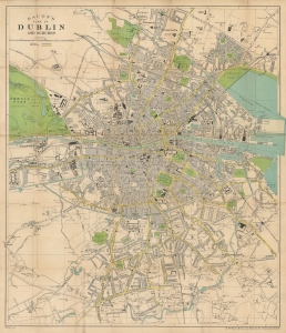
Bacon's plan of Dublin and suburbs.
$350.00
Acquire
- Digital Map Information
- Suitable for large format printing
- Full resolution TIFF file
- ICC color profile embedded
- Delivered instantly via download link
A highly detailed c. 1926 map of Dublin, Ireland published by G.W. Bacon and Co. It was produced soon after Ireland's turbulent revolutionary period and reflects the lingering effects of the conflict. (more details)