This item has been sold, but you can get on the Waitlist to be notified if another example becomes available, or purchase a digital scan.
1918 Italian Commemorative Handkerchief Map of Italy Celebrating the End of WWI
ItaliaRedenta-unknown-1918$175.00

Title
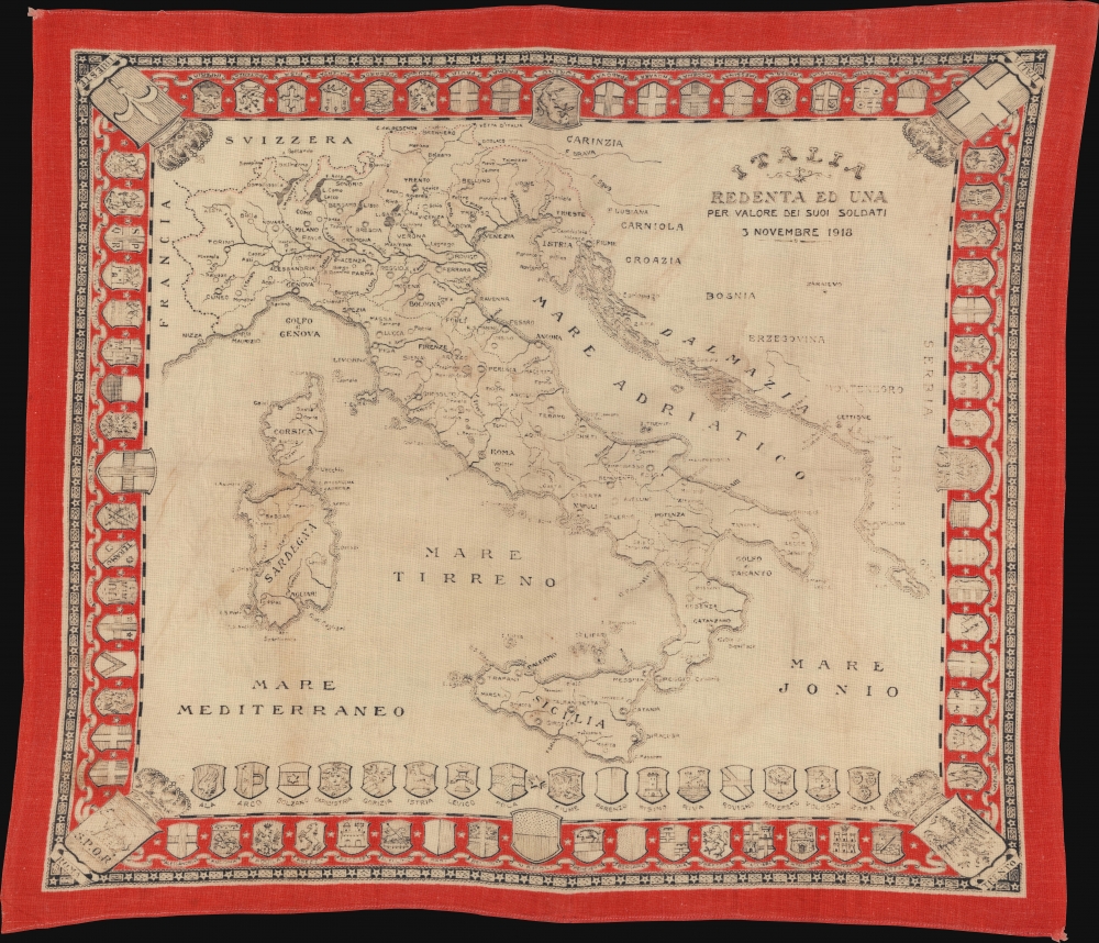
Italia Redenta ed una per valore dei suoi soldati, 3 Novembre 1918.
1918 (dated) 18.2 x 20.75 in (46.228 x 52.705 cm)
1918 (dated) 18.2 x 20.75 in (46.228 x 52.705 cm)
Description
This is a 1918 Italian handkerchief map of Italy celebrating the end of World War I (1914 - 1918). Created soon after the signing of the Armistice of Villa Giusti, the map incorporates Italy's new northern border gained because of cessions from the treaty.
A Closer Look
Cities, towns, and villages are identified throughout Italy. Intriguingly, Padua is not highlighted, even though the Armistice was signed just outside that city. Italy's northern border has been extended to include Trieste and Istria, territory ceded to Italy under the terms of the Armistice. The coasts of arms of Italian cities create the border, with Trieste, Rome, and Trento occupying three of the corners; the Italian coat of arms occupies the fourth.The Armistice of Villa Giusti
The Armistice of Villa Giusti was an armistice signed at the Villa Giusti outside Padua, Italy, on November 3, 1918, between Austria-Hungary and the Allied Powers. Per its terms, all hostilities were to end 24 hours after signing, so 15:00 on November 4. However, a unilateral order from the Austrians ended the fighting on November 3. The terms of the Armistice stated that the Austro-Hungarian Army would withdraw from all occupied territory immediately and that Austria-Hungary would cede regions disputed with Italy, including Trieste and Dalmatia. The Armistice limited the size of the Austro-Hungarian Army and stated that all German soldiers were to leave Austria-Hungary within 15 days or face internment. Also, it granted Allied armies freedom of movement in Austria-Hungary (which would allow the Allies to attack Germany from the south) and freedom of navigation on the Danube River.Publication History and Census
This map was created and published in 1918. We note cataloged examples as being part of the collections at the Museo Nazionale di Castel Sant'Angelo and the Museo Civico del Risorgimento in Bologna, Italy. Examples appear on the private market from time to time.Condition
Very good. Two corners frayed.
References
Museo Civico del Risorgimento (Bologna, Italy) n. 2677.