This item has been sold, but you can get on the Waitlist to be notified if another example becomes available, or purchase a digital scan.
1930 Dolph and Stewart Map of Jacksonville, Florida
Jacksonville-dolph-1930-3$275.00


Title
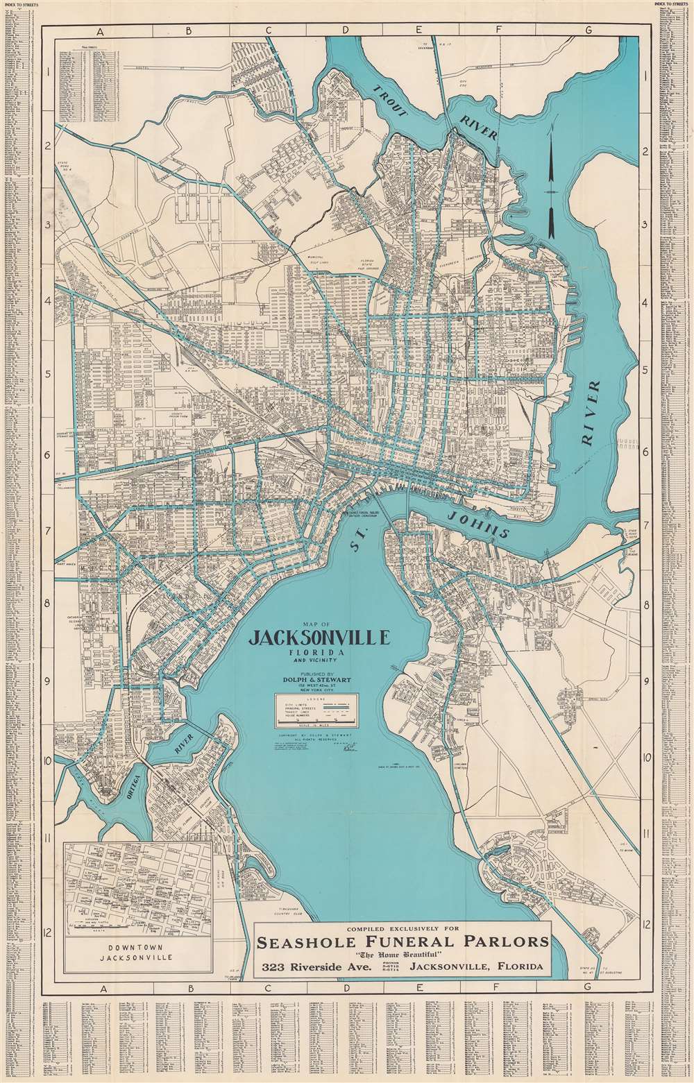
Map of Jacksonville, Florida, and vicinity.
1930 (undated) 34 x 21.75 in (86.36 x 55.245 cm) 1 : 27000
1930 (undated) 34 x 21.75 in (86.36 x 55.245 cm) 1 : 27000
Description
This is a c. 1930 Dolph and Stewart city plan or map of Jacksonville, Florida and its immediate environs highlighting the city's ongoing development. The map focuses on what is now Jacksonville's urban core, prior to consolidation: the area loosely delineated by the Ortega River, St. John's, and the Trout River. The Lake Forest neighborhood is appears at a time when it would have sported pecan groves. The proposed road and bridge linking Edgewood and Tallulah Avenues is marked but has not yet been constructed. The bridge, crossing Moncrief Creek, was not completed until 1945.
Public Housing and Segregated Neighborhoods
The 1920s brought a real estate boom to Jacksonville driven by railroad traffic en route to new tourist destinations in South Florida, and the completion of the Dixie Highway. Several housing projects marked date from this period. Durkeeville Housing Project is marked. This historic neighborhood was the result of growth and prosperity in Jacksonville's African American community. Not far to the northeast, the c. 1920s Brentwood housing project, the first White housing project in Jacksonville, is noted. It is unlikely that either neighborhood would have appeared on a map much earlier than 1928, and it may be that this is the first map to highlight them.Publication History and Census
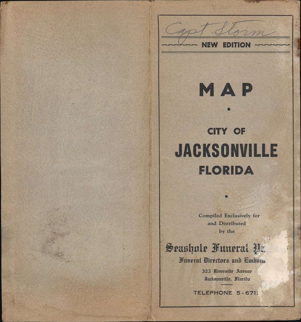
This map was drawn by Clif Hallman, about whom we know nothing. He seems to have produced no other maps with his name attached. If he did more, it was likely as an anonymous draftsman under the New York firm Dolph and Stewart, who published this map. Due to the Dolph and Stewart copyright, the map was printed prior to Frank Dolph's takeover of the firm in the 1940s. A handful of examples prior to 1950 appear in OCLC. These later editions included a map on the verso, which is not present here. Two examples in OCLC dated '1900s' and '1930s' appear to correspond with this one, except the advertisement for 'Seashole Funeral Parlors' is not mentioned in the former, and appears to differ in language on the latter, suggesting a possible change in state. Our dating of 1930 is a conservative estimate.Cartographer
Frank B. Dolph (October 3, 1897 - November 26, 1975) was an American businessman and map publisher. Born in Great Neck, Long Island, New York, Dolph served as a Navy storekeeper during World War I. He began selling maps in 1919 after returning from England, likely for the George F. Cram Company, where he ultimately became an administrative aide. He also worked for the Rand McNally Company for some time before he founded his own map publishing firm, Dolph and Stewart, with his friend, sometime in the 1920s. Dolph and Stewart made maps throughout the 1920s and 1930s until they sold the firm in 1945 when Dolph decided to return to Florida. Dolph opened a new map publishing business, the Frank B. Dolph Map Co. in Ft. Lauderdale and published city plans of cities throughout the United States. Many of his maps were distributed by Chambers of Commerce or sold at newsstands. Real estate developers greatly appreciated his maps, those published by both the Dolph and Stewart Company and the Frank B. Dolph Company. Dolph retired as president of his firm around 1965, when he handed the business off to his son, Frank B. Dolph, Jr. Dolph worked with cartographer Theodore M. Politano for decades while operating the Frank B. Dolph Map Company. More by this mapmaker...
Condition
Very good. Light wear along original fold lines. Reinforced where once attached to original binder.
References
OCLC 44606661.