1975 Japan Air Lines Pictorial Tourist Map of Jakarta and Bali, Indonesia
Jakarta-jal-1975$1,100.00

Title
JAL's Jakarta / Bali.
1975 (dated) 20.75 x 14.25 in (52.705 x 36.195 cm)
1975 (dated) 20.75 x 14.25 in (52.705 x 36.195 cm)
Description
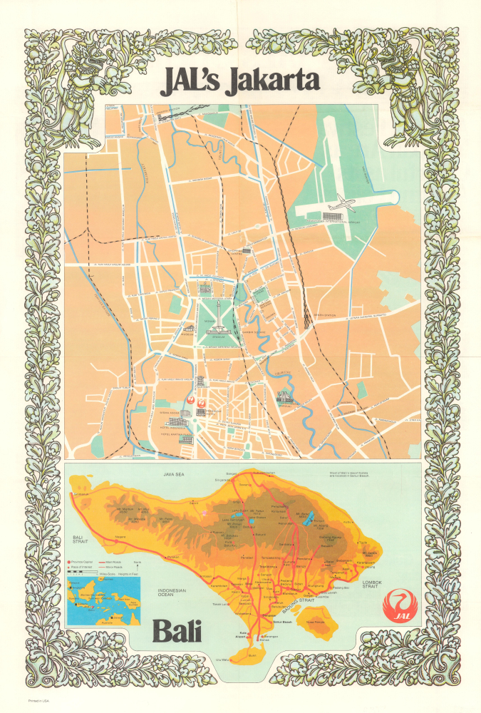
This is a colorful 1975 Japan Air Lines (JAL) pictorial tourist map of Jakarta and Bali, Indonesia. It is aimed at businesses (more likely to be heading to Jakarta), tourists, and travel agents (more likely to be interested in Bali).
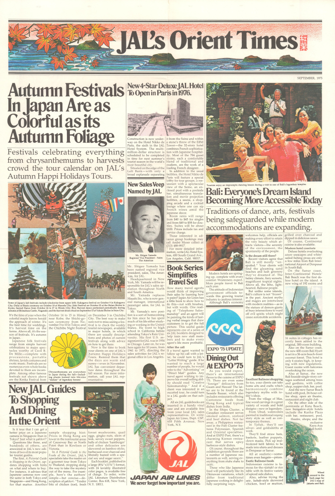
Promotional information and images for JAL, Bali, and the 1975 International Exposition in Okinawa are featured on the verso. Although the description and photographs of Bali (all including the same elderly couple) generally evoke a more luxurious experience, the text does mention Bali's attractiveness to 'young clients' (i.e., hippies) who were responsible for the island's initial tourism boom.
Bali, on the other hand, had already developed a highly mythologized reputation as a tranquil - and affordable - tropical paradise. In the years following Indonesia's independence, the island benefited economically from international tourism, including from the Netherlands, Japan, and 'hippies' of many nationalities seeking 'Eastern wisdom.' Tourist hotels opened in succession in the early to mid-1960s, and in 1970, the Ngurah Rai International Airport (here simply as 'Airport') was opened, quickly becoming the second-busiest airport in Indonesia after Jakarta's Kemayoran.
A Closer Look
The sheet is divided into two parts, with the upper two-thirds constituting a city plan of the central part of Jakarta. Major hotels, the National Museum, the National Monument (Monas), the Taman Ismail Marzuki theater and arts center, Kemayoran Airport, JAL offices, railway lines, waterways, and other notable features are labeled and, in many cases, illustrated. The bottom third of the sheet features a map of Bali, highlighting roads and points of interest, and providing a sense of the island's topography. It also contains an inset map of Indonesia that highlights the locations of both Jakarta and Bali.Promotional information and images for JAL, Bali, and the 1975 International Exposition in Okinawa are featured on the verso. Although the description and photographs of Bali (all including the same elderly couple) generally evoke a more luxurious experience, the text does mention Bali's attractiveness to 'young clients' (i.e., hippies) who were responsible for the island's initial tourism boom.
Historical Context
This map was produced when Indonesia was ostensibly turning a corner after decades of unrest and war, including Japanese occupation during World War II (1939 - 1945), the postwar fight for independence from the Netherlands, and an internal ideological struggle resulting in the horrific mass killings of suspected Communists in 1965 - 1966. Although a large (roughly five million people) and rapidly growing city, Jakarta was hardly considered an international tourist destination at this time. Some monumental works had been put in place during the rule of Sukarno, who wanted to make the city a beacon (mercusuar) of the country's post-colonial independence, but the city's governor at the time this map was produced, Ali Sadikin, was understandably focused on improving basic services like housing, roads, and sanitation.Bali, on the other hand, had already developed a highly mythologized reputation as a tranquil - and affordable - tropical paradise. In the years following Indonesia's independence, the island benefited economically from international tourism, including from the Netherlands, Japan, and 'hippies' of many nationalities seeking 'Eastern wisdom.' Tourist hotels opened in succession in the early to mid-1960s, and in 1970, the Ngurah Rai International Airport (here simply as 'Airport') was opened, quickly becoming the second-busiest airport in Indonesia after Jakarta's Kemayoran.
Publication History and Census
This map was prepared by Japan Air Lines (now stylized as Japan Airlines) in September 1975. The artistic border surrounding the map was drawn by an unnamed artist. We have been unable to locate any other examples of this map in institutional collections or on the market. However, a potential later edition, dated 1979, is held by the Library of Congress (OCLC 31644147).Condition
Very good. Slight wear on old fold lines.