1757 Bellin Map of the Kamchatka Peninsula and the northern Kuril Islands
Kamchatka-laurent-1757$250.00

Title
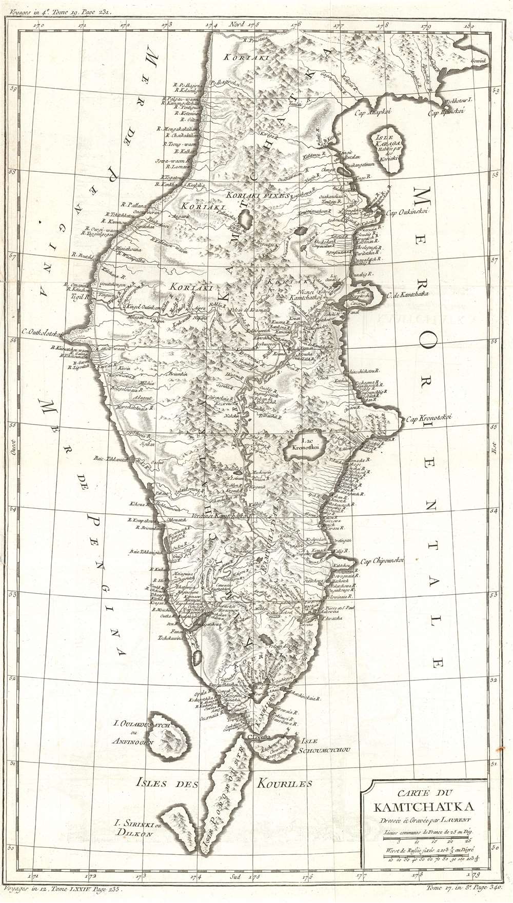
Carte du Kamchatka.
1757 (undated) 21.25 x 12.25 in (53.975 x 31.115 cm) 1 : 2700000
1757 (undated) 21.25 x 12.25 in (53.975 x 31.115 cm) 1 : 2700000
Description
This is a 1757 Jacques-Nicolas Bellin map of the Kamchatka Peninsula. The map depicts the entire peninsula and parts of the Sea of Okhotsk and the Bering Sea. Based on the work of Stepan Petrovich Krasheninnikov, an incredibly detailed illustration of the peninsula's interior is presented. Myriad rivers are illustrated and labeled, as is a chain of mountains running up the peninsula's center. A handful of lakes are also identified. The northernmost Kuril Islands are illustrated and labeled as Isle Schoumctchou, I. Oulakousatch ou Anfinogen, Isle Poromoustr, and I. Sirinki ou Dilkon.
Publication History
This map was drawn and engraved by J. Laurent and published by Jacques-Nicolas Bellin for inclusion in Abbé Prévost's Histoire Générale des Voyages in 1757.Cartographer
Jacques-Nicolas Bellin (1703 - March 21, 1772) was one of the most important cartographers of the 18th century. With a career spanning some 50 years, Bellin is best understood as geographe de cabinet and transitional mapmaker spanning the gap between 18th and early-19th century cartographic styles. His long career as Hydrographer and Ingénieur Hydrographe at the French Dépôt des cartes et plans de la Marine resulted in hundreds of high quality nautical charts of practically everywhere in the world. A true child of the Enlightenment Era, Bellin's work focuses on function and accuracy tending in the process to be less decorative than the earlier 17th and 18th century cartographic work. Unlike many of his contemporaries, Bellin was always careful to cite his references and his scholarly corpus consists of over 1400 articles on geography prepared for Diderot's Encyclopedie. Bellin, despite his extraordinary success, may not have enjoyed his work, which is described as "long, unpleasant, and hard." In addition to numerous maps and charts published during his lifetime, many of Bellin's maps were updated (or not) and published posthumously. He was succeeded as Ingénieur Hydrographe by his student, also a prolific and influential cartographer, Rigobert Bonne. More by this mapmaker...
Condition
Very good. Even overall toining. Light wear along original fold lines. Closed tear extending one half inch into printed area from left margin professionally repaired on verso. Very close left margin. Blank on verso.
References
OCLC 1061240579.