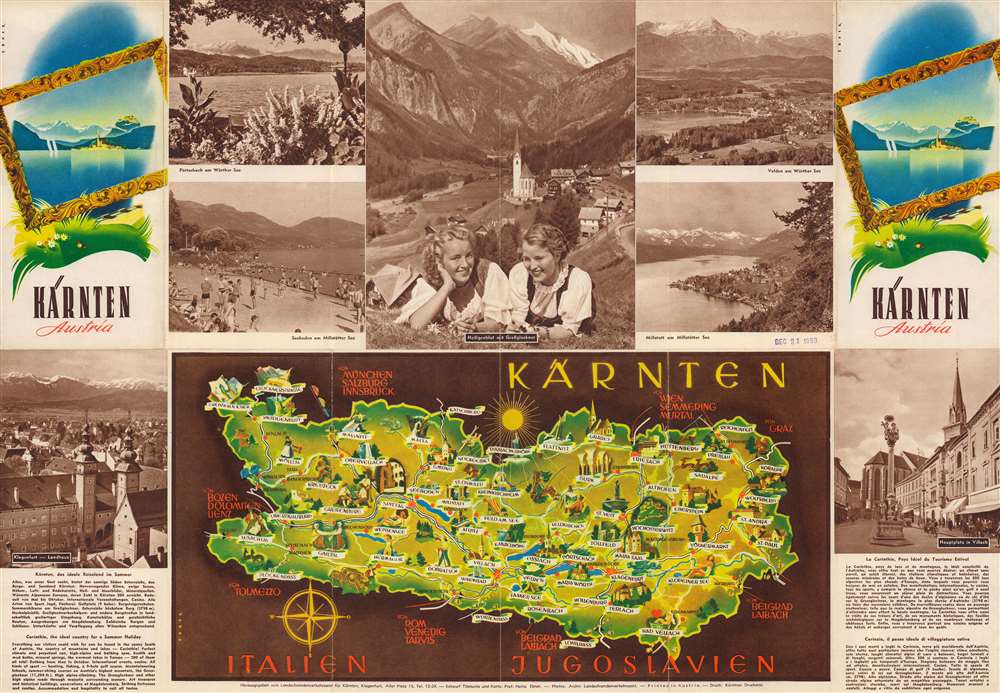
1953 Ebner Pictorial Tourist Map of Karnten (Carinthia), Austria
KarntenAustria-ebner-1953$125.00

Title
Kärnten Austria.
1953 (undated) 16.25 x 23.5 in (41.275 x 59.69 cm)
1953 (undated) 16.25 x 23.5 in (41.275 x 59.69 cm)
Description
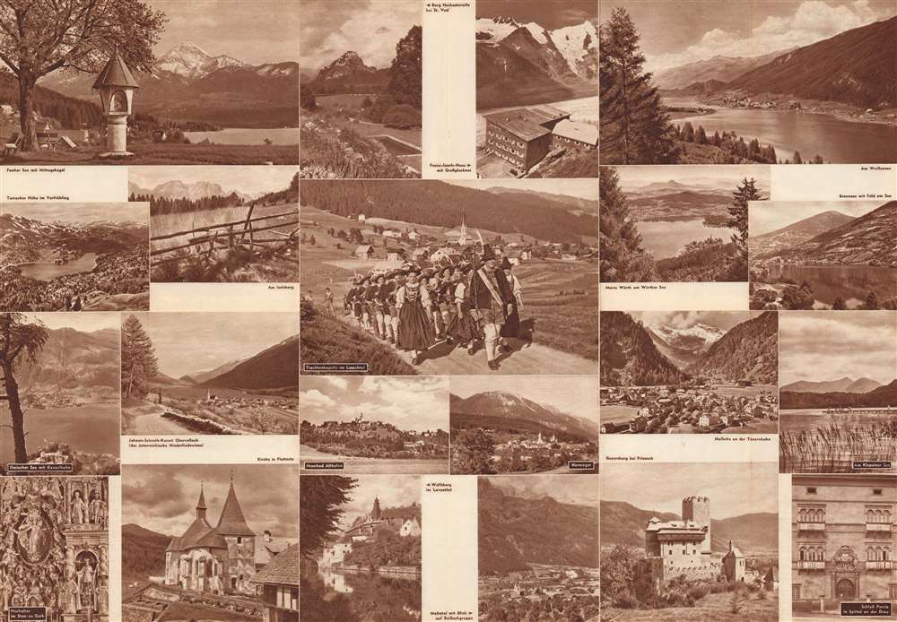
This is a c. 1953 Heinz Ebner pictorial map of Kärnten (Carinthia), Austria. Pictorial vignettes illustrate cities and towns throughout Kärnten, the southernmost state in Austria bordering modern-day Slovenia and Italy. Tourists appear skiing and sunbathing, while locals are depicted dancing and painting. Beautiful illustrations highlight churches, fortresses, and other buildings in the state. German and English text promote Kärnten / Carinthia as a tourist destination and laud its mountains, lakes, majestic scenery, and health spas. Printed photographs on both the recto and verso provide potential tourists with stunning views of both scenery and architecture.
Publication History and Census
This map was drawn by Heinz Ebner and published by the State Tourist Office for Kärnten c. 1953. This is the only known cataloged example.Condition
Very good. Light wear along original fold lines. Printed photographs on verso.