1950 Ashok Tourist Map of the Kashmir Valley, India
KashmirValley-ashok-1950$375.00
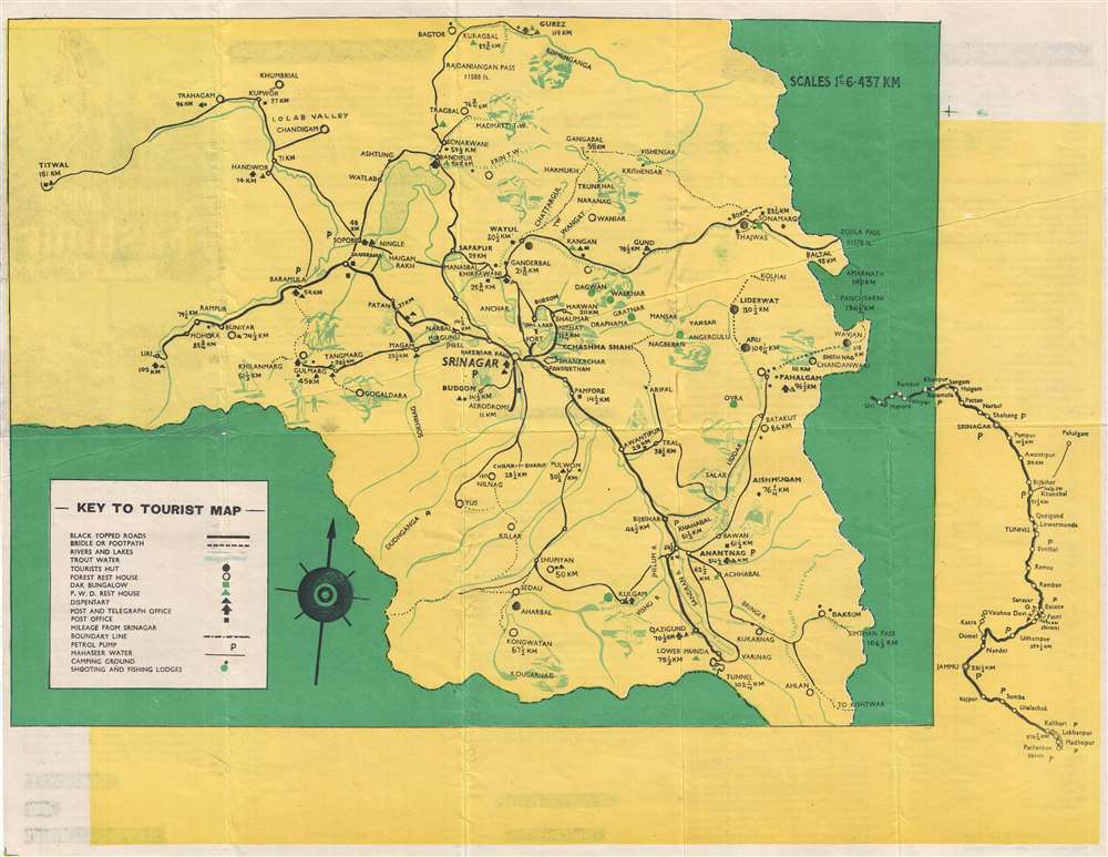

Title
Tourist Map of Kashmir Valley.
1950 (undated) 17 x 21.75 in (43.18 x 55.245 cm) 1 : 4000
1950 (undated) 17 x 21.75 in (43.18 x 55.245 cm) 1 : 4000
Description
This is a c. 1950s Ashok tourist map of the Kashmir Valley in India. Centered on Srinagar, the map depicts the region from Titwal to Zojila Pass and from Bagtor and Burez to Ahlan. Numerous cities, towns, and villages are labeled throughout the region, and the transportation network is clearly marked. Black topped roads are illustrated by the solid black lines, while bridle and foot paths are noted by dashed lines, allowing the traveler to know exactly where they can and cannot drive. Petrol stations are also marked, as are post and telegraph offices. Various types of accommodations are also indicated, including tourist huts, forest rest houses, dak bungalows, and P.W.D. rest houses. Campgrounds and hunting and fishing lodges are also noted. Vignettes of various outdoor activities, including fishing, horseback riding, and hunting, populate the map and led it an air of fun.
Census and Publication History
This map was created by Ashok and published in the 1950s. We are not aware of any other known examples, as this map does not appear in the OCLC, making it an extremely rare find.Condition
Very good. Even overall toning. Wear along original fold lines. Blank on verso.