This item has been sold, but you can get on the Waitlist to be notified if another example becomes available, or purchase a digital scan.
1941 Leiser, Jr. City Map or Plan of Key West, Florida
KeyWest-leiserjr-1957$75.00

Title
The Fascinating Florida Keys and Key West Via the World Famous Overseas Highway Map and Historical Data.
1955 (undated) 12.5 x 17.5 in (31.75 x 44.45 cm) 1 : 19460
1955 (undated) 12.5 x 17.5 in (31.75 x 44.45 cm) 1 : 19460
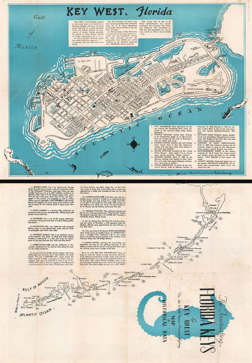
Description
This is a c. 1957 Theodore Leiser, Jr. city map or plan of Key West, Florida. The map depicts the entirety of Key West from Fort Taylor to Stock Island and from the Gulf of Mexico to the Atlantic Ocean. Streets throughout the city are illustrated and labeled, with schools, city happ, the post office, and the West Martello Tower Art Gallery illustrated as well. The U.S. naval base and the navy barracks are identified, as is Meacham Field Airport. The Overseas Highway is labeled along with the naval hospital and the Key West Yacht Club. A short narrative history of Key West is included above the island, while an index of ten locations is situated in the lower right corner and provides short descriptions of these ten sites. A map of the Florida Keys is illustrated on the verso. Each key is labeled and an index in the upper left quadrant provides a sentence or two of information about each one.
Publication History and Census
This map was created by Theodore Leiser, Jr. and published c. 1957. An example of this map is part of the Touchton Map Library at the Tampa Bay History Center and the OCLC catalogs examples as being part of the institutional collections at the University of Wisconsin - Milwaukee and the University of South Florida.Cartographer
Theodore Leiser, Jr. (1942 - present) is an American artist currently living in Alabama. More by this mapmaker...
Condition
Very good. Wear along original fold lines. Some soiling. Map of Florida Keys on verso.
References
Touchton Map Library M1822. OCLC 1102320862.