1923 Chinese Ministry of Finance Postal Wall Map of Manchuria, China
KiHeiManchuria-printingbureau-1923$1,900.00


Title
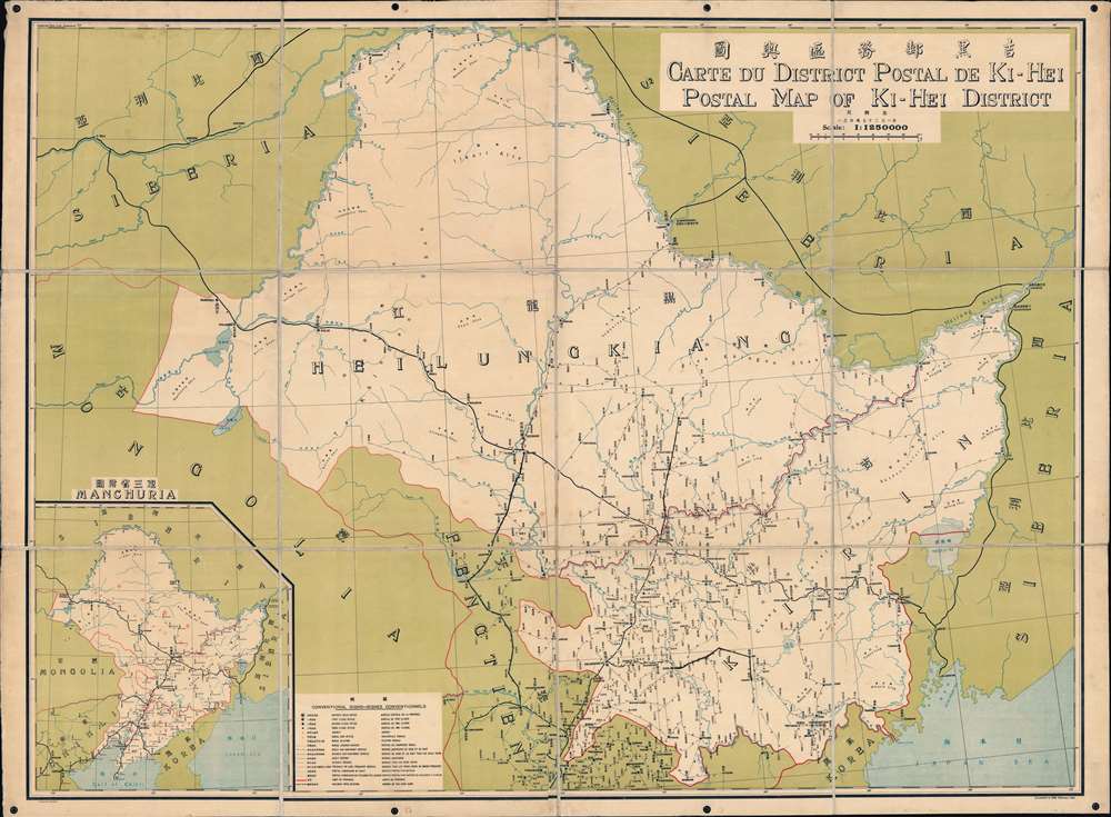
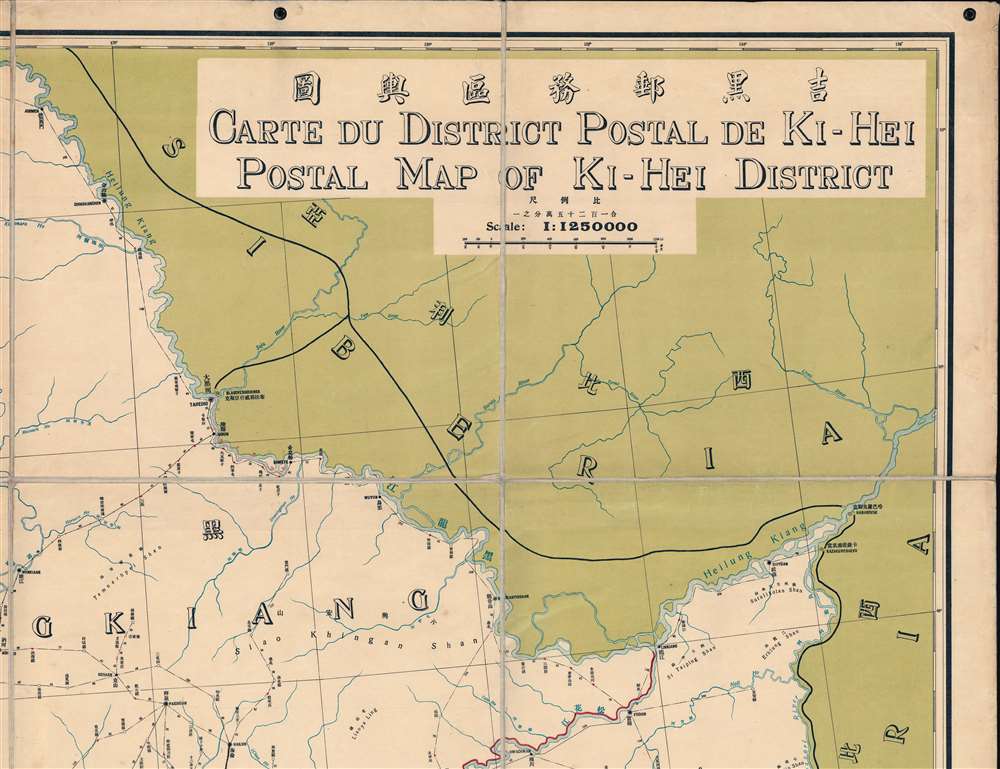
吉黑郵務區輿圖 / Carte du District Postal de Ki-Hei. / Postal Map of Ki-Hei District.
1923 (dated) 42 x 57.25 in (106.68 x 145.415 cm) 1 : 1250000
1923 (dated) 42 x 57.25 in (106.68 x 145.415 cm) 1 : 1250000
Description
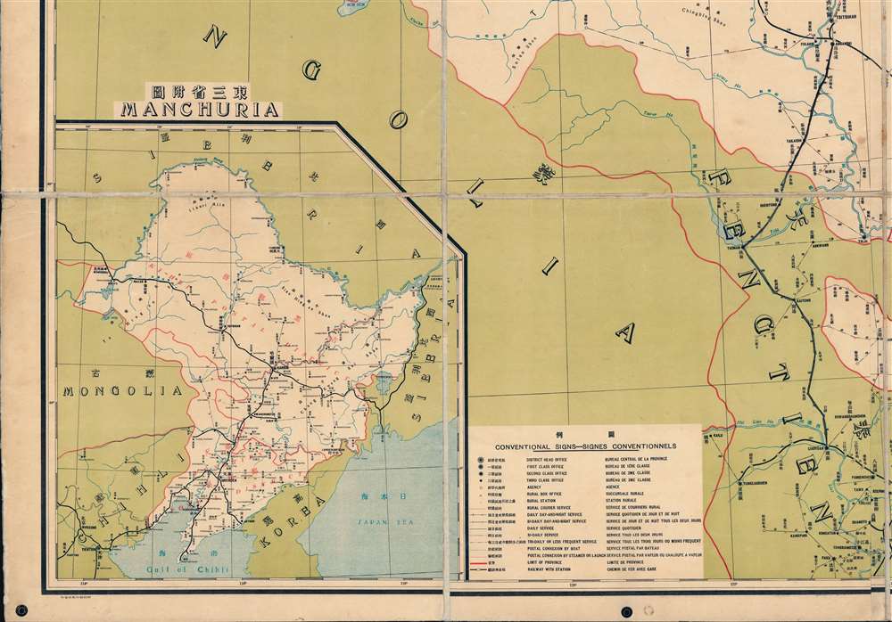
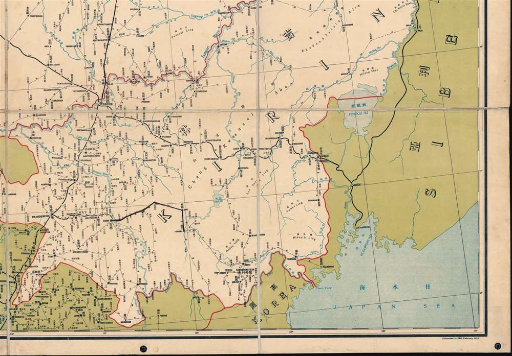
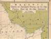
This is an impressive 1923 official tri-lingual (Chinese, French, English) postal wall map of Jihei, at the time known as Ki-Hei, northern Manchuria. The work is a comprehensive postal administration tool, and with it, a postmaster could reasonably manage postal distribution throughout the massive province.
A Closer Look
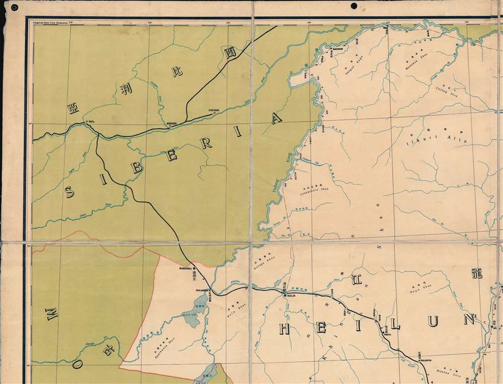
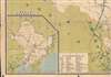
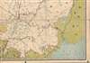
Coverage is centered on the district capital of Harbin. The map is bordered on the north and east by Siberia and the Heilong River (Amur River), and on the south by Mongolia, Fengtien, and Korea. The impressively detailed chart notes postal roads, river crossings, and mileage between post locations. Post Offices appear throughout and are subdivided by size, with seven designations between the single District Head Office (Harbin) and numerous Rural Stations. A key at bottom center breaks down these and other distinctions not used on this map, such as 'Postal Connexion by Boat' suggesting that this coding system was used on other postal maps of the period.Chinese Post
Prior to the Japanese invasion of Manchuria in 1931, during the Mínguó or Republic of China Era (1912 - 1949), Manchuria was divided into two large postal districts. The northern district, Jihei or Ki-Hei, centered on Harbin (哈尔滨) and covered most of modern-day Manchuria to its borders with Siberia, Korea, and Mongolia. The smaller but more populous southern district, Fengtien, consisted of the Liaodong Peninsula, including Russian-administered Port Arthur (大連; Dalian), Moukden (奉天; Shenyang), and Newchwang (牛庄; Yingkou).Railroad Routes
The map notes the Trans-Siberian railway passing north of the border from Chita to Vladivostok. It also notes the Tras-Manchurian Railway to Harbin and the South Manchuria Railway from Harbin to Lüshunkou (旅顺口区). Minor manuscript annotation highlights the line from Kirin (吉林; Jilin) to Omu and Tunhwa (Tonghua; 通化市).Publication History and Census
This map was printed in Beijing by the printing bureau of the Ministry of Finance (財政部) for the Chinese Postal Service in 1923, during the Republic of China. This map was first issued in 1920. The present example has minor updates to 1923. We note examples of the map in its 1927 edition at Yale University and at the British Library, St. Pancras. There is only one recorded holding of this 1923 edition, which is at the University of Kansas.Condition
Very good. Laid down on old linen in 12 sections by publisher. Old linen stable.
References
OCLC 896882279, 755101998.