This item has been sold, but you can get on the Waitlist to be notified if another example becomes available, or purchase a digital scan.
1967 Huiseongsa Korean Pictorial Map of Korea
Korea-huiseongsa-1967$250.00

Title
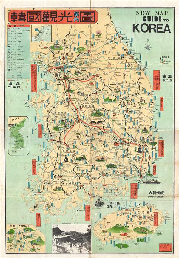
New Map Guide to Korea. / Han'guk Kwan'gwang Annaedo.
1967 (dated) 29 x 20 in (73.66 x 50.8 cm) 1 : 786000
1967 (dated) 29 x 20 in (73.66 x 50.8 cm) 1 : 786000
Description
A very attractive 1967 Korean issue pictorial guide map to Korea by Huiseongsa. The map focuses on modern day South Korea extending from Seoul to Jejudo Island (Cheju). Important historical sites and natural resources are illustrated pictorially. Clearly printed with the Chinese, English, and Japanese tourist in mind, all of the text is in both Chinese and English. An inset in the lower right focuses on Jejudo Island, considered the Hawaii of South Korea, still a wildly popular tourist destination. A secondary inset, in the lower left details Gyeongju (Kyong Ju), a major historical site and the 1000+ year old capital of the Silla Dynasty. On the verso there is are two smaller maps of Seoul. This map was published by Huiseongsa in 1967.
Condition
Good. Minor wear on original fold lines archivally reinforced on verso.
References
OCLC 5412801, 52273992.