
This item below is out of stock, but another example (left) is available. To view the available item, click "Details."
Details
1894 Niigata Shinbun Map of Korea during First Sino-Japanese War
1894 (dated) $1,200.00
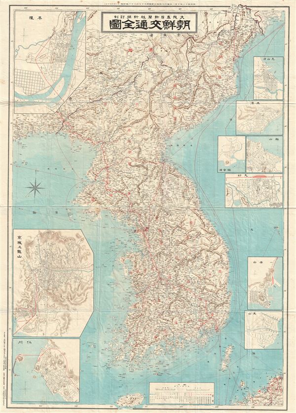
1910 Meiji 43 Large Japanese Map of Korea or Corea
Korea-meiji43-1910$175.00

Title
Korea.
1943 (undated) 43 x 30 in (109.22 x 76.2 cm) 1 : 1000000
1943 (undated) 43 x 30 in (109.22 x 76.2 cm) 1 : 1000000
Description
This is an unusual and appealing large format map of Korea (Corea) dating to 1910 or Meiji 43. This map of Korea made in the 43rd year of the Emperor Meiji's reign, covers all of peninsular Korea (Corea) as well as parts of adjacent Manchuria. The map proper is surrounded by ten inset maps detailing important Korean cities and ports, including Seoul, Pyongyang, Busan, Incheon, etc. All major towns, cities, provinces, roads, and railways are noted, including various other topographical details. Text is in Japanese. This map was printed by the Osaka Mainichi News in 1910.
Condition
Very good. Minor wear along original fold lines. Blank on verso.