This item has been sold, but you can get on the Waitlist to be notified if another example becomes available.
1965 Kwang Chi Book Company City Plan or Map of Kowloon, Hong Kong
KowloonHongKong-kwongchi-1965$325.00

Title
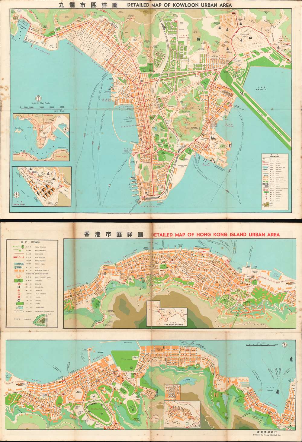
Detailed Map of Kowloon Urban Area. / 圖詳區市龍九
1965 (undated) 15.5 x 21.25 in (39.37 x 53.975 cm) 1 : 16000
1965 (undated) 15.5 x 21.25 in (39.37 x 53.975 cm) 1 : 16000
Description
This is a bilingual Chinese and English c. 1965 Kwong Chi Book Company city plan or map of Kowloon and Victoria, Hong Kong. Small icons highlight the city's airport and runway, ferry lines, piers, and factories. Other mark stadiums, rail lines, and bus routes. Streets are labeled in both Chinese and English. Contour lines provide some understanding of the city's topography. A key situated in the bottom right corner details the icons and symbols used, and insets in the lower left corner depict Kowloon and Kwun Tong.
Publication History and Census
This map was created and published by the Kwong Chi Book Company c. 1965. We have not been able to identify another example in any sales history or institutional collection.Cartographer
The Kwong Chi Book Company (fl. c. 1900 - c. 1965) was a book publishing firm active in Hong Kong during the early- and mid-twentieth century. More by this mapmaker...
Condition
Good. Exhibits wear and soiling along original fold lines. Foxing along margins. Two maps of Hong Kong on verso. Image represents both sides of a printed map.