This item has been sold, but you can get on the Waitlist to be notified if another example becomes available, or purchase a digital scan.
1945 British Army Map of Kuala Lumpur and Environs, Malaysia
KualaLumpur-gsgs-1945$600.00

Title
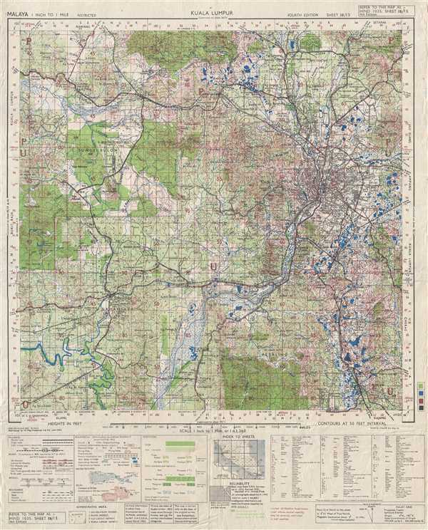
Kuala Lumpur. HIND 1035, Sheet 3B/15 4th Edition.
1945 (dated) 24 x 19.5 in (60.96 x 49.53 cm) 1 : 63360
1945 (dated) 24 x 19.5 in (60.96 x 49.53 cm) 1 : 63360
Description
This is a 1945 British Army map of the city of Kuala Lumpur and its environs. The map depicts the region from west of Batu Tiga to Batu Ampat and from the Batu Caves to Serdang. Kuala Lumpur is situated along the map's right side, with myriad buildings illustrated within and around the city. Several locations are labeled, such as the army camp, the race course, and the golf club. Roads and railways extend out from the city in almost every direction and all the F.M.S. Railways lines are labeled. Contour lines throughout the map indicate altitude, with each line indicating an increase of fifty feet. Estates, forests, and rivers are illustrated and labeled. A key along the bottom of the map explains the various notations used, including the different symbols denoting rubber, oil palm, coconut, and orchard trees. A second table, to the right of the key, includes all the abbreviations used on the map.
This map was created by the Geographical Section of the General Staff and printed by the IIO Map Production Company in June 1945.
This map was created by the Geographical Section of the General Staff and printed by the IIO Map Production Company in June 1945.
Condition
Very good. Even overall toning. Wear along original fold lines. Blank on verso.