1964 Survey Dept. of Malaya Map of Kuala Lumpur, Malaysia
KualaLumpur-surveydept-1964$1,350.00

Title
Kuala Lumpur.
1964 (dated) 31.5 x 27.5 in (80.01 x 69.85 cm) 1 : 10560
1964 (dated) 31.5 x 27.5 in (80.01 x 69.85 cm) 1 : 10560
Description
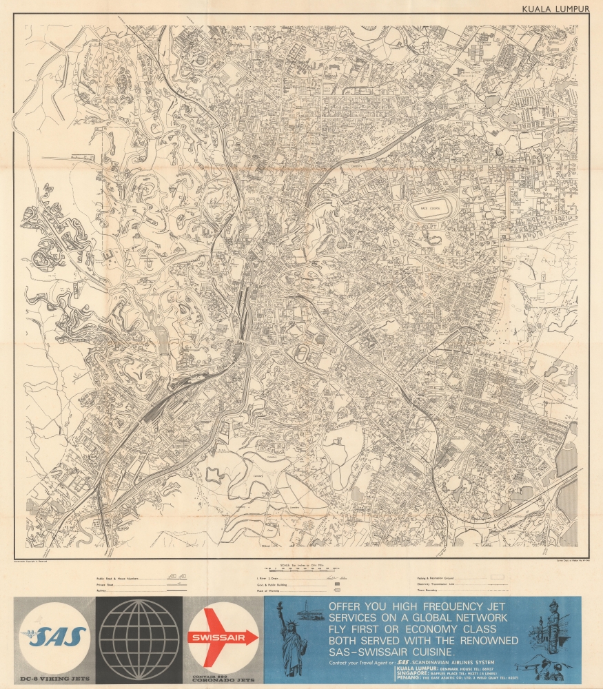
A rare 1964 large-scale Survey Department of Malaya map of Kuala Lumpur, Malaysia. This map is centered on the Kuala Lumpur City Center and the modern-day Central Market. This map captures Kuala Lumpur's most dramatic period of urban expansion. At the base of the map various airlines, including SAS and Swiss, promote their services.
Kuala Lumpur
Kuala Lumpur became the capital of the Federation of Malaya in 1957 and, one year before this map was printed, in 1963, the capital of Malaysia. Between 1940 and 1970 the city tripled its area and more than quadrupled its population - transforming into a major center of population and commerce. Today Kuala Lumpur is a sprawling megacity and the capital of Malaysia. It is the only 'alpha world' city in Malaysia and is the nation's cultural, financial, and economic center.Publication History and Census
This map was printed for the Survey Department of Malaya one year after Kuala Lumpur was made capital of Malaysia. Any early map of KL is rare.Cartographer
Survey Department, Federation of Malaya (1885 - present), today the Department of Survey and Mapping Malaysia (Jabatan Ukur dan Pemetaan Malaysia, abbreviated as JUPEM), has origins in the Department of Survey, Johor, established in 1885. The survey departments of the various states and settlements of Malaya were gradually merged and formally placed under a single administration upon independence in 1957, though to this day JUPEM is divided into units according to state that are generally successors to the former survey departments of the individual states. More by this mapmaker...
Condition
Very good. Some wear on old fold lines.