This item has been sold, but you can get on the Waitlist to be notified if another example becomes available, or purchase a digital scan.
1757 Bellin Map of Hudson Bay
LaBayeDeHudson-bellin-1757$87.50

Title
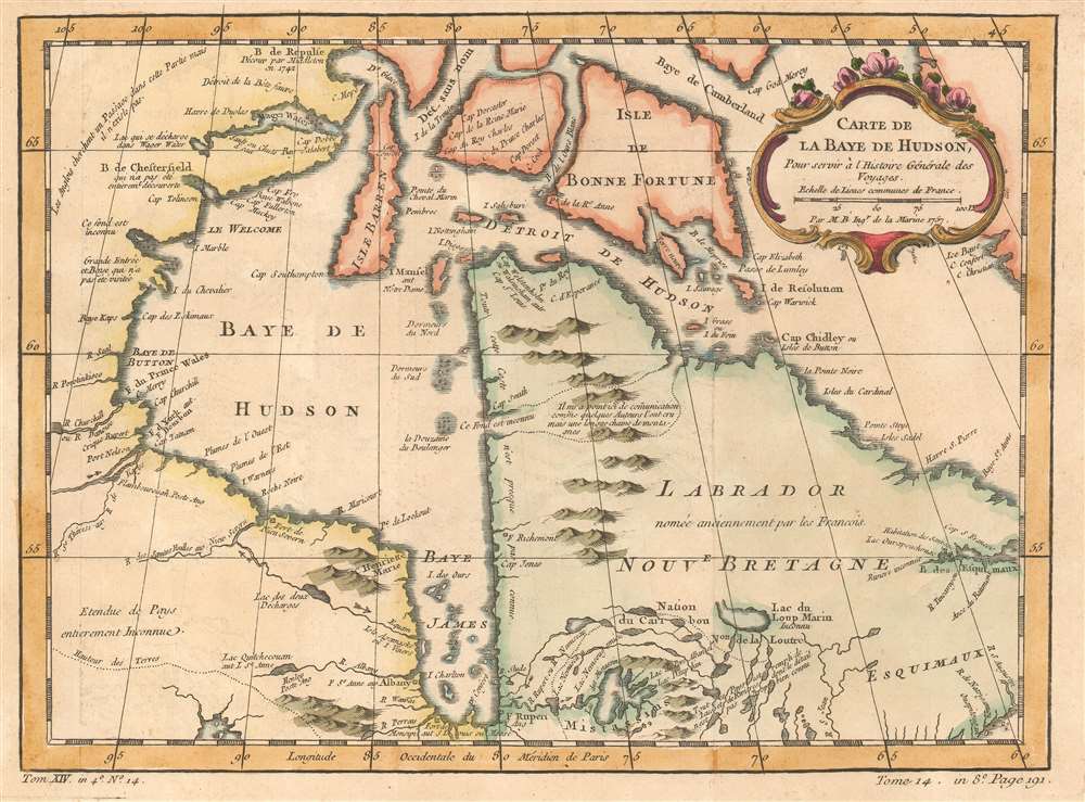
Carte de La Baye de Hudson
1757 (dated) 8.75 x 12 in (22.225 x 30.48 cm) 1 : 3168000
1757 (dated) 8.75 x 12 in (22.225 x 30.48 cm) 1 : 3168000
Description
This is a 1757 Jacques-Nicolas Bellin map of Hudson Bay. The map depicts the region from Manitoba and Nunavut to Newfoundland and Labrador and from Southampton Island to Ontario. Myriad locations throughout the region are labeled, mostly rivers, bays, and islands. Notes about the region are also included, such as the west coast of Labrador, which reads, 'All of this coast is almost completely unknown'. Another, in Manitoba / Nunavut states, 'The English are looking for a [Northwest] Passage in this area but it doesn't exist,' while Ontario is 'entirely unknown'.
Census and Publication History
This map was created by Jacques-Nicolas Bellin for publication in in Abbé Prévost's Histoire Générale des Voyages.Cartographer
Jacques-Nicolas Bellin (1703 - March 21, 1772) was one of the most important cartographers of the 18th century. With a career spanning some 50 years, Bellin is best understood as geographe de cabinet and transitional mapmaker spanning the gap between 18th and early-19th century cartographic styles. His long career as Hydrographer and Ingénieur Hydrographe at the French Dépôt des cartes et plans de la Marine resulted in hundreds of high quality nautical charts of practically everywhere in the world. A true child of the Enlightenment Era, Bellin's work focuses on function and accuracy tending in the process to be less decorative than the earlier 17th and 18th century cartographic work. Unlike many of his contemporaries, Bellin was always careful to cite his references and his scholarly corpus consists of over 1400 articles on geography prepared for Diderot's Encyclopedie. Bellin, despite his extraordinary success, may not have enjoyed his work, which is described as "long, unpleasant, and hard." In addition to numerous maps and charts published during his lifetime, many of Bellin's maps were updated (or not) and published posthumously. He was succeeded as Ingénieur Hydrographe by his student, also a prolific and influential cartographer, Rigobert Bonne. More by this mapmaker...
Condition
Very good. Even overall toning. Light wear along original fold lines. Blank on verso.
References
OCLC 5411766.