This item has been sold, but you can get on the Waitlist to be notified if another example becomes available.
1965 S. Florida Flood Control Dist. Recreation Dept. Pictorial Map of Lake Okeechobee
LakeOkeechobee-recdept-1965$100.00

Title
A Comprehensive Fishing and Recreation Map of the Lake Okeechobee Area.
1965 (dated) 16.5 x 14 in (41.91 x 35.56 cm) 1 : 158400
1965 (dated) 16.5 x 14 in (41.91 x 35.56 cm) 1 : 158400
Description
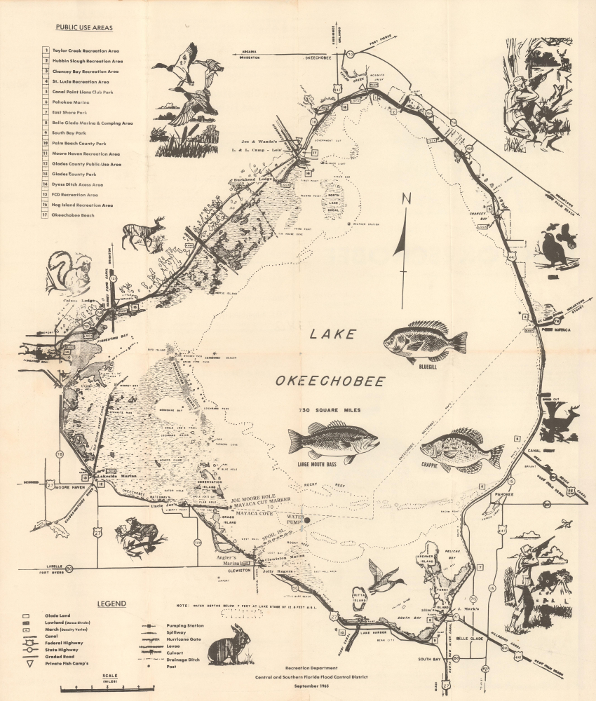
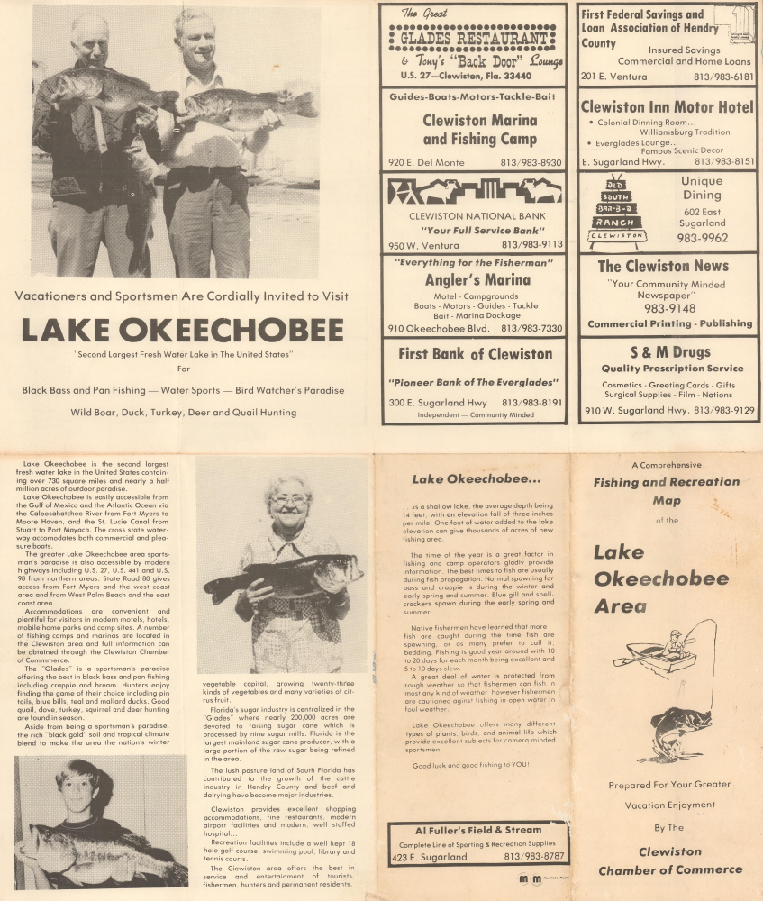
This is a 1965 Central and Southern Florida Flood Control District Recreation Department pictorial tourist map of Lake Okeechobee, Florida. The map highlights places for tourists to stay, including campgrounds and lodges, as well as recreation areas, parks, and, of course, marinas for launching boats to enjoy Lake Okeechobee from the water.
A Closer Look
Ringed by highways, Lake Okeechobee fills the sheet. Lodges, campgrounds, marinas, islands, locks, coves, creeks, and other coastal locations are identified. 17 different locations are numerically labeled, including several recreation areas, many parks, and Okeechobee Beach. Clewiston and Belle Glade are both labeled. Several illustrations adorn the piece, including drawings of a largemouth bass, a crappie, and a bluegill, along with a rabbit, puma, and several ducks. Vignettes of hunters appear along the right edge. Advertisements for businesses in Clewiston and information about Lake Okeechobee occupy the verso.Publication History and Census
This map was created by the Recreation Department of the Central and Southern Florida Flood Control District in September 1965 and published as part of a promotional brochure of the Lake Okeechobee area by the Clewiston Chamber of Commerce. Two empty OCLC entries exist for this map (one that dates the map to 1965 and the other to 1966), which suggests that an institution that was once a member of the OCLC created the entry. We have been unable to determine the difference between the two editions in the OCLC. The Touchton Map Library at the Tampa Bay History Center has an example of the map in their collection, but its verso content is different from the present example.Condition
Very good. Light wear along original fold lines. Slight loss along a fold line just to the right of Spoil Isl. through the text that reads 'Water Pump'.
References
Tampa Bay History Center Touchton Map Library 2018.115.048. OCLC 948302124, 948304199.