This item has been sold, but you can get on the Waitlist to be notified if another example becomes available.
1974 J and R Map Company City Plan or Map of Largo, Florida, and Environs
LargoFlorida-jrmapco-1974$75.00


Title
Largo, Florida.
1974 (dated) 31 x 18 in (78.74 x 45.72 cm) 1 : 37270
1974 (dated) 31 x 18 in (78.74 x 45.72 cm) 1 : 37270
Description
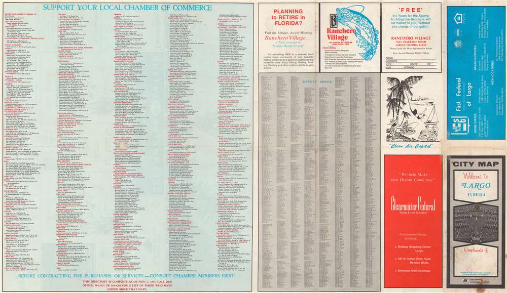
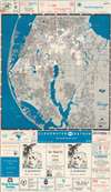
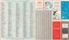
This is a 1974 J and R Map Company city plan or map of Largo, Florida and environs. Depicting from Old Tampa Bay south to the Tom Stuart Causeway and the Seminole Bridge, streets are illustrated and labeled throughout the area. Largo is highlighted by a bright white, while the rest of the region is shaded gray. A red dashed line marks Largo's city limits. Other than streets and lakes, the only sites labeled are golf clubs and a yacht club. Advertisements for local realtors, banks, churches, and a handful of local businesses appear above and below. A business index and a street index occupy the majority of the verso.
Publication History and Census
This map was created and published by the J and R Map Company in 1974. We note a single cataloged example, at the Library of Congress.Condition
Good. Wear along original fold lines. Soiling.
References
OCLC 5413885.