
1960 Pictorial Map of Las Vegas (The Strip)

This Item
Enquire
Hit the Strip!
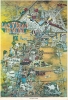
A dramatic pictorial view of Las Vegas issued by 'King' in 1960. The view looks north on Las Vegas, following South Las Vegas Blvd. (the Strip) towards its intersection with Fremont Street (Old Las Vegas). Various old-time casinos are labeled, ranging from the Tropicana, to MGM, to Caesar's Palace and the Dunes. The airport is at bottom right and a sign at upper left points southeast towards Hoover Dam. Those not gambling play gulf, prospect for gold, or explore the many varied 'entertainments' the city has to offer.Publication History and Census
The map is unsigned, but Rumsey associates it with 'King'. Although much reproduced, originals are extremely scarce. The Rumsey example, now housed at Stanford, is the only other surviving original of which we are aware.Condition
Average. Various margin repairs and reinforcements. Some fading.
References
Rumsey 8959.000. Stanford, Rumsey Map Center, G4354.L3 A5 1960 .K5.