
1943 Metsker Map of Lincoln County, Washington

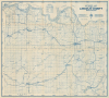

Metsker's Map of Lincoln County Washington.
Largest Hydroelectric Dam in North America.
- Digital Map Information
- Suitable for large format printing
- File Size: 37.22 MB
- File Type: ZIP / TIFF
- ICC color profile embedded
- Delivered instantly via download link
Largest Hydroelectric Dam in North America.
This is Charles F. Metsker's 1943 survey map of Lincoln County, Washington. Among other features, it is notable for including the Grand Coulee Dam (which was completed the previous year) and reflecting the changes it brought to the area.A Closer Look
Survey lines overlie the map, forming a numbered grid. Aside from these neat, geometric lines, cities, towns, waterways, roads (of varying qualities), railroads, electrical lines, airports, and other features are indicated, with symbols explained in the legend to the left of the title. This area includes several ghost towns, including Fishtrap (located at the right, towards the bottom), Bagdad (at the top-left), and Govan (at the left). Notably, the Grand Coulee Dam is indicated at top-left, just beyond the county boundary. The dam, which was fully opened the previous year, had a massive impact on surrounding areas, completely transforming the width of the Columbia River at top here, to the extent that it was dubbed 'Empire Lake' along this portion (for comparison, see the similar, 1908 'Official Map of Lincoln County, Washington' digitized by the Washington State University Libraries).Grand Coulee Dam
The Grand Coulee Dam was first imagined in the late 19th century as a means of providing a reliable supply of irrigation water for central and eastern Washington. The Grand Coulee is an ancient riverbed carved out by a glacier, making it a natural channel for snowmelt and rainwater, or for storing irrigation water. The concept of building a dam at the Grand Coulee was given strong impetus when the U.S. Bureau of Reclamation was created in 1902, with a focus on dam projects in the Western U.S. Still, the Grand Coulee project faced obstacles, including voters' rejection of a bond measure for it in 1914.Although support for a concrete dam increased over the following decade, President Calvin Coolidge's administration showed little interest in or support for the project. Studies were conducted by the U.S. Army Corps of Engineers, providing a solid basis for construction when political support finally arrived with the start of the Franklin D. Roosevelt Administration in 1933. Now with a focus on power generation in addition to irrigation, funds were allocated, and construction on the project began in July 1933. Designs were changed after construction began, from a 'low dam' to a more ambitious 'high dam' (the hydroelectric power generated by the 'high' dam was used to pump water into the basin), which delayed its completion until 1942. Nevertheless, the scale of the project and the benefits it provided made it a showcase piece for the Bureau of Reclamation and the Roosevelt Administration. It was later expanded with additional generators and has long been considered the largest power generation facility in the country by capacity.
Like nearly all the Bureau of Reclamation's dam projects, the Grand Coulee Dam has not been without controversy. It was especially damaging to local Native American communities, whose traditional methods of fishing and hunting in these areas were made untenable. Seasonal and permanent settlements, including burial grounds, of local native peoples were also submerged under water by the project. As a result, since the 1990s, the federal government has allocated funds to compensate the Colville and Spokane tribes.
Publication History and Census
This map was prepared by Charles Frederick Metsker in 1943 (dated in very small print just outside the neatline at bottom-right). The map is unrecorded in the OCLC; while much later editions with this title do appear, the closest contemporary, partial match to this map is a c. 1934 'Metsker's pocket map of Lincoln County, Washington' on a different scale held by the University of California and Washington State University (OCLC 39222306).Cartographer
Charles Frederick Metsker (December 5, 1881 - October 6, 1966) was an American cartographer and publisher. Born in Douglas County, Kansas, Metsker's family moved to Winlock, Washington, in 1900. Metsker began publishing maps in 1901 in Tacoma, Washington. By the 1920s he was advertising as 'Metsker the Map Man' in Washington and Oregon newspapers. He opened a brick and mortar store in 1950 in Seattle and sold Township maps and atlases and County maps. He married Minnie B. Clevenger (1888 - 19xx) on May 11, 1905, with whom he had two children. They divorced sometime between 1910 and 1920. He married Elizabeth F. Metsker (1899 - 1982) on November 6, 1922, with whom he had a daughter. He retired in 1948 when he turned the business over to his son. He died in McMinnville, Oregon, at the age of 84. Metsker Maps joined forces with the Kroll Map Company, another Seattle-based mapmaker, in 1980. Metsker Maps continues to operate in Seattle to this day, where they can be visited at the Pike Place Market in the Sanitary Market Building. Further Details...
Condition
Very good. Some wear, toning, and verso stabilization along some old fold lines. Blank on verso.