This item has been sold, but you can get on the Waitlist to be notified if another example becomes available, or purchase a digital scan.
1900 Bacon Pocket Map of London, England
London-bacon-1900$125.00

Title
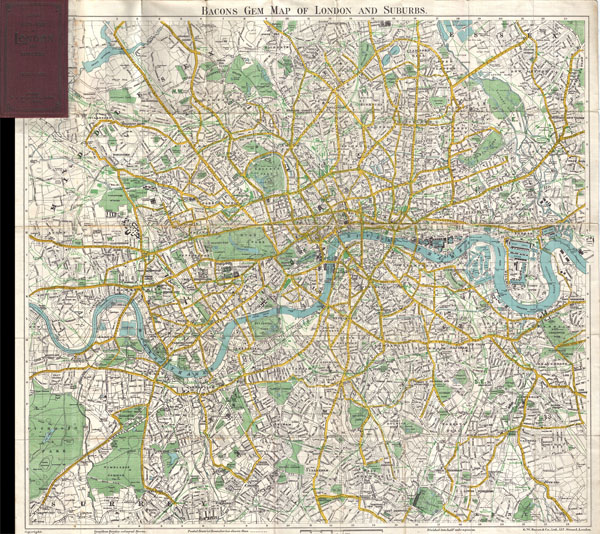
Bacons Gem Map of London and Suburbs
1900 (undated) 22 x 24 in (55.88 x 60.96 cm)
1900 (undated) 22 x 24 in (55.88 x 60.96 cm)
Description
This Bacon's uncommon c. 1900 map of London, England. Covers London from Mortlake and Richmond Park to the East India Docks and Greenwich Park. Names all streets, parks, railways, and numerous important buildings. Folds into its original maroon binder.
Cartographer
George Washington Bacon (1830 - 1922) was a London based book and map publisher active in the mid to late 19th century. Bacon's firm G.W. Bacon and Co. purchased the plates created by Edward Weller for the Weekly Dispatch Atlas then modified and updated them for several of their own important atlases, including The New Ordnance Atlas of the British Isles. In 1893, Bacon & Co. acquired the map publishing business of J. Wyld. Then, around the turn of the century, Bacon & Co. itself was folded into the Scottish publishing house of W.& A.K. Johnston. More by this mapmaker...
Condition
Very good condition Minor wear on original fold lines. Blank on verso. Attached to original linen binder.