1831 Cruchley Map of London w/ Original Stitched Sleeve
London-cruchley-1831$2,500.00

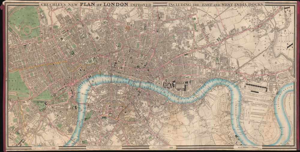


Title
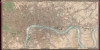
Cruchley's New Plan of London Improved including the East and West India Docks.
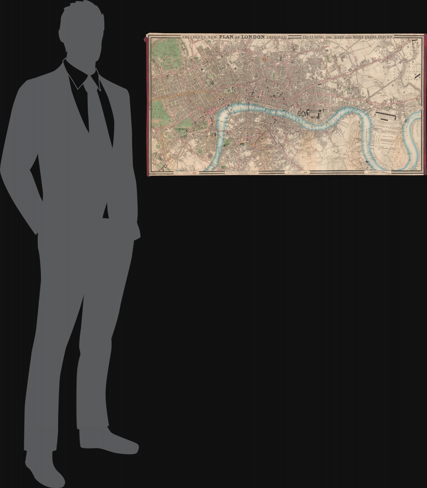
1831 (undated) 18.5 x 37 in (46.99 x 93.98 cm) 1 : 12870
1831 (undated) 18.5 x 37 in (46.99 x 93.98 cm) 1 : 12870
Description
A fine example of the scarce 1831 edition of George Frederick Cruchley's large and famous city plan or map of London, contained within its original rolled silk slip-bag, a unique presentation giving the piece an authentic objective tactility.
The John signed here may have been John Fullerton (c. 1784 - 1854), son of William Fullerton-Elphinstone and Elizabeth Fullerton. Though his father (who had been director of the East India Company several times) was still alive, he had suffered a stroke in 1825 and it conceivable that John and his mother jointly signed this map together, though John appears to have been in Canton with the East India Company for most of his adult life. It is also possible that the John signed here was a lesser-known member of the family, not memorialized at length in the family genealogies, and Eliza was his wife or perhaps sister or mother.
A Closer Look
The map depicts the city from Hyde Park to the London Docks and from Regent's Park and the Regents Canal to Kennington and Walworth. It is highly detailed, with streets and other locations labeled throughout. Buckingham Palace, St. James's Palace, the Houses of Parliament, Westminster Abbey, and the Tower of London are among the sites specifically identified. The detail even extends to labeling locations within the city parks. The City of London, Westminster, and Southwark are differentiated. Within Southwark, the jurisdictions of the Rules of the King's Bench Prison, Rules of Fleet Prison, and Liberty of Clink are similarly demarcated.Center of the 19th Century World
The early 19th century was a period of extraordinary growth for London as the industrial revolution motivated thousands to relocate to the teaming metropolis. The wealth generated by a global empire combined with a population explosion led to greater demand for modern urban infrastructure. Cruchley aptly names this his 'New Plan of London' and takes pains to note all the latest and greatest additions to the city's landscape. From docks and canals to new bridges and tunnels (including the projected Thames Tunnel at right-center, a pioneering engineering marvel), Cruchley's London was transforming into a modern global megapolis.Peerage Provenance
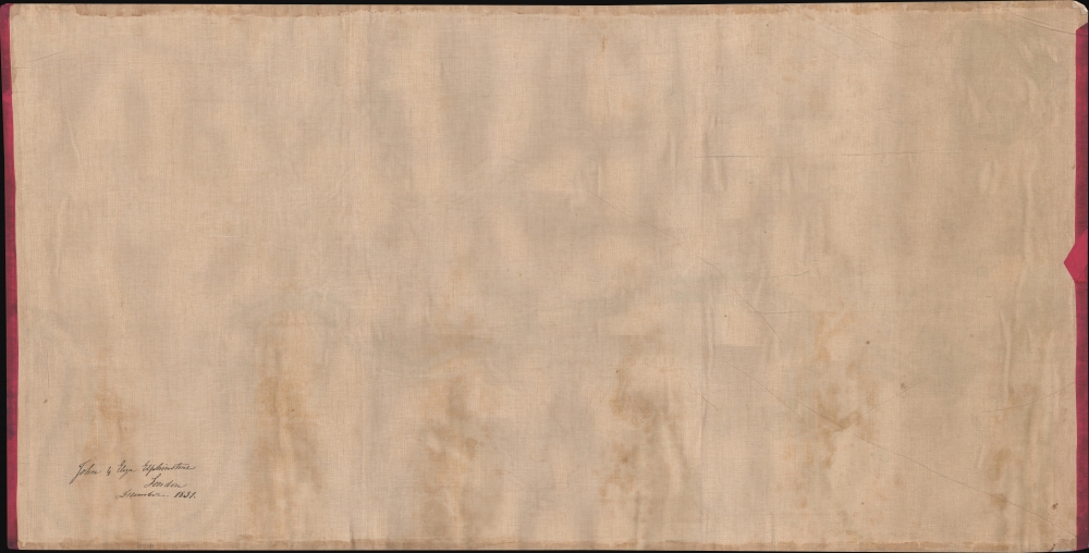
The verso is signed 'John and Eliza Elphinstone, London, December 1831.' Undoubtedly, these were members of the esteemed Scottish noble and baronial family which played an especially prominent role in the history of India. The exact identity of these individuals is unclear. John may be the 13th Lord Elphinstone, who became a member of Parliament and had an esteemed career in India, including governorships of Madras and Bombay, including during the 1857 Mutiny. However, that Lord Elphinstone is not known to have ever married (though a rumor contends that he was sent to India after gaining the attractions of a young Queen Victoria).The John signed here may have been John Fullerton (c. 1784 - 1854), son of William Fullerton-Elphinstone and Elizabeth Fullerton. Though his father (who had been director of the East India Company several times) was still alive, he had suffered a stroke in 1825 and it conceivable that John and his mother jointly signed this map together, though John appears to have been in Canton with the East India Company for most of his adult life. It is also possible that the John signed here was a lesser-known member of the family, not memorialized at length in the family genealogies, and Eliza was his wife or perhaps sister or mother.
Publication History and Census
Cruchley first issued this map in 1827, with more than 18 subsequent editions, most of which included significant updates throughout. Aside from the date of the signature on the verso, the present example can be tentatively dated as it lacks the phrase 'improved to 1829/1832' present on earlier and subsequent editions, but can be judged to depict London in the early 1830s. It is also distinguished by the inclusion of the phrase 'including the East and West India Docks' in its title. Examples of this edition are scarce, only being noted among the holdings of the Zentralbibliothek Zürich (dated 1832 by them), and this example is especially notable for being accompanied by its original roll slip bag.Cartographer
George Frederick Cruchley (April 23, 1797 - June 16, 1880) was a London based book and map seller active in the middle part of the 19th century. Cruchley began his cartographic career as an apprentice at the venerable Aaroon Arrowsmith firm. Many of Cruchley's earliest maps bear the words 'From Arrowsmith's' on the imprint. In 1844, Cruchley acquired the massive stock of the important early 19th century firm of John Cary. Cruchley published his own maps as well as reissues of Cary's stock well into the 1870s. He is best known for his detailed plans of London, which in recent years have become increasingly scarce and desirable. Cruchley was based in London on 38 Ludgate Street until 1834 when he moved his offices to 81 Fleet Street. Shortly before his death in 1880 Cruchely auctioned (Hodgson's Auctions, Jan 16, 1877) his entire stock. Many of his map plates were thusly acquired by 'Gall and Inglis' who continued the Cruchley tradition well into the early 20th century. Cruchley's son, also George Frederick (1837 - 1882), continued to work as a book and map seller until his death. More by this mapmaker...
Condition
Very good. Some sporadic areas of wear and creasing.
References
Howgego, James L., Printed Maps of London circa 1553-1850, #304, B, state 6. OCLC 1284309215, 730018666.