This item has been sold, but you can get on the Waitlist to be notified if another example becomes available, or purchase a digital scan.
1890 Pocket Map of London, England and Vicinity
London-unknown-1890$150.00

Title
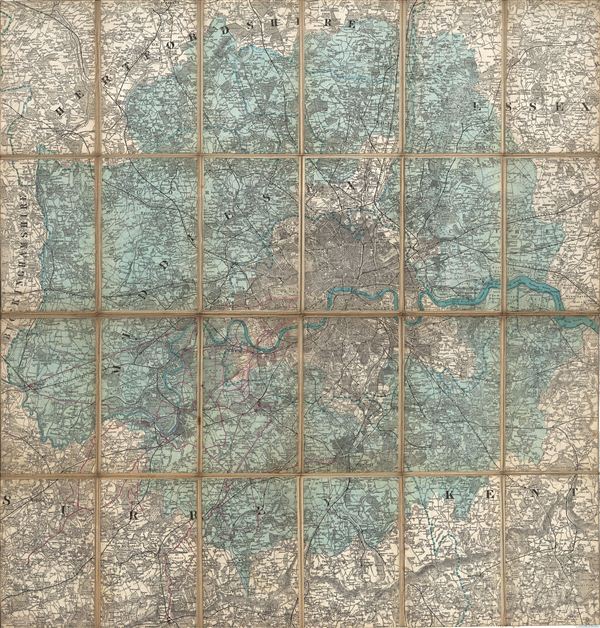
London.
1890 (undated) 27.5 x 26.5 in (69.85 x 67.31 cm)
1890 (undated) 27.5 x 26.5 in (69.85 x 67.31 cm)
Description
An unusual map of London, england, and vicinity by an unknown cartographer – but probably part of the Ordinance Survey. Centered on the valley of the Thames, this map covers all of central London as well as Middlesex County, parts of Surrey, Kent, essex, Buckinghamshire and Hertfordshire. Middlesex is highlighted in light blue to distinguish it from London proper and the surrounding counties. Unknown cartographer. Undated but stylistically consistent with the late 19th century.
Condition
Good condition. Dissected and mounted on linen. Borders trimmed.