This item has been sold, but you can get on the Waitlist to be notified if another example becomes available, or purchase a digital scan.
1805 City Plan or Map of London, England, and Environs
LondonEnvirons-anonymous-1805$125.00

Title
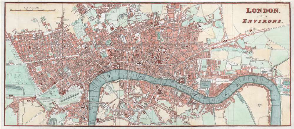
London and its Environs.
1805 (undated) 9 x 21 in (22.86 x 53.34 cm) 1 : 9400
1805 (undated) 9 x 21 in (22.86 x 53.34 cm) 1 : 9400
Description
This is an 1805 city plan or map of London created by an anonymous cartographer. Depicting the city from Hyde Park to the West India Docks and from Pentonville to Tothill Fields, sites around the city are identified. St. Paul's Church, the London Amphitheatre, and the Tower of London rank among these locations. Streets and parks are labeled throughout the city. A grid labeled with Roman numerals divides the map, but no key is present.
Condition
Good. Area 2 by 2.5 inches near Queens Garden expertly reattached. Top right corner reattached.
References
Howgego, J. Printed Map of London circa 1553 - 1850, #234.