1957 U.S. Air Force Aeronautical Map of the London Reefs, Spartly Islands
LondonReefs-usaf-1957$100.00

Title
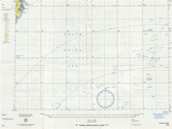
London Reefs Vietnam.
1957 (dated) 22 x 29 in (55.88 x 73.66 cm) 1 : 1000000
1957 (dated) 22 x 29 in (55.88 x 73.66 cm) 1 : 1000000
Description
This is an uncommon 1957 U.S. Air Force aeronautical chart of the London Reefs located in the Spartly Islands of the South China Sea. The map covers from Nha Trang on the southeastern coast of Vietnam and extends southeast as far as West York Island. The map identifies islands and reefs throughout including reefs whose existence is doubtful. It also cautions pilots on uncharted reefs and shoals.
The Spartly Islands, a group of more than 750 reefs, islets, atolls and islands in the South China Sea, are dangerous for mariners due to the numerous reefs which rise unexpectedly from the depths of the ocean. Due to its proximity to the Philippines, Vietnam and Malaysia, as well as China and Taiwan, the region is in the midst of a territorial dispute.
Verso of this chart features legends and a world aeronautical chart index. This chart was published by the Aeronautical Chart and Information Center and issued as chart no. 740. First issued in 1954, this is the fifth edition revised to 1957.
Condition
Very good. Minor wear and toning along original fold lines. Minor worm holes along centerfold.