1914 Hammond Road Map of Long Island w/ Brooklyn and Suffolk Co.
LongIsland-hammond-1914$600.00

Title
Hammond's New Road Map Long Island.
1914 (dated) 16.75 x 26 in (42.545 x 66.04 cm) 1 : 126720
1914 (dated) 16.75 x 26 in (42.545 x 66.04 cm) 1 : 126720
Description
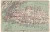
This is a 1914 C.S. Hammond double-sided road map of Long Island with eastern Suffolk County on the recto and New York City on the verso.
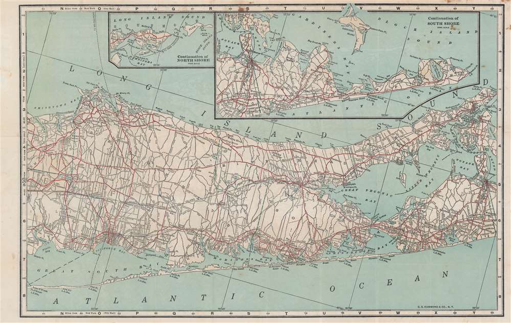
Eastern Suffolk County
A map of eastern Suffolk County occupies the recto. Major roads are illustrated and are differentiated between 'good roads' and 'fair roads'. Riverhead, Southold, and Southampton are illustrated. An inset along the upper border continues along South Shore and focuses on East Hampton. A second, smaller inset continues the North Shore and illustrates Orient Point, Gardiners Bay, and Plum Island.Brooklyn and Queens
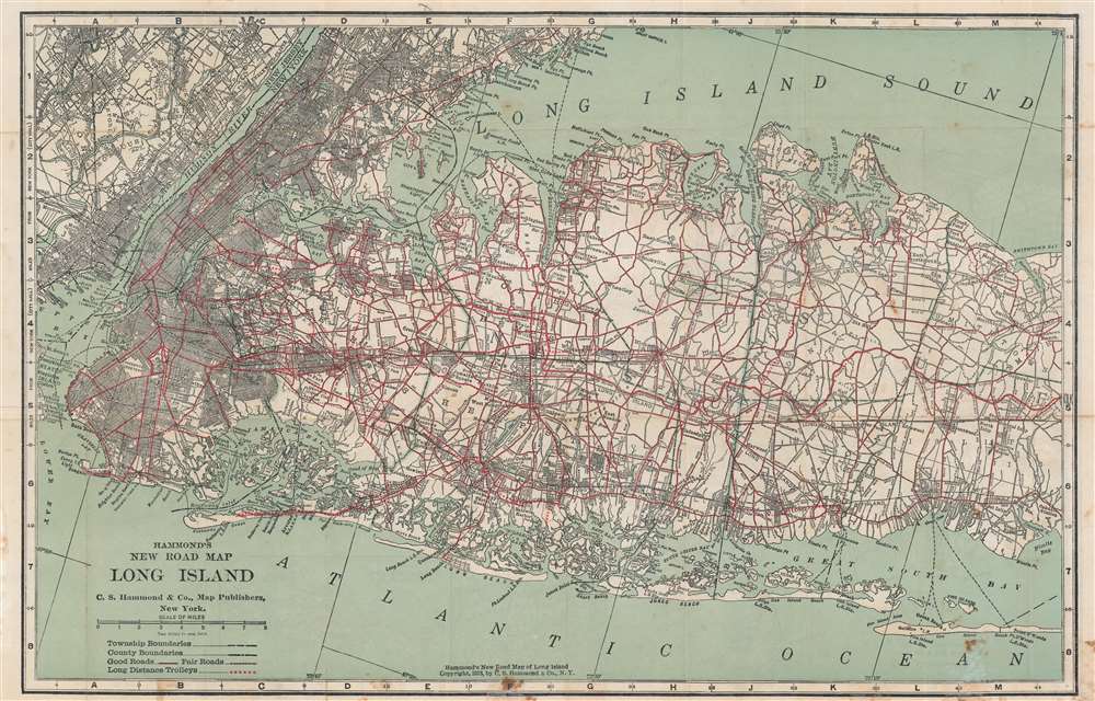
On the verso, a map illustrating New York City and Nassau County, depicting from New Jersey east to Smithtown and Central Islip. Red lines highlight major highways, just as it was on the recto in eastern Suffolk County, but only a handful of other roads are illustrated east of Brooklyn and Queens. The street grid in Brooklyn, Manhattan, and the Bronx is illustrated, along with certain neighborhoods in Queens, including Long Island City, Flushing, and Corona. Towns farther east on Long Island are labeled, many of which have small street grid illustrations as well. The Long Island Railway is depicted, and lines of red dots trace long-distance trolley lines. Both the Atlantic and Long Island Sound coastlines are covered in detail.Publication History and Census
This map was created and published by C.S. Hammond in 1914. We note earlier and later examples of Hammond's map of Long Island in OCLC, but the 1914 edition does not appear in the database.Cartographer
Caleb Stillson Hammond (1862 - 1929) was the founder of C. S. Hammond & Company, a map making and printing firm based in Brooklyn, New York. Hammond started his career in mapmaking as the head of Rand McNally's offices in New York City, where he began working in 1894. Hammond split with Rand McNally, forming his own printing concern in Brooklyn, New York, in 1900. The firm was subsequently incorporated in 1901 and relocated to Manhattan, and then to Maplewood, New Jersey, near Hammond's family home. Hammond rose to become one of the largest cartographic publishers in the United States, second only to Rand McNally in volume. On his retirement, C. S. Hammond passed the firm to his son, who subsequently passed it to his own son, C. D. Hammond, who sold the company to Langenscheidt Publishers in 1999. The firm has since been folded into Universal Map, an affiliate of Kappa Publishing Group. This archives of the Hammond World Atlas Corporation, an invaluable resource, where donated to the Library of Congress in 2002. More by this mapmaker...
Condition
Good. Light wear along original fold lines. Soiling. Shows use. Map is printed on both sides so both sides cannot be displayed at once.