
1946 Hill City Plan of Los Angeles, California

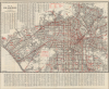
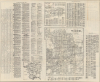
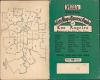
Map of Los Angeles California / Hill's Official City Map and Tourist Guide of Los Angeles Pasadena and San Gabriel Valley Addition.
Los Angeles Just After World War II.
$350.00
Choose a Collection:
- Digital Map Information
- Suitable for large format printing
- Full resolution TIFF file
- ICC color profile embedded
- Delivered instantly via download link
This Item
Enquire
Los Angeles Just After World War II.
This is a 1946 Ernest F. Hill city plan or map of Los Angeles, California, and surrounding communities, published during a population boom in the wake of World War II (1939 - 1945). The war was a watershed event in the history of Southern California, with thousands of servicemen passing through the region and many settling there afterward.A Closer Look
The map covers the Los Angeles and nearby cities and communities, including Santa Monica, Westwood, Beverly Hills, Glendale, Huntington Park, and Inglewood. Mass transit takes center stage, with red overprinting highlighting streetcar and bus routes, including those of the Pacific Electric Railway. Innumerable streets are correlated to a street index printed at the top, continuing at the bottom, and on the verso. The verso also contains maps of Pasadena, the San Gabriel Valley, and a map of greater L.A., including Long Beach and the 'Shoestring' extension to the Port of Los Angeles.One notable aspect of this map is that it captures the demise of the Pacific Electric Railway system, which is even more evident when compared to a map of the region from earlier in the century (such as Hill's own 1937 map, also offered by us, LosAngeles-hill-1937). Nicknamed 'Red Cars' (as opposed to the 'Yellow Cars' of the equally imperiled Los Angeles Railway), Pacific Electric was the largest electric railway in the 1920s and served Los Angeles, Orange, San Bernardino, and Riverside Counties. Even so, the railway was never exceptionally profitable, with the company's windfall coming from the sale of land along the routes' right-of-way, mostly sold long before this map's publication. Underutilized routes were replaced by buses as early as 1925, and the rise of automobiles and, in the Postwar Period, freeways were the final nail in the coffin of the Red Cars.
Historical Context
This map presents Los Angeles and its neighboring cities at a time when they were growing rapidly, driven by wartime and postwar migration, particularly of military personnel who had passed through Southern California during their service and decided it was a nice place to live. The GI Bill greatly facilitated this suburban sprawl, incentivizing developers to construct entire neighborhoods quickly. The result was that the few areas of Los Angeles that had not already been developed became so now, with space set aside for expected amenities, including golf courses. Even the canyons, hills, and mountains to the northwest of downtown and sporadically elsewhere (such as Baldwin Hills) became populated around this time, mostly by wealthier residents who sought escape from the bustle of the low-lying lands below.At this point, L.A. was only in the preliminary stages of the highway building boom that would define it in the coming years. The Arroyo Seco Parkway and Hollywood Parkway were already extant, serving as prototypes for later essential arteries, such as the San Diego Freeway through the Sepulveda Pass (part of the San Diego Freeway/Interstate-405).
Publication History
This map was created and published by Ernest F. Hill and the Hill Map Company in 1946. Editions of Hill's map of Los Angeles began appearing in the 1920s and were published through the late 1940s, but we do not locate any example of this edition in the OCLC.Cartographer
Ernest F. Hill (fl. c. 1923 - c. 1942) was a map publisher based in Los Angeles. Hill owned and operated the Hill Map Company in Los Angeles. Further Details...
Condition
Very good. Light wear along original fold lines. Closed edge tear professionally repaired on verso. Verso repair to a fold separation. Street index and map of Pasadena on verso.