1905 Blackmar and State Mining Bureau Map of Los Angeles Oil Field
LosAngelesOil-statemining-1905$600.00

Title
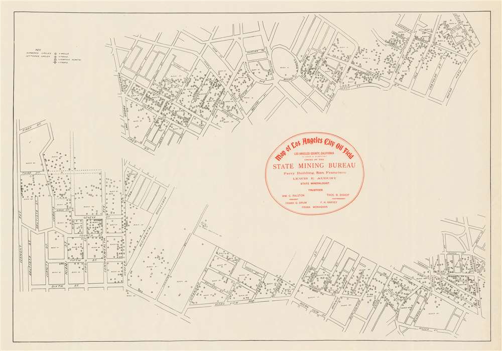
Map of Los Angeles City Oil Field Issued by the State Mining Bureau.
1905 (undated) 17.75 x 25.25 in (45.085 x 64.135 cm)
1905 (undated) 17.75 x 25.25 in (45.085 x 64.135 cm)
Description
This c. 1905 State Mining Bureau map of the Westlake neighborhood of Los Angeles details the oil field then operating in the area. Oil wells, tanks, pumping plants, and traps dot the streets, the majority of which are identified. Sections of modern-day Occidental Boulevard, Coronado Street, and Alvarado Street are included, among other streets since renamed or removed.
The Los Angeles City Oil Field
First discovered in 1890, the Los Angeles City Oil Field was California's most productive field in 1895, accounting for more than half of the state's production. Production peaked in 1901, when approximately 200 individual companies operated on the field. At one point, 1,250 wells had been drilled. As of 2011, there was one remaining active oil well in the Westlake neighborhood with an output of 3.5 barrels per day. Today, the entire field has been built over with commercial and residential developments.Publication History and Census
This map was drawn by Charles A. Blackmar and published c. 1905 by the State Mining Bureau in San Francisco. Eight examples are catalogued in the OCLC as part of the collections at Yale University, Harvard College, the University of Chicago, the University of California-Los Angeles, the University of California-Riverside, the University of California-Berkeley, Stanford University, and the California Historical Society. It appears on the market infrequently.Condition
Very good. Even overall toning. Blank on verso.
References
OCLC 24708498.