This item has been sold, but you can get on the Waitlist to be notified if another example becomes available, or purchase a digital scan.
1924 Enge Brothers View or Map of Jacksonville Heights, Florida
LynnParkLots-engebrothers-1925$125.00

Title
Lynn Park Lots.
1925 (undated) 10 x 8.375 in (25.4 x 21.2725 cm)
1925 (undated) 10 x 8.375 in (25.4 x 21.2725 cm)
Description
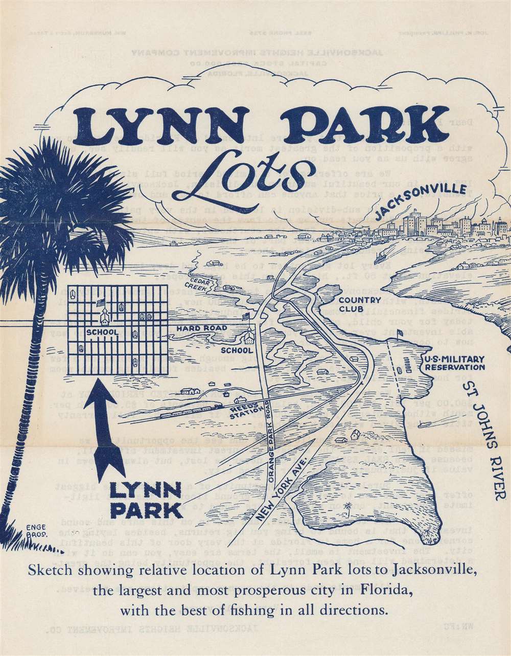
This is a c. 1925 Enge Brothers map of Lynn Park Lots in Jacksonville Heights, Jacksonville, Florida. Lynn Park Lots was a development south of Jacksonville along the St. John's River. The view highlights the area's main streets, its railroad station, and its school. A country club and a U.S. military base (Jacksonville Naval Air Station) are both labeled. An inset map illustrates the lot layout of Lynn Park.
A Promotional Piece
This piece promotes Lynn Park Lots and states rather convincingly that lots in the area would make great investments. Two of its most repeated pitches are its proximity to Jacksonville ('only eight miles') and the importance of Jacksonville within Florida ('the largest and most prosperous city in Florida'). The typewritten letter on the verso states that 50' by 125' lots were for sale for $60 each, $50 if paid in cash, and that this was the 'opportunity of a lifetime'.Publication History and Census
This map was created by Enge Brothers and published by the Jacksonville Heights Improvement Company of Jacksonville c. 1925. This is the only known cataloged example.Cartographer
Enge Brothers (fl. c. 1923 - 1925) was an commercial art firm based in Jacksonville, Florida, and active during the 1920s. We have been unable to unearth any more information about this publisher. More by this mapmaker...
Condition
Very good. Exhibits light wear along original fold lines. Text on verso.