This item has been sold, but you can get on the Waitlist to be notified if another example becomes available, or purchase a digital scan.
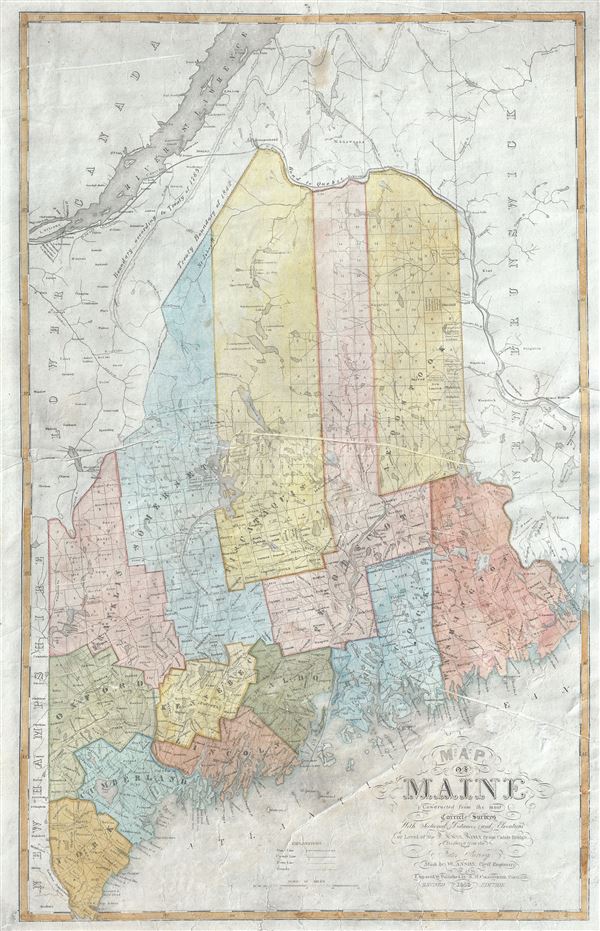
1843 Anson Map of Maine (Post 1842 Webster Ashburton Treaty)
Maine-anson-1843$100.00

Title
Map of Maine Constructed from the most Correct Surveys With Sectional Distances and Elevations or Level, of the St. Croix River from Calais Bridge.
1843 (dated) 24 x 15 in (60.96 x 38.1 cm) 1 : 940500
1843 (dated) 24 x 15 in (60.96 x 38.1 cm) 1 : 940500
Description
This is a rare and beautiful 1843 first edition map of Maine by W. Anson. The northern boundary of Maine is depicted according to the Treaty of 1842, making it one of the first maps published following the Webster–Ashburton Treaty of 1842. The earlier boundary, according to the treaty of 1783 is also noted. The map notes counties, Indian townships, rivers, roads, lakes and a host of additional geographical and topographical details.
Although the title of the map identifies this as the 'Revised 1843 Edition,' it is in fact the first edition and is a revision of Anson's earlier 1839 map of the state, based on his surveys in 1836. Engraved and published by S. H. Colesworthy, Portland.
Although the title of the map identifies this as the 'Revised 1843 Edition,' it is in fact the first edition and is a revision of Anson's earlier 1839 map of the state, based on his surveys in 1836. Engraved and published by S. H. Colesworthy, Portland.
Condition
Good. Overall fading. Cracks and damage at places, including print creases with verso repair. Professionally flattened and backed with archival tissue. Foxing at places. Original platemark visible.
References
Rumsey 2964.001. Library of Congress, Map Division, G3730 1843 .A6.