This item has been sold, but you can get on the Waitlist to be notified if another example becomes available, or purchase a digital scan.
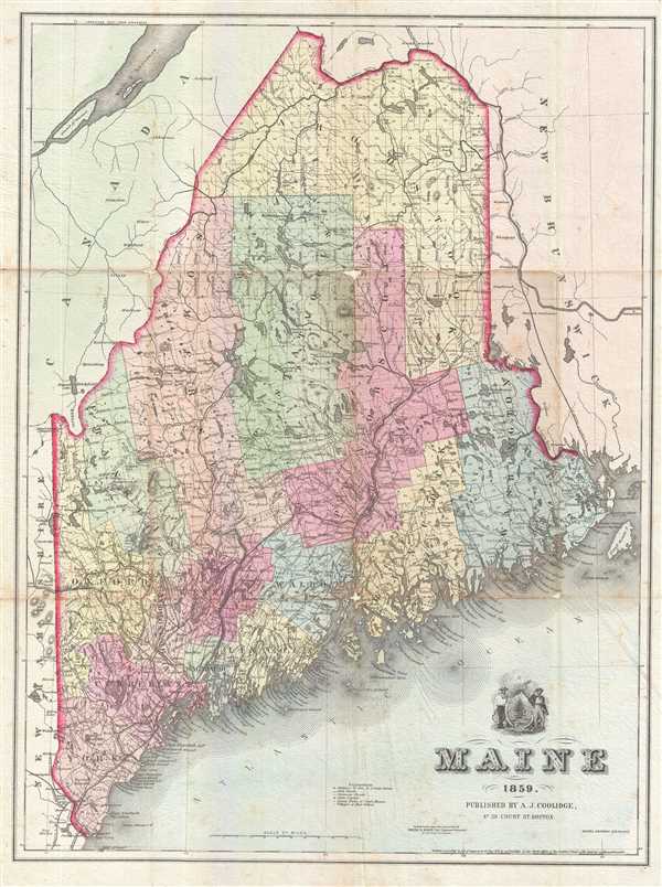
1859 Coolidge Map of Maine
Maine-coolidge-1859$100.00

Title
Maine.
1859 (dated) 21.5 x 16.5 in (54.61 x 41.91 cm) 1 : 970000
1859 (dated) 21.5 x 16.5 in (54.61 x 41.91 cm) 1 : 970000
Description
This is an excellent 1859 map of Maine by A. J. Coolidge. It covers the entire state as well as adjacent parts of Canada and New Hampshire. The map details the proposed St. Andrews and Quebec Railway, construction of which was abandoned before completion. It also identifies various roads, rivers, mountain passes, Coast Survey stations and an assortment of additional topographical details. Counties are colored with blue, green, yellow, pale orange and pink pastels. Notes fifteen counties, just prior to the organization of Knox County in 1860. The state seal is included above the title. Plotted on the polyconic projection by Shedd & Edson, Civil Engineers & Surveyors. Dated and copyrighted to A. J. Coolidge.
Source
Coolidge, A. J., and Mansfield, J. B., A History and Description of New England, general and local. Vol. I. Maine, New Hampshire and Vermont, Boston, 1859.
Condition
Very good. Minor wear and toning along original fold lines. Minor creasing. Professionally flattened and backed with archival tissue.
References
Rumsey 3544.000.