This item has been sold, but you can get on the Waitlist to be notified if another example becomes available, or purchase a digital scan.
1780 Bellin Map of the Coast of India, Persia and Arabia
Malabar-bellin-1780$87.50

Title
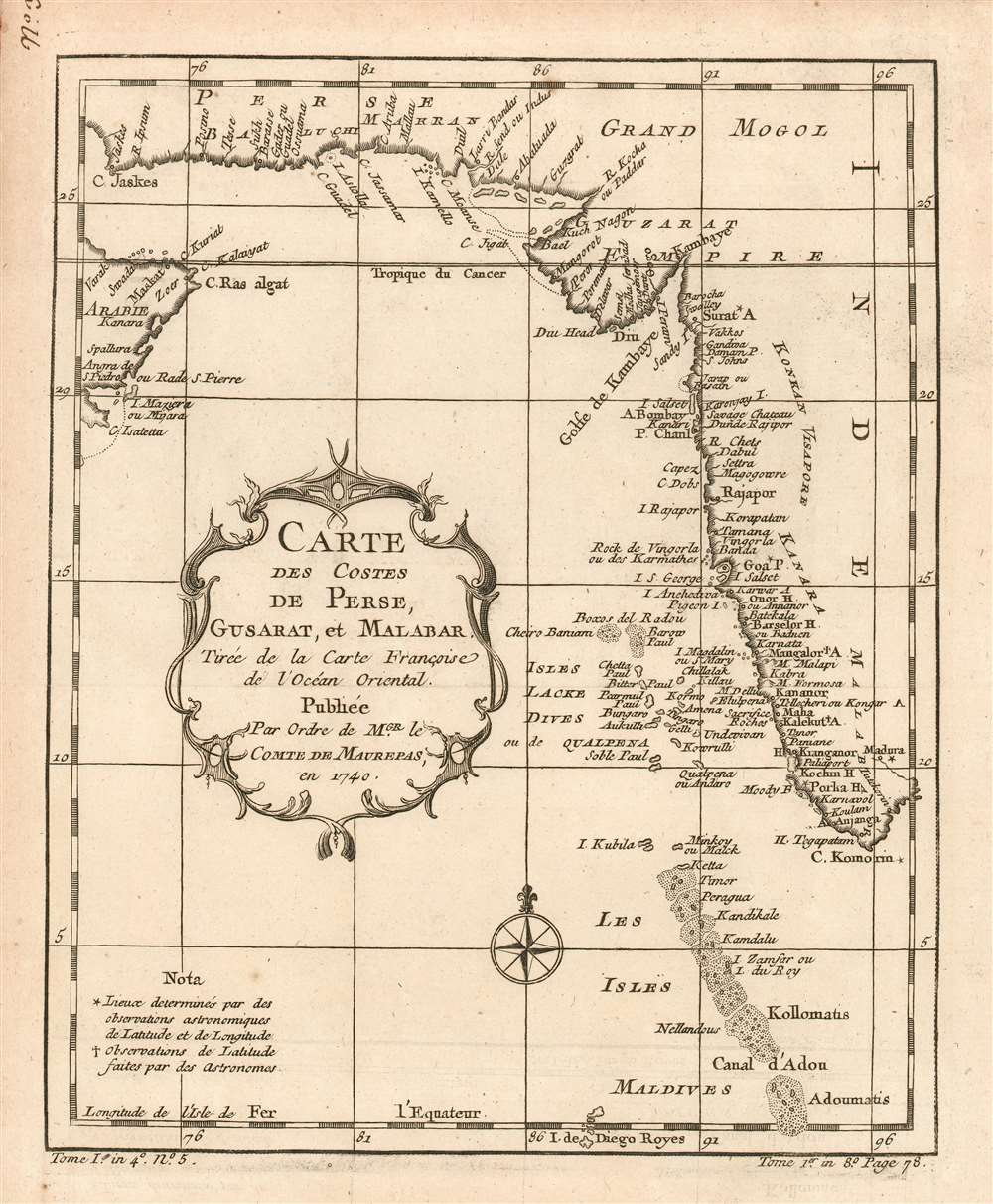
Carte des Costes de Perse, Gusarat et Malabar: Tirée de la Carte Françoise de l'Océan Oriental; Publiée Par Ordre de MGR. le Comte De Maurepas, en 1740.
1780 (undated) x 8 in (0 x 20.32 cm) 1 : 3000000
1780 (undated) x 8 in (0 x 20.32 cm) 1 : 3000000
Description
This is a 1780 Bellin map of the western coast of India, the coast of Iran, and part of the Arabian Peninsula, showing many islands west of India, including the Maldives. Bellin drew the information for this chart from his own superb 1740 chart of the Indian Ocean, Carte Reduite de l'Ocean Oriental ou Mer des Indes Contenant Les Costes d'Afrique. It was this grand chart, and not the present lovely if narrowly-focused engraving, that was produced 'Par Ordre'of the Count de Maurepas. It seems slightly misleading that Bellin should here invoke this famous French statesman, naval strategist and spymaster, given that the present map was to appear in Harpe's 1780 Abrégé de l'histoire générale des voyages, which epitomized Prévost's Histoire générale des voyages - a work perhaps better known for its imaginative flourish than for its factuality. Nevertheless, despite the venue, Bellin drew on state-of-the-art knowledge for the maps he contributed.
Publication History and Census
This map appears on the market from time to time, and separateto be rare on the market, although OCLC only lists copies of the separate map at the Library of Congress, the Universitatsbibliothek LMU Munchen, Bayerische Staatsbibliothek, and the University of Texas at Austin. Prévost's Histoire and Harpe's abridged version of it are well represented in institutional collections.Cartographer
Jacques-Nicolas Bellin (1703 - March 21, 1772) was one of the most important cartographers of the 18th century. With a career spanning some 50 years, Bellin is best understood as geographe de cabinet and transitional mapmaker spanning the gap between 18th and early-19th century cartographic styles. His long career as Hydrographer and Ingénieur Hydrographe at the French Dépôt des cartes et plans de la Marine resulted in hundreds of high quality nautical charts of practically everywhere in the world. A true child of the Enlightenment Era, Bellin's work focuses on function and accuracy tending in the process to be less decorative than the earlier 17th and 18th century cartographic work. Unlike many of his contemporaries, Bellin was always careful to cite his references and his scholarly corpus consists of over 1400 articles on geography prepared for Diderot's Encyclopedie. Bellin, despite his extraordinary success, may not have enjoyed his work, which is described as "long, unpleasant, and hard." In addition to numerous maps and charts published during his lifetime, many of Bellin's maps were updated (or not) and published posthumously. He was succeeded as Ingénieur Hydrographe by his student, also a prolific and influential cartographer, Rigobert Bonne. More by this mapmaker...
Source
De la Harpe, Abrégé de l'histoire générale des voyages. - Paris, 1780
Condition
Excellent condition, with full margins and no repairs.
References
OCLC 635210793. Not in Gole.