This item has been sold, but you can get on the Waitlist to be notified if another example becomes available, or purchase a digital scan.
1937 Swift Map of Martha's Vineyard Island, Massachusetts
MarthasVineyard-swift-1937$87.50

Title
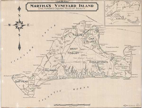
Martha's Vineyard Island One Hundred Square Miles of Beauty.
1937 (dated) 18 x 23.5 in (45.72 x 59.69 cm) 1 : 62500
1937 (dated) 18 x 23.5 in (45.72 x 59.69 cm) 1 : 62500
Description
This is a lovely 1937 map of Martha’s Vineyard Island, Massachusetts by Donald Swift. It covers the entire island, popular summer colony, in beautiful detail noting towns, roads, trails, harbors, beaches, ponds, coves, bays, and a host of additional topographical features. The town of Chilmark and the village of Menemsha, made famous in the movie ‘Jaws’ is also identified. Various hills are along with their heights are noted. An inset of Nantucket Sound and the region surrounding Martha’s Vineyard is included in the top right quadrant. The map was created and copyrighted by Donald Swift.
Condition
Very good. Minor toning and wear along edges. Minor foxing.