This item has been sold, but you can get on the Waitlist to be notified if another example becomes available.
1958 La Revue Francaise Pictorial Map of Martinique
Martinique-revuefrancaise-1958$100.00

Title
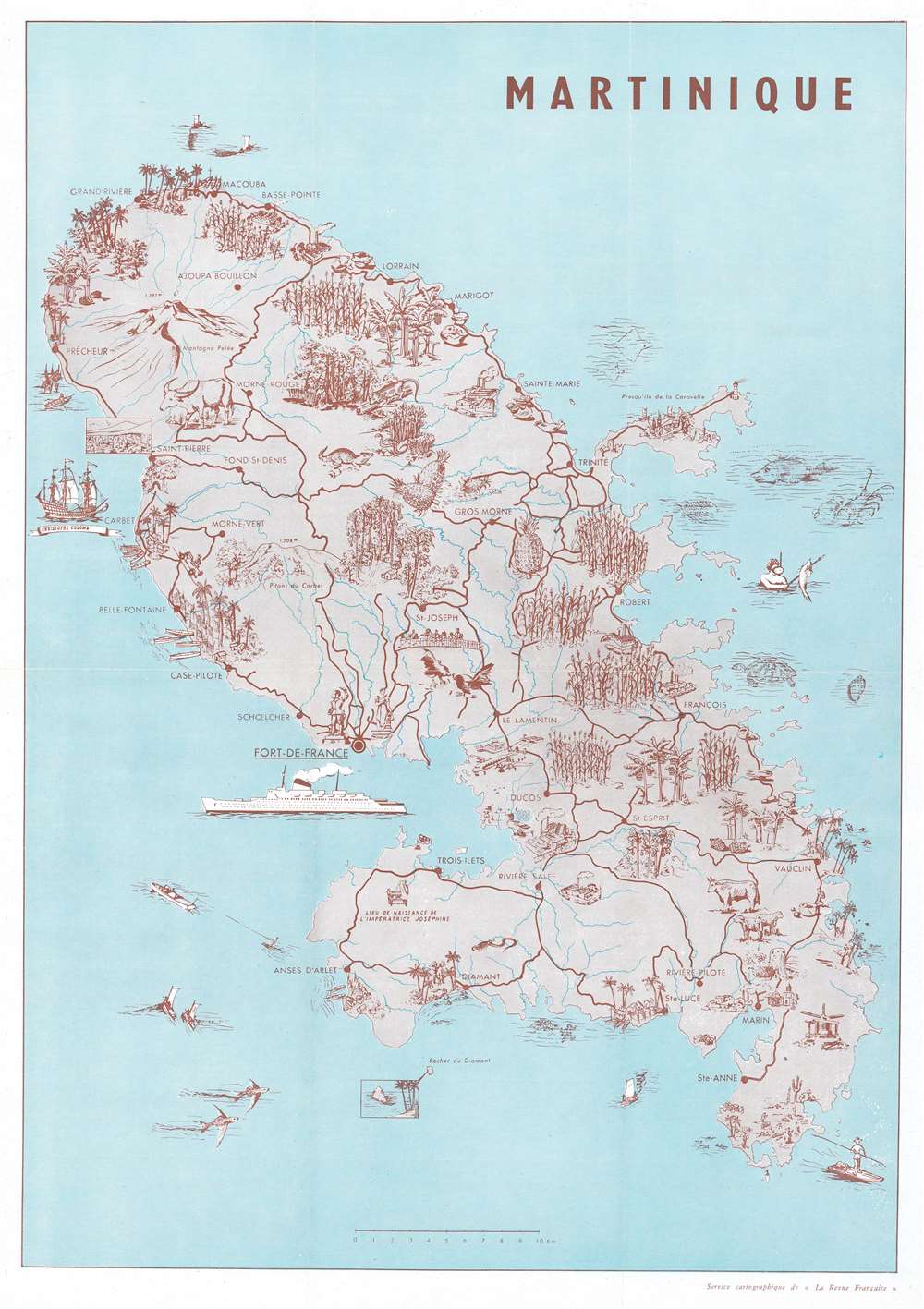
Martinique.
1958 (undated) 15.75 x 11 in (40.005 x 27.94 cm) 1 : 175000
1958 (undated) 15.75 x 11 in (40.005 x 27.94 cm) 1 : 175000
Description
This is a 1958 La Revue Francaise pictorial map of Martinique. Pictorial vignettes populate the map, highlighting the island's beautiful forests, rich agriculture, and other tropical charms. Cities and towns are identified, including Fort-de-France, Basse-Pointe, and Grand Rivière. One of Christopher Columbus's ships appears off the coast of Carbet, while the birthplace of Empress Josephine is marked not far from Trois-Ilets. Steam ships and airplanes reinforce the island's accessibility, while people waterskiing, kayaking, and spearfishing underscore the island as a vacation destination.
Publication History and Census
This map was drawn for and published by La Revue Francaise in a tourist booklet promoting Martinique in 1958. We have been unable to locate any other cataloged examples.Condition
Very good. Exhibits light wear along original fold lines. Closed margin tear professionally repaired on verso.