1951 Troy Map of the World of Fabre Line Shipping Routes
MediterraneanGreatLakes-fabre-1951$900.00

Title
Fabre Line Marseilles. Mediterranean Great Lakes Services.
1951 (undated) 24 x 38 in (60.96 x 96.52 cm)
1951 (undated) 24 x 38 in (60.96 x 96.52 cm)
Description
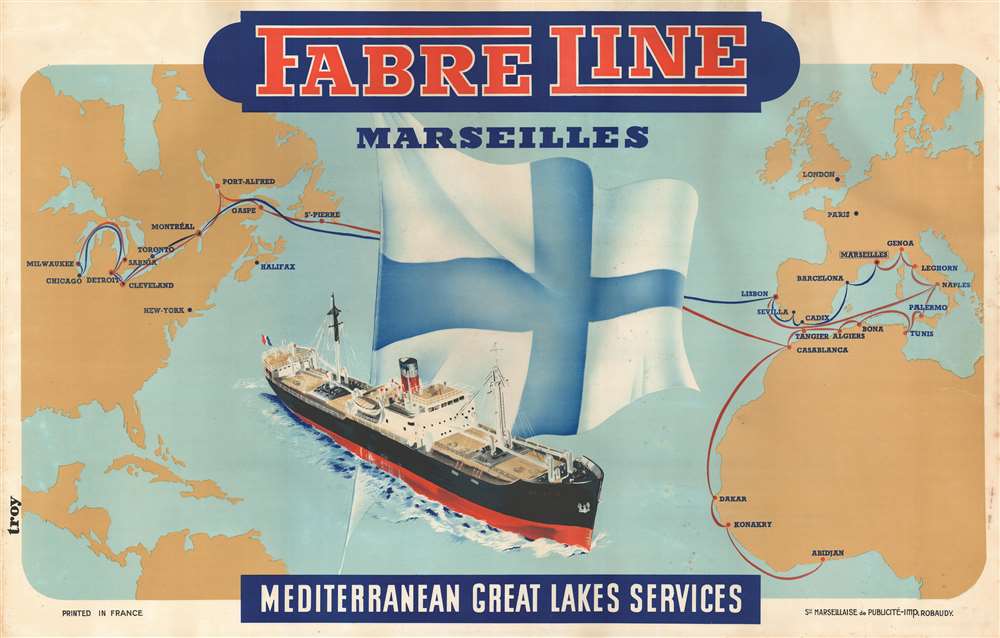
This is a c. 1951 Troy map of the world illustrating Fabre Lines shipping routes. The poster celebrates the launch of the Kolibryn, a specially designed ship built to navigate both the ocean and the St. Lawrence River, thus forging the first direct shipping link between Chicago and the Mediterranean.
A Closer Look
Coverage embraces from Milwaukee, Wisconsin, to the Balkans and Central Africa and from Hudson Bay and Scandinavia to northern South America and Central Africa. Two routes, blue and red, are illustrated and the ports of call along each labeled: Marseille, Lisbon, Montreal, etc. The flag of the Fabre family occupies most of the Atlantic, along with a large ocean-going ship, the Kolibryn.The 'Kolibryn'
According to the September 11, 1951, Commercial-Mail, the Kolibryn was a Norwegian vessel specifically built for Fabre Lines to navigate St. Lawrence River and the Great Lakes. Fabre brought the ship to Chicago to promote its newly inaugurated service between that city and the Mediterranean, providing Chicago's first direct link to the Mediterranean by ship.Fabre Lines
Based in Marseille, Fabre was a French company founded in the 1860s by Cyprien Fabre. The firm expanded throughout the late 19th and early 20th centuries, both in the number of ships and scope of operations. By World War I (1914 - 1918), Fabre Lines, reorganized as Compagnie Française de Navigation à Vapeur Cyprien Fabre et Cie, reached every part of the world. Fabre Lines began merger proceedings with Compagnie Fraissinet following the 1930 marriage of Jean Alfred Fraissinet and Mathilde Cyprien Fabre. Both companies survived World War II (1939 - 1945), completing the merger in 1955 with the formation of the Compagnie de Navigation Fraissinet et Cyprien Fabre. Fraissinet operated until 1968, and Fabre survived until 1979.Publication History and Census
This map was drawn by an artist identified only as 'Troy' and printed by the Imprimerie Robaudy. We see just one other example, located at the Musée des Civilisations de l'Europe et de la Méditerranée in Marseille. Not in OCLC. We have found just one record of this map appearing at auction in the last thirty years.Condition
Very good. Even overall toning. Closed margin tears professionally repaired on verso. Wear along margins. Foxing along margins. Blank on verso.
References
MUCEM 2014.12.20.