This item has been sold, but you can get on the Waitlist to be notified if another example becomes available, or purchase a digital scan.
1858 Marmocchi Map of Melanesia, Southwestern Pacific
Melanesia-marmocchi-1858$150.00

Title
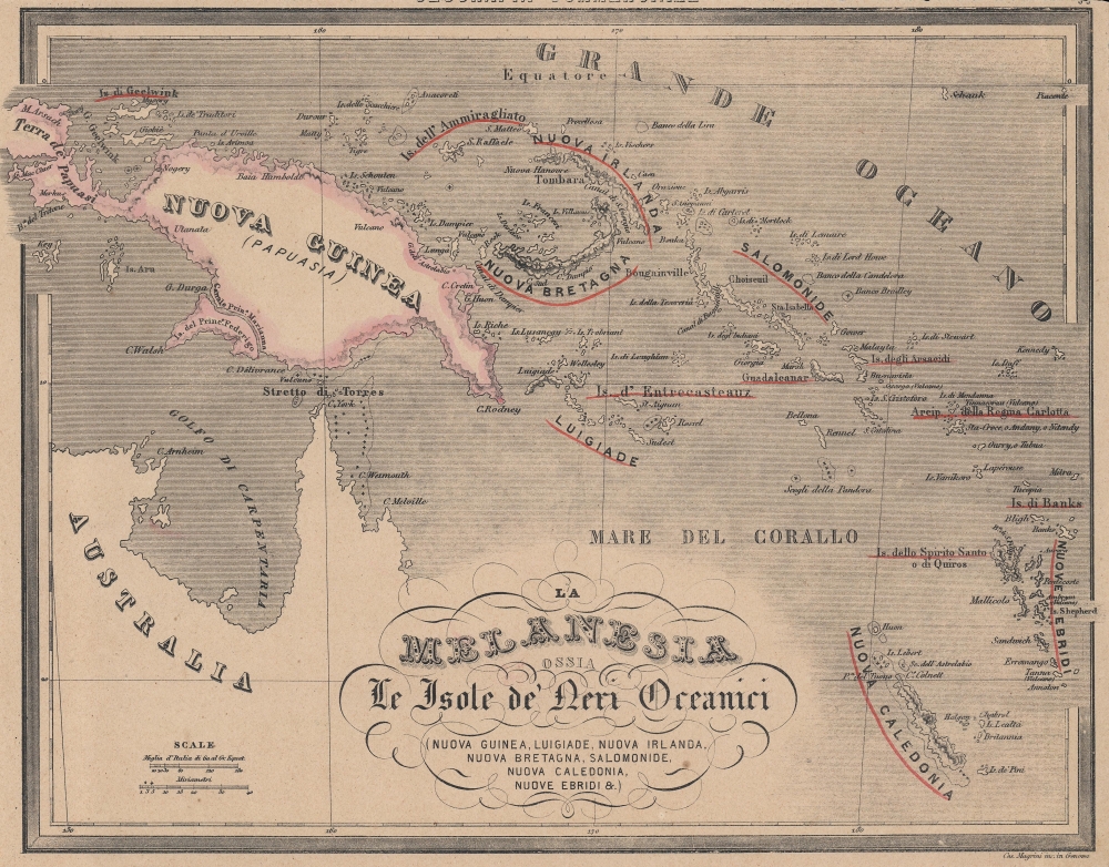
La Melanesia ossia Le Isole de Neri Oceanici Nuova Guinea, Luigiade, Nuova Irlanda, Nuova Bretagna, Salomonide, Nuova Caledonia, Nuove Ebridi...
1858 (undated) 10.5 x 14 in (26.67 x 35.56 cm) 1 : 12070000
1858 (undated) 10.5 x 14 in (26.67 x 35.56 cm) 1 : 12070000
Description
An 1858 Francesco Marmocchi map of Melanesia, including New Guinea, the Solomon Islands, Vanuatu (the New Hebrides), and New Caledonia. It was published for the Italian atlas Il Globo Atlante di Carte Geografiche.
A Closer Look
Coverage includes the islands of the southwest Pacific including the modern nations and territories of Papua New Guinea, the Solomon Islands, Vanuatu, and New Caledonia, along with the northeastern coast of Australia. The names of major islands and island groups are underlined in red, including Guadalcanal at right-center. Nautical hazards are indicated throughout with crosses.Publication History and Census
This map appeared as in Francesco Marmocchi's Il Globo Atlante di Carte Geografiche, published in 1858, the year of Marmocchi's death. The maps in the atlas employ the plates used in his earlier work Geografia Commerciale, including the title of that work on each map, which likely explains the close cutting of the margin. It was engraved by Cesare Magrini in Genoa. This map is not independently cataloged in the OCLC and is scarce to the market, while the entire atlas is held by the David Rumsey Historical Map Collection, the Newberry Library, and the National Library of Australia.Cartographer
Francesco Costantino Marmocchi (August 26, 1805 - September 9, 1858) was an Italian geographer. Following in the footsteps of his father, a professor of physics, he began his studies in the natural sciences. He became involved in the Italian nationalist movement and was an associate of Guiseppi Mazzini, leading to his being arrested and briefly imprisoned before being put under house arrest in his hometown of Poggibonsi. He tried to move to Naples under a pseudonym, but was discovered and was forced to leave, settling in Rome. He then focused on publishing, producing translations, original works, and managing a popular broadsheet dedicated to scientific discoveries. More by this mapmaker...
Source
Marmocchi, Francesco C., Il Globo Atlante di Carte Geografiche, (Genoa: Paolo Rivara) 1858.
Condition
Very good.