This item has been sold, but you can get on the Waitlist to be notified if another example becomes available.
1963 Miller, Bacon, Avrutis, and Simons Tourist Map of Miami Beach, Florida
MiamiBeachHoliday-millerbacon-1963$112.50

Title
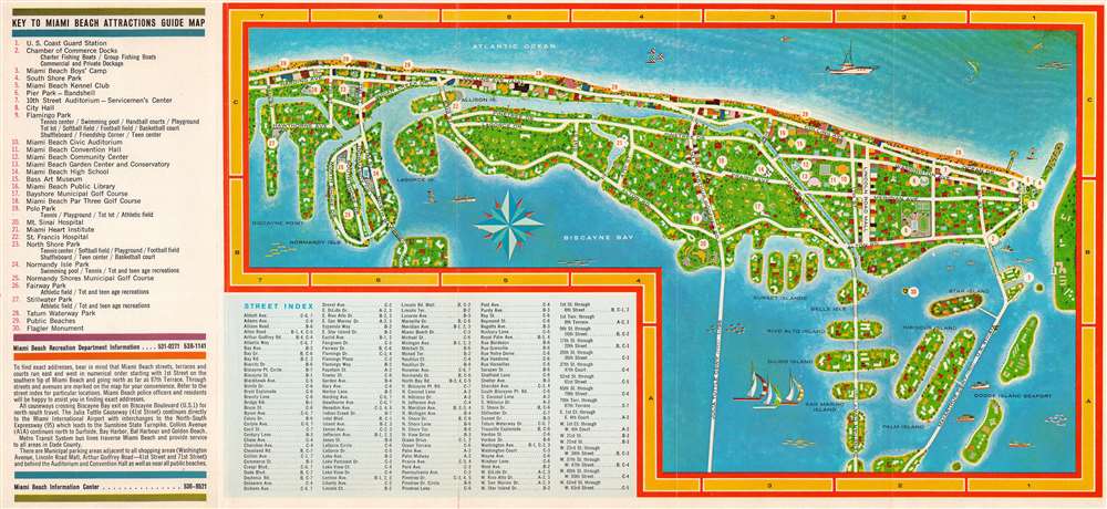
Miami Beach Holiday Guide Map. Miami Beach Vacationland USA.
1963 (undated) 8.75 x 19 in (22.225 x 48.26 cm)
1963 (undated) 8.75 x 19 in (22.225 x 48.26 cm)
Description
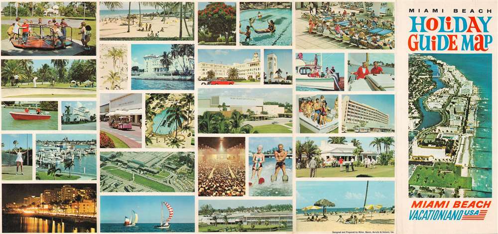
This is a c. 1963 Miller, Bacon, Avrutis, and Simons tourist map of Miami Beach, Florida. A brilliantly colored piece, white circles containing numbers mark thirty 'attractions' throughout Miami Beach, including the local high school, parks, several golf courses, the public library, and of course the public beaches. Major streets are labeled, along with the three causeways linking Miami Beach with Miami. Illustrations of boats, water skiers, and fish add to the piece's charm. Color photographs highlighting many aspects of life in Miami Beach fill the verso.
Publication History and Census
This map was 'designed and prepared' by Miller, Bacon, Avrutis and Simons, Inc. around 1963. This is the only known cataloged example.Condition
Very good. Verso repair to a fold separation. Printed color photographs on verso.