This item has been sold, but you can get on the Waitlist to be notified if another example becomes available.
1957 Rand McNally Pictorial Tourist Map of Miami Beach and Miami, Florida
MiamiMiamiBeach-randmcnally-1957$175.00

Title
Miami Miami Beach Tourguide Map.
1957 (undated) 35.5 x 17.5 in (90.17 x 44.45 cm) 1 : 29100
1957 (undated) 35.5 x 17.5 in (90.17 x 44.45 cm) 1 : 29100
Description
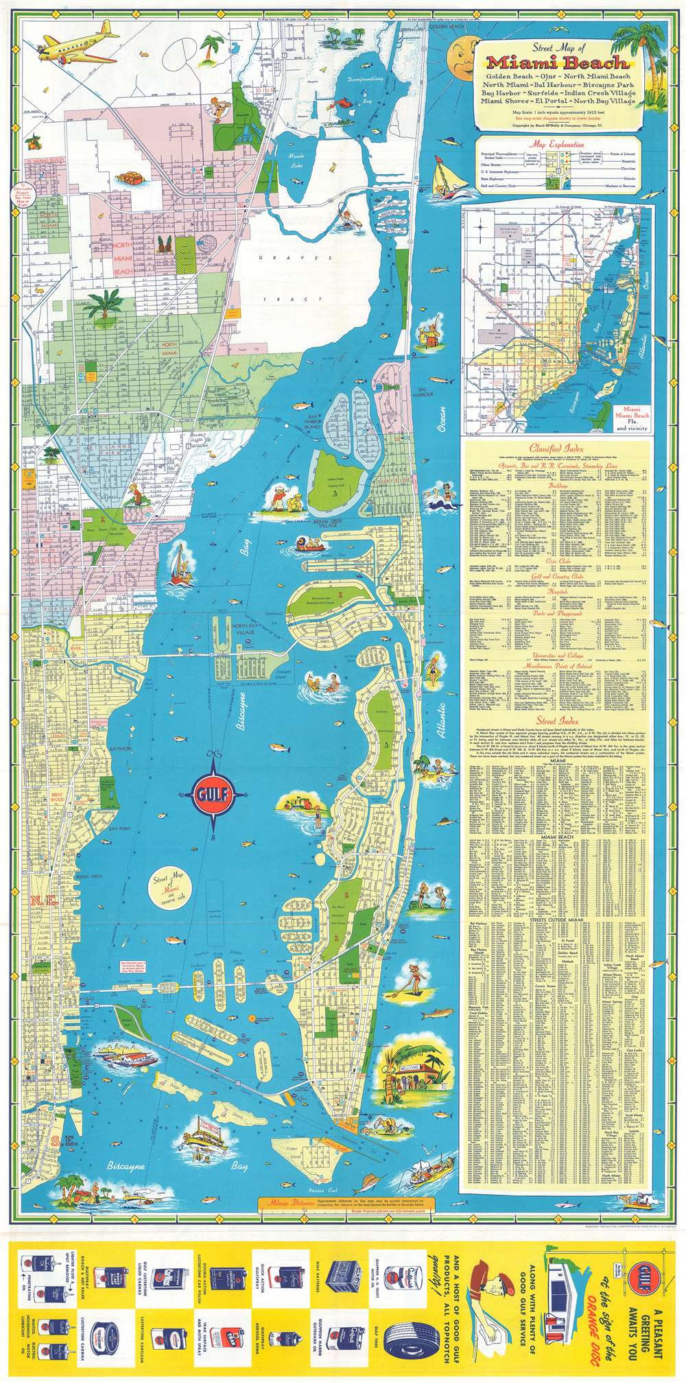
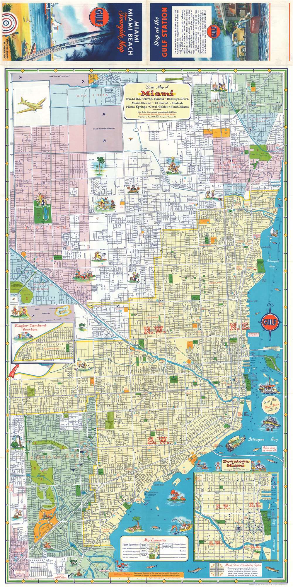
This is a c. 1957 Rand McNally city plan or map of Miami and Miami Beach, Florida. Miami Beach appears on the recto and Miami on the verso. Humorous vignettes populate both maps, including people playing golf, tennis, football, and polo. Others enjoy the fantastic weather, suntanning on the beach or taking a nap under a palm. Vacationers go fishing, sailing, and take in a game at the Orange Bowl. Streets are illustrated and labeled throughout, along with numerous other locations, such as parks, hospitals, churches, schools, libraries, and golf courses.
Publication History and Census
This map was created by Rand McNally for the Gulf Oil Corporation c. 1957. Several editions were published. The present edition is not cataloged in OCLC but the 1954 edition does appear in the database.Cartographer
Rand, McNally and Co. (fl. 1856 - present) is an American publisher of maps, atlases and globes. The company was founded in 1856 when William H. Rand, a native of Quincy, Massachusetts, opened a print shop in Chicago. Rand hired the recent Irish immigrant Andrew McNally to assist in the shop giving him a wage of 9 USD per week. The duo landed several important contracts, including the Tribune's (later renamed the Chicago Tribune) printing operation. In 1872, Rand McNally produced its first map, a railroad guide, using a new cost effective printing technique known as wax process engraving. As Chicago developed as a railway hub, the Rand firm, now incorporated as Rand McNally, began producing a wide array of railroad maps and guides. Over time, the firm expanded into atlases, globes, educational material, and general literature. By embracing the wax engraving process, Rand McNally was able to dominate the map and atlas market, pushing more traditional American lithographic publishers like Colton, Johnson, and Mitchell out of business. Eventually Rand McNally opened an annex office in New York City headed by Caleb S. Hammond, whose name is today synonymous with maps and atlases, and who later started his own map company, C. S. Hammond & Co. Both firms remain in business. More by this mapmaker...
Condition
Very good. Exhibits light wear along original fold lines. Map of Miami on verso.
References
OCLC 985624271 (1954).