1954 Beach Products State 'Map-Nap' of Minnesota
Minnesota-beachproducts-1954$175.00


Title
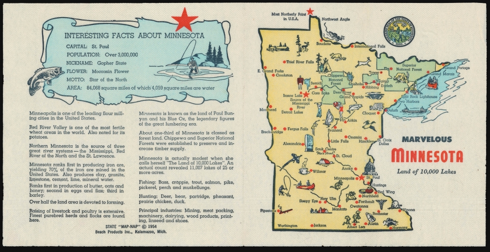
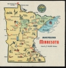
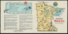
Marvelous Minnesota Land of 10,000 Lakes.
1954 (dated) 6.5 x 7.5 in (16.51 x 19.05 cm) 1 : 5500000
1954 (dated) 6.5 x 7.5 in (16.51 x 19.05 cm) 1 : 5500000
Description
This is a 1954, 'Map-Nap' of the state of Minnesota from an obscure but fascinating national series of placements.
A Closer Look
This colorful map, printed on a napkin, marks principal cities, and is decorated pictorially with Minnesota's flora, fauna, and produce. The Split Rock Lighthouse is pictured on the shore of Lake Superior, along with a canoe and a classic lake freighter (of which about 300 plied the Great Lakes at the time this was printed. The ill-fated Edmund Fitzgerald was of this type.) The source of the Mississippi is marked, near a depiction (unnamed) of Paul Bunyan and Babe the Blue Ox. Chippewa and Superior National Forests are both shown. The reverse fold lists an array of 'Interesting Facts about Minnesota,' offering information of the state's size, population, produce, and industry. For example, the reader learns that 'Northern Minnesota is the source of three great river systems - the Mississippi, Red River of the North, and the St. Lawrence'. It further points out that 'Minnesota is actually modest when she calls herself 'The Land of 10,000 Lakes'. An actual count revealed 11,007 lakes of 25 or more acres.' Principal industries are listed as 'Mining, meat packing, machinery, dairying, wood products, printing, linseed and shoes'.A Full Series?
Beach Products appears to have produced this piece as part of a series of 'State Map-Naps.' We are aware of examples not only dedicated to Minnesota, but also for Florida, Indiana, Michigan, California, North Dakota, and Texas. While it would be reasonable to assume a plan to produce a 'Map Nap' for every state in the Union, we have not seen a full array on the market, and it may be that the project was cut short.Publication History and Census
This map was printed by Beach Products of Kalamazoo, Michigan, having been copyrighted in 1954. (Beach Products were a paper goods company less known for their maps and more for their napkins.) We see no examples of the California Map-Nap in OCLC, but there is a single listing for another in the series (Michigan: Water Wonderland) in the collection of the Library of Michigan.Cartographer
Beach Products, Inc. (1940s - 1960s) was an American paper goods company based in Kalamazoo, Michigan. Incorporated in 1941 and running a factory employing 50 workers, they appear to have focused primarily on printed napkins, paper plates, and cups, on a variety of themes (a 1957 advertisement touts such seasonal themes as 'Pumpkin Designs' and 'Singing Cats.' Between 1954 and 1956, their offerings included a series of state maps, printed to both full size dinner napkins and smaller format cocktail napkins: these 'Map-Naps' featured a map of a given state on the forward fold, whilst the reverse fold contained an array of 'Interesting Facts' about the state portrayed. Some of these, notably the Map Nap dedicated to Texas, included further material, with all four folds containing entertaining content. While it would be natural to assume at least a plan to present a Map Nap for every state of the Union, we have identified only a handful to have survived. Given the purpose of the average napkin, it is only to be expected that these survive poorly, and it may be that many are lost to posterity. More by this mapmaker...
Condition
Very good. Virtually no wear at folds.