This item has been sold, but you can get on the Waitlist to be notified if another example becomes available, or purchase a digital scan.

1865 Chapman Sectional Map of Minnesota ( Pocket Map )

MN-chapman-1865
$375.00
Chapman’s Sectional Map of the Surveyed Part of Minnesota. - Main View
Processing...

1865 Chapman Sectional Map of Minnesota ( Pocket Map )

MN-chapman-1865


Title


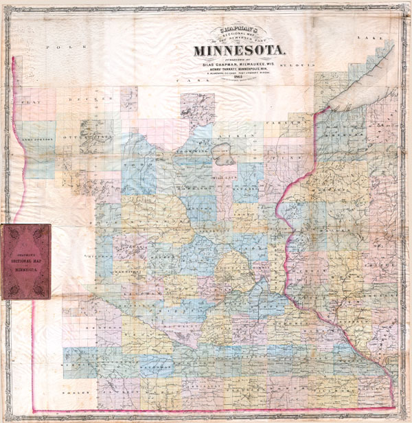
Chapman’s Sectional Map of the Surveyed Part of Minnesota.
  1865     29 x 29.5 in (73.66 x 74.93 cm)

Description


This historically important pocket map of Minnesota by Silas Chapman was made shortly after the it entered the Union in order to lay out the counties and districts of the new state. Counties in the extreme west and south are unorganized and left completely blank. Lake Superior is well mapped, as opposed to the 1856 version where it is unmapped. Excellent details throughout on a scale of 1 inch to 10 miles. Locates towns, physical features, townships and sections, and railroads. Shows all of Minnesota except northern and extreme northeastern portion. Bound in its original 16vo linen folder.

Cartographer


Silas Chapman (June 9, 1813 - December 14, 1899) was active publisher of Midwest maps from roughly 1850 to the mid-1870s. Chapman was born in Southampton, Massachusetts and as a young Man attended New York University. In 1841 he moved to Prairieville (Waukesha) Wisconsin where he worked in academia as a local principle then as a schoolmaster in Milwaukee. Around 1843 his turned his attentions to publishing and briefly partnered with printer Philetus C. Hale until striking out independently in 1850. It was in this period - post 1850 - that his most important maps were published. From roughly 1850 to 1870, Chapman published a series of important wall and pocket format maps of the Midwest focusing specifically on the states of Michigan, Minnesota, Iowa, Minnesota and Illinois. Upon his retirement the Chapman firm was acquired by Dyer and Pasmore, who continued to update and republish his maps into the 1880s. More by this mapmaker...

Condition


Generally very good condition. Some browning and creasing along original folds.

References


Rumsey #1667. Publisher: Silas Chapman and his associates where hired by the U.S. Government to compile a series of maps and surveys of the Midwestern territories on the even of and just after statehood – 1850 to 1870. His works predominantly focus on the states of and surround Iowa, Minnesota and Wisconsin. Chapman’s work contributed the eventual layout of counties and districts in his focus states.