This item has been sold, but you can get on the Waitlist to be notified if another example becomes available, or purchase a digital scan.
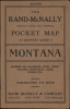
1912 Rand McNally Pocket Map of Montana
MontanaPocketMap-randmcnally-1912$175.00

Title
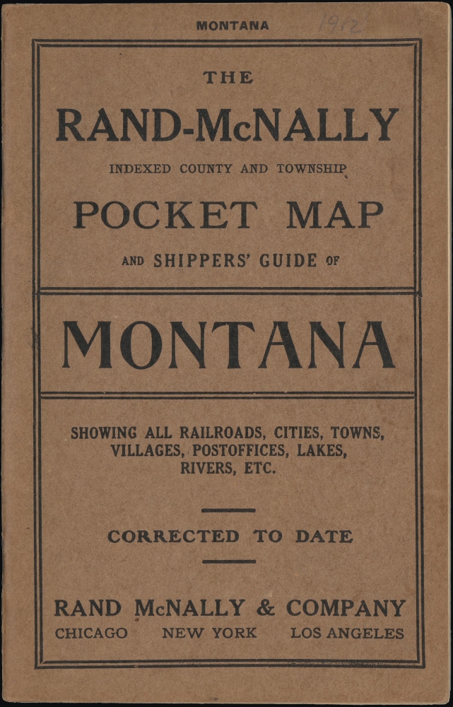
The Rand-McNally Indexed County and Township Pocket Map and Shippers' Guide of Montana.
1912 (dated) 26.75 x 19 in (67.945 x 48.26 cm) 1 : 1457280
1912 (dated) 26.75 x 19 in (67.945 x 48.26 cm) 1 : 1457280
Description
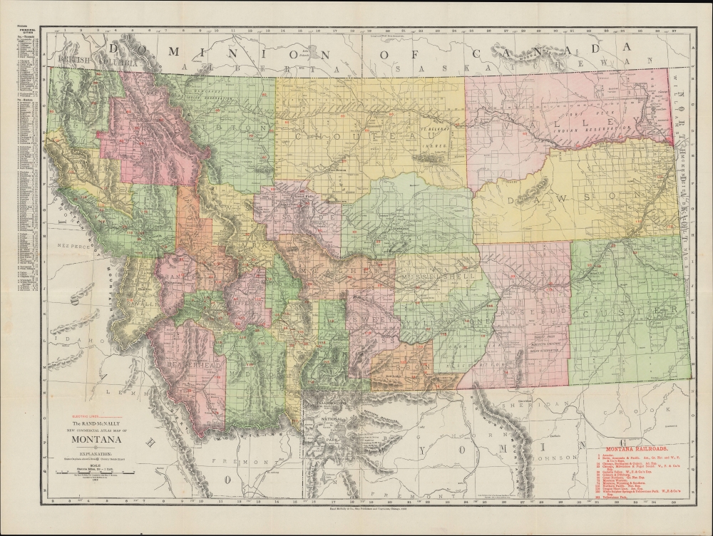
A 1910 Rand McNally pocket-style folding map of Montana. It presents geographic, administrative, and economic information in rich detail, combining utility and aesthetics.
Cities and towns are listed at top-left according to their population and are given a coordinate corresponding to the numbered and lettered grid system in the margins. It includes several national parks, national forests, and Indian reservations; these systems were quite young and still evolving, with borders and names changing frequently.
Then in 1908, a skirmish (Swan Valley Massacre) occurred between Pend d'Oreilles hunters and a Montana state game warden. The hunters resided on the Flathead Reservation but had treaty rights to hunt beyond its borders, a fact that irritated nearby white settlers. The game warden and an armed posse tried to chase off the Pend d'Oreilles several times, and eventually resorted to shooting, leaving four Native Americans and the warden dead.
In the early 20th century, provisions were made in adjustments to the Homestead Act to offer ever larger tracts of land to homesteaders, mostly from the Midwest, to settle in Montana. Large-scale irrigation projects also facilitated agriculture and attracted settlers. Meanwhile, mining moved beyond gold prospecting to coal, copper, and oil, and incorporated advanced technologies, while the vast forests of western Montana were the source for a timber boom that lasted decades. The development of railroads both facilitated and intensified these processes.
A Closer Look
This map covers the state of Montana, identifying counties, rivers, topography, and railroads, which are listed in red text at bottom-right, including the Northern Pacific and Great Northern. Perhaps the most interesting of the lines indicated here is the interurban electric lines serving Bozeman and surrounding towns. Founded in 1908, the Gallatin Valley Electric Railway was quickly bought (along with Bozeman's streetcar system) by the Chicago, Milwaukee, St. Paul and Pacific Railroad, which expanded the network to link up to its existing network at Three Forks and later added a combined train and bus service to Yellowstone National Park.Cities and towns are listed at top-left according to their population and are given a coordinate corresponding to the numbered and lettered grid system in the margins. It includes several national parks, national forests, and Indian reservations; these systems were quite young and still evolving, with borders and names changing frequently.
Historical Context
At this time, Montana was still in the early phase of statehood and becoming more integrated with the economy and infrastructure of surrounding states. The recent tumult of the Indian Wars and the rapid increase in white settlers (many seeking gold) in the late 19th century would have been fresh in people's minds. The railroads and confinement of Native Americans to reservations led to a continual increase in white settlers, who then demanded more land, coming into conflict with native peoples and restoking tensions. Pitched battles were fought as recently as 1887 (Battle of Big Hole), and legal disputes continued as additional land was sheaved off from reservations. For instance, in 1904 the U.S. Congress passed an act 'allotting' land in individual parcels to indigenous people on the Flathead Indian Reservation to discourage traditional communal land holding arrangements, and then claiming the remaining communal land, roughly one-half of the reservation's land, to be 'surplus,' which was then doled out to white settlers. In fact, unlike earlier editions of this map (as recently as 1910), the Flathead Indian Reservation is not indicated here.Then in 1908, a skirmish (Swan Valley Massacre) occurred between Pend d'Oreilles hunters and a Montana state game warden. The hunters resided on the Flathead Reservation but had treaty rights to hunt beyond its borders, a fact that irritated nearby white settlers. The game warden and an armed posse tried to chase off the Pend d'Oreilles several times, and eventually resorted to shooting, leaving four Native Americans and the warden dead.
In the early 20th century, provisions were made in adjustments to the Homestead Act to offer ever larger tracts of land to homesteaders, mostly from the Midwest, to settle in Montana. Large-scale irrigation projects also facilitated agriculture and attracted settlers. Meanwhile, mining moved beyond gold prospecting to coal, copper, and oil, and incorporated advanced technologies, while the vast forests of western Montana were the source for a timber boom that lasted decades. The development of railroads both facilitated and intensified these processes.
Publication History and Census
This map was published by Rand, McNally, and Co. in 1912, based on their New Commercial Atlas map of Montana. Two copyrights are indicated here, suggesting that an existing 1909 map was updated after 1910 to incorporate data from the 1910 census and other updates. Rand McNally pocket maps of Montana in this format with this title or similar titles appeared between from the 1880s to the mid-1910s, though they do not always include a dated copyright. Despite the wide date range, they are scarce. We note a small handful of examples of the 1911 and 1913 editions of the Pocket Map and Shippers' Guide in the OCLC, but no examples of the current edition.Cartographer
Rand, McNally and Co. (fl. 1856 - present) is an American publisher of maps, atlases and globes. The company was founded in 1856 when William H. Rand, a native of Quincy, Massachusetts, opened a print shop in Chicago. Rand hired the recent Irish immigrant Andrew McNally to assist in the shop giving him a wage of 9 USD per week. The duo landed several important contracts, including the Tribune's (later renamed the Chicago Tribune) printing operation. In 1872, Rand McNally produced its first map, a railroad guide, using a new cost effective printing technique known as wax process engraving. As Chicago developed as a railway hub, the Rand firm, now incorporated as Rand McNally, began producing a wide array of railroad maps and guides. Over time, the firm expanded into atlases, globes, educational material, and general literature. By embracing the wax engraving process, Rand McNally was able to dominate the map and atlas market, pushing more traditional American lithographic publishers like Colton, Johnson, and Mitchell out of business. Eventually Rand McNally opened an annex office in New York City headed by Caleb S. Hammond, whose name is today synonymous with maps and atlases, and who later started his own map company, C. S. Hammond & Co. Both firms remain in business. More by this mapmaker...
Source
Rand McNally and Co's indexed county and township pocket map and shippers' guide of Montana : showing all railroads, cities, towns, villages, postoffices, lakes, rivers, etc., (Chicago) 1912.
Condition
Very good. Light wear along original folds. Accompanied by guide and covers.