This item has been sold, but you can get on the Waitlist to be notified if another example becomes available, or purchase a digital scan.
1840 Century Arabic Comparative Map or Chart of the World's Mountains
MountainsRivers-arabic-1800s$125.00

Title
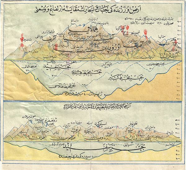
Comparative Map of World's Mountains.
1800s (undated) 6.5 x 7 in (16.51 x 17.78 cm)
1800s (undated) 6.5 x 7 in (16.51 x 17.78 cm)
Description
This is an extremely uncommon example of a 19th century comparative map or chart of the world's mountains. Printed in Arabic, this chart notes the relative elevation of the important mountains of the World. The map is divided into two parts, each with heights and depths listed near the right margin. The depth of what appears to be the ocean floor is also noted. This map was published in Persia in the 19th century.
Condition
Very good. Minor wear on original centerfold. Contains a few red stains. Minor creasing. Blank on verso.