1954 U.S. Air Force Aeronautical Chart or Map of Eastern Mali, Africa
MountInRabe-usaf-1954$100.00

Title
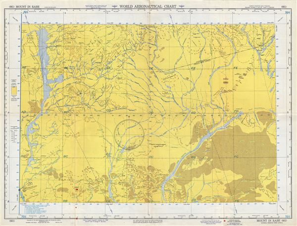
Mount In Rabe Algeria-French West Africa.
1954 (dated) 22 x 29 in (55.88 x 73.66 cm) 1 : 1000000
1954 (dated) 22 x 29 in (55.88 x 73.66 cm) 1 : 1000000
Description
This is a fine 1954 U.S. Air Force aeronautical chart or map of eastern Mali, focusing on the Mont i-n-Rabe. It covers the region from Gao on the Niger east to Mont Maya and north as far as Aguelhok (Aguelock) in the Kidal region of eastern Mali. The map is highly detailed, noting communes, valleys, mountains, deserts, rivers, dunes, cities and other hydrographical and topographical features essential for the air pilot. Verso of this chart features legends and a world aeronautical chart index. This chart was published by the USAF Aeronautical Chart and Information Service, Washington 25, D.C., and was issued as chart no. 661. First issued in 1944, this is the fourth edition revised to May 1954.
Condition
Very good. Minor wear and toning along original fold lines. Minor spotting.