This item has been sold, but you can get on the Waitlist to be notified if another example becomes available, or purchase a digital scan.
1890 Rand Avery Map of Nantasket Beach, Massachusetts and Vicinity
NantasketBeach-oldcolony-1890$87.50

Title
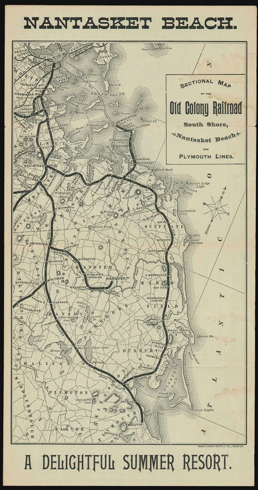
Sectional Map of the Old Colony Railroad South Shore, Nantasket Beach and Plymouth Lines. Nantasket Beach A Delightful Summer Resort.
1890 (dated) 14.25 x 7.5 in (36.195 x 19.05 cm) 1 : 200000
1890 (dated) 14.25 x 7.5 in (36.195 x 19.05 cm) 1 : 200000
Description
An 1890 Old Colony Railroad tourist map of southeastern Massachusetts published only a few years before its acquisition by the New York, New Haven, and Hartford Railroad. Old Colony promotes its South Shore, Nantasket Beach, and Plymouth Lines, all of which were popular with Bostonians trying to escape the summer heat. The rail lines are emphasized in black and many stops are noted, including Nantasket, Braintree, Kingston, and Plymouth.
The Old Colony Railroad
Founded in 1845, the Old Colony Railroad operated in southeastern Massachusetts and parts of Rhode Island until 1893. Named after the 'Old Colony', a reference to Plymouth, the company's network grew extensively though mergers and acquisitions. Old Colony operated both passenger and freight services, as well as steamship service to New York City. A steamer between Woods Hole, Martha's Vineyard, and Nantucket also operated from 1872. The New York, New Haven, and Hartford Railroad acquired the Old Colony trackage rights in 1893, renaming it the 'Old Colony Division' of the New York, New Haven, and Hartford Railroad.Publication History and Census
This map was created by the Rand Avery Supply Company of Boston and published by the Old Colony Railroad in 1890. It was published in both a black and white and colored edition.Cartographer
Rand, Avery, and Company (1851 – 1886) was a Boston based book and map printer active in the late 19th century. The company was founded in 1851 by George Curtis Rand (December 13, 1819 – December 30, 1878) and his brother-in-law Abraham Avery (November 15, 1824 - April 3, 1893). George C. Rand was a brother to William H. Rand of Rand, McNally, and Company of Chicago. George C. Rand was born in Woodstock, Vermont, to Baptist minister John Rand (1781 – 1855) and his wife. Rand began working in the printing industry from at least the 1840s, wherein he mostly produced religious tracts. He married Julia Avery in 1851 and brought his brother-in-law, Abraham Avery, into the business, renaming the firm Rand, Avery, and Company. Avery was born in Wibraham, Massachusetts and studied at Wesleyan University, which his father helped to found. Rand, Avery, and Company was based in Cornhill, Boston, and was, for a time, they were the largest printers in New England. Such works as Uncle Tom's Cabin were included in their catalog. Avery retired when Rand died in 1878, but the firm continued to publish under another generation of managers, including Rand's son, Avery L. Rand, until at least 1886. They also took on a fourth partner, Orrin F. Frye, and published as Rand, Avery, and Frye. After retiring Avery moved to Los Angeles where he died in 1893. It appears that this firm also published under the name the Rand Avery Supply Company. More by this mapmaker...
Condition
Good. Exhibits some soiling. Text on verso.