This item has been sold, but you can get on the Waitlist to be notified if another example becomes available, or purchase a digital scan.
1944 Navy Education Services Map of the Southwest Pacific Ocean
NavWar5SouthwestPacific-usn-1944-2$500.00

Title
NavWarMap No. 5. Southwest Pacific.
1944 (dated) 39.5 x 58.5 in (100.33 x 148.59 cm)
1944 (dated) 39.5 x 58.5 in (100.33 x 148.59 cm)
Description
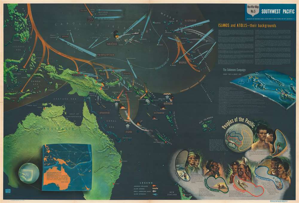
This is a 1944 Navy Education Services pictorial wall map of the Southwest Pacific. A critical theater in the Pacific War, the map depicts from Celebes, Indonesia to the Marshall and Gilbert Islands and from the Philippines and the Marianas Islands to New Zealand.
Understanding the Map
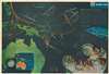
The central map follows events in the Pacific War that take place over a period of more than two years. The orange arrows follow the Imperial Japanese offensive (December 1941 - January 1942) south through the Philippines, Indonesia, and New Guinea to the Solomon Islands and Guadalcanal, where the United States undertakes their first offensive. While the invasion of Guadalcanal is not marked by a specific date and text box, a blue arrow marks the American landing and the crooked yellow line marks the staunch Allied defense. Other blue arrows indicate successive Allied raids and landings. Some of these, such as raids against Truk and Guam and the landings on Tarawa and in the Marshalls, are supplemented with text. An area of light orange illustrates the furthest reach of the Japanese advance, while a white dotted line indicates Allied progress through April 1944. An inset in the lower left provides context, noting that 'approximately five United States could be contained' in the area depicted.Other Content
Aside from the central map, there is supplementary educational content. Short descriptions of islands and atolls are situated below the title and offer short summaries of their 'history of discovery', climate, and appearance. These include Guinea, the Gilbert Islands, and the Marshall Islands, which had already been taken, or were actively fought over when this map was published. Others, such as the Marianas and the Philippines, would become battlegrounds later in 1944. Below sits a chronological history of the Solomons Campaign, which everyone looking at this piece in 1944 would have been at least slightly familiar with due its significance. Thirteen actions, both naval battles and land assaults, are recounted, with each numerically identified on the corresponding map. In the lower right there are pseudo-ethnographic sketches of the 'peoples of the Pacific'. These were likely intended to prepare service members for encounters with unfamiliar indigenous cultures.The NavWarMap Series
NavWarMap No. 5 Southwest Pacific is part of a series of six maps that was created by the Bureau of Naval Personnel, part of the Navy Department. These include:- NavWarMap No. 1 The Mediterranean
- NavWarMap No. 2 The South China Sea Area
- NavWarMap No. 3 World War II in the North Sea Area
- NavWarMap No. 4 The North Pacific Area
- NavWarMap No. 5 Southwest Pacific
- NavWarMap No. 6 We Fight a Global War
Publication History and Census
This map was created within the Bureau of Naval Personnel, most likely by the training division, and distributed by the Educational Services Section. No OCLC references exist for the individual maps. One OCLC entry catalogues nine institutions that possess the entire set of six in their collection: Franklin and Marshall College, the Ohio State University, the University of Michigan, the University of Wisconsin, the Wisconsin Historical Society, the University of Florida, Idaho State University, the National Library of Australia, and Monash University in Clayton, Australia.Condition
Very good. Minor reinforcement on a few old fold lines, and a 3 margin mines. Slight pinhole loss at two fold intersections.
References
OCLC 53073135.