1935 Desimoni Italian Pictorial Map of New England
NewEngland-desimoni-1935$350.00
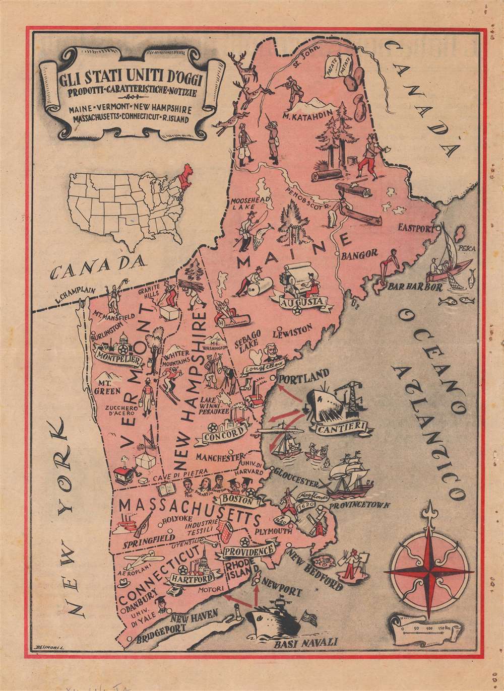

Title
Gli Stati Uniti d'Oggi...
1935 (undated) 12 x 8.75 in (30.48 x 22.225 cm) 1 : 2750000
1935 (undated) 12 x 8.75 in (30.48 x 22.225 cm) 1 : 2750000
Description
A scarce c. 1935 Italian pictorial map of New England by L. Desimoni. It highlights industries, leisure activities, and other characteristic features in the different parts of the region.
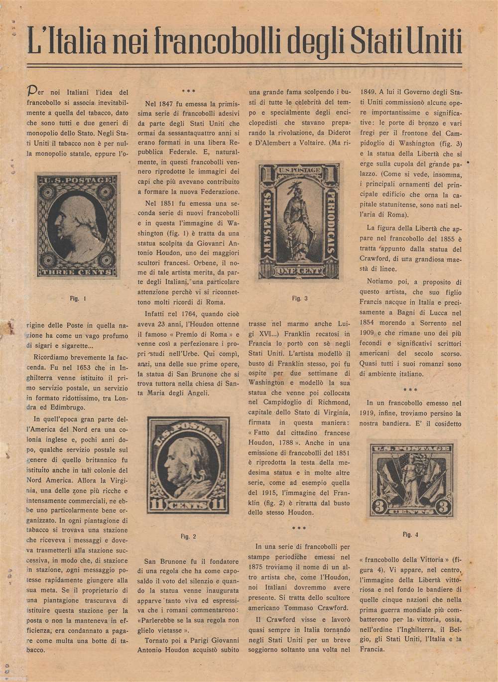
The verso text, titled 'Italy in the postage stamps of the United States' briefly discusses the history of postal systems in England and the U.S., the use of sculpted busts in postage stamps, and the connections of famous sculptors such as Jean-Antoine Houdon and Thomas Crawford with Italy, and more specifically Rome, where both studied.
A Closer Look
The six states of New England are depicted with their distinctive traits emphasized, such as logging, skiing, hunting, maple syrup (zucchero d'acero), and hiking in northern New England, textile mills, the aeronautics industry, and universities in southern New England, and fishing and naval dockyards along the coast. Historical references are made to the landing of the Pilgrims at Plymouth and famous literary and political figures associated with the region, including Henry Wadsworth Longfellow, Ralph Waldo Emerson, and Edgar Allan Poe.The verso text, titled 'Italy in the postage stamps of the United States' briefly discusses the history of postal systems in England and the U.S., the use of sculpted busts in postage stamps, and the connections of famous sculptors such as Jean-Antoine Houdon and Thomas Crawford with Italy, and more specifically Rome, where both studied.
Publication History and Census
Aside from the surname and first initial of the artist, there is no information available about this map. It does not appear in any institutional collections and has no known history on the market. The emphasis on naval dockyards may suggest a later date, perhaps 1940, but very likely before Italy declared war on the U.S. in December 1941. The holes punched in right margin suggest this map may have originally been bound in a larger work.Condition
Good. Holes punched in right-hand margin, repaired on verso with archival tissue. Even toning. Light foxing. Small hole in inset map of the U.S. where Oklahoma sits.